7.0 New Communities Design Guidelines
Countywide Design Guidelines
Chapter 7: New Communities Design Guidelines
Section titled “Countywide Design Guidelines Chapter 7: New Communities Design Guidelines”7.1 Purpose
Section titled “7.1 Purpose”Sacramento County expects high quality design in new communities and other large projects. One of the objectives of the County’s General Plan Land Use Element is to have urban design in the unincorporated County that is functional, aesthetically pleasing, and distinctive. This objective will be met through the County’s Design Review program – a process in which projects from individual buildings to entire new communities are reviewed to ensure that their design is compatible with the project’s surroundings and that the project will be a positive addition to the County, both functionally and aesthetically.The County has established design guidelines for residential and nonresidential projects which are at the individual building or subdivision scale and design guidelines for new communities which are at the community-wide scale.
The purpose of the guidelines in this chapter is to assist master planning of new communities at the community-wide scale. The application of these guidelines will contribute to the development of high quality new communities where residents could reside, work, socialize and recreate. New communities encompass master plans for new growth areas, master plans for large infill projects, and major revisions to existing planned communities. Master plans for communities in new growth areas and communities in established urban areas should indicate the community’s special character, image, livability and sustainability that contribute to the quality of life in Sacramento County.
Using the County-wide Design Guidelines, master plan documents for new communities shall illustrate consistency with design guidelines for each of the plan’s land use components (commercial, industrial, residential, etc.). All new communities shall submit a project level set of Design Guidelines or equivalent that demonstrate compliance substantial conformance with the County’s Guidelines and provide a fine grain of detailed project design features. The Master Plan Design Guidelines shall be evaluated on:
- A comprehensive response to meeting and exceeding the new community goals, planning principles, and guideline objectives in Chapter 7.0 ; the development design guidelines contained in Chapters 2.0, 3.0, 4.0, 5.0 and 6.0; the relevant County Department of Transportation, Department of Parks and Recreation, and local park District Design Guidelines; and the South Sacramento Habitat Conservation Plan Design Guidelines (adoption pending).
- Meeting its stated special and unique character, sense of place, and contribution to the health and well-being of present and future residents of Sacramento County.
- Providing a finer grain of specific details for the quality envisioned for the project, including building form, theming at the neighborhood and community level, a robust list of amenities, design and activation of the public realm, and the relationship between uses.
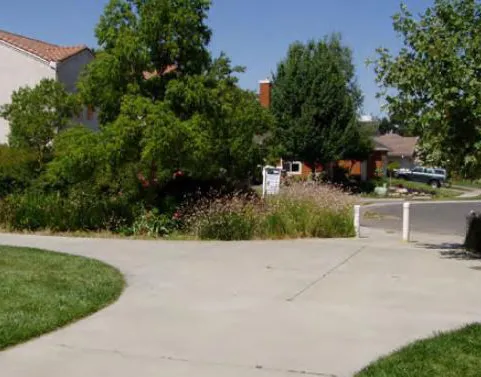
Safe and appealing streetscapes encourage pedestrian activity.
7.2 Planning Goals
Section titled “7.2 Planning Goals”The Design Guidelines for New Communities shall implement the goals and policies of the County’s 2030 General Plan.
The specific goals for new communities shall encompass:
- Mix of Land Uses: Mix land uses to build complete communities that combine a variety of housing options, retail and commercial opportunities, employment centers, civic and community facilities, public spaces, and recreational amenities. Locate vibrant and compact mixed-use town centers and lifestyle centers near neighborhoods and in major transportation corridors, providing an environment where pedestrians feel safe and comfortable.
- Walkable Neighborhoods: Create neighborhoods with housing, jobs, public spaces, goods and services located within reasonable walking and biking distance of each other. Build compact, mixed-use communities with safe and appealing streetscapes, paseos (walkways) and trails to encourage pedestrian and bicycle travel.
- Range of Housing Options: Plan and build a range of housing choices within neighborhoods, varied by cost, design, size, location, and tenure to allow a diversity of economic levels, age groups and cultures to live together. Locate housing near places of work, retail, and educational and health services; and provide an integrated transportation system to offer residents an alternative to traditional, segregated suburban neighborhoods.
- Comprehensive Transportation System: Integrate land use and transportation planning to design and implement a safe and efficient multi-modal transportation system, tied to both local and regional networks. Provide facilities that encourage walking, biking and public transit usage as preferred alternatives to automotive travel. Encourage compact mixed-use developments along transportation corridors clustered around transit stops.
- Natural Resource Preservation: Protect, enhance, and preserve natural resources as valued assets that provide critical ecosystems and food production.
- Focus on Livability: The community shall as a whole and in its parts enhance the quality of life, health and wellness for its residents and users, and provide a unique sense of place and contribution to the community.
- Focus on Sustainable Design: Sustainable design supports development in ways that are environmentally conscious, economically sound, and which provide community-wide benefits. Sustainable design increases community resilience, as well as enhances health, livability and protects natural resources. Design strategies should be used that support energy and water conservation, water use efficiency, integrative storm water treatment, urban greening and forestry, green infrastructure, and use of renewable resources. Active design strategies are also sustainable and should also be used to provide active transportation choices such as walking, bicycling, and accessing transit in coordination with safety and crime prevention through environmental design elements.
- Comprehensive Planning: All parts of the community should function as an integrated whole.
- Integrated with Other Communities: The land use plan for a new master plan community should be integrated with those of adjacent master plan communities. For instance, land uses along the community’s borders should be compatible with land uses of the adjacent community.
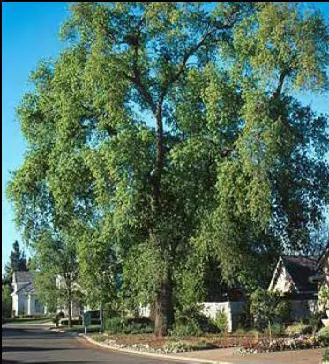
Mature trees such as this live oak should be preserved and incorporated into the project.
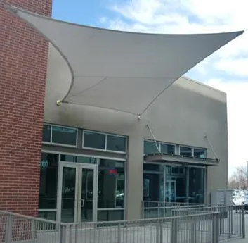
Passive cooling elements incorporated into design of building.
7.3 Application of Guidelines
Section titled “7.3 Application of Guidelines”- These guidelines shall apply to all development encompassing new communities of over 50 acres that are not part of an existing plan.
- Master plans of new communities should include the following components and meet and exceed the objectives of the following guidelines. It is recognized that some projects, due to size limitations, cannot include all of the components.
7.4 Components
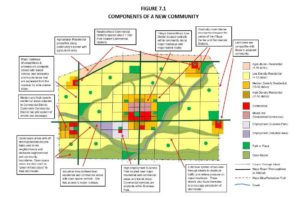
Section titled “7.4 Components”(Note: Figure 1 “Components of a New Community” illustrates the application of many of the following guidelines)
Buildings designed around main plaza.

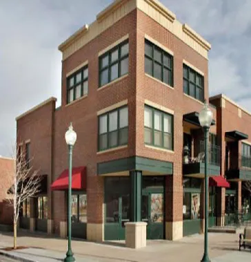
7.4.1 Village Center / Mixed Use Districts
Section titled “7.4.1 Village Center / Mixed Use Districts”Design Guidelines
- 🚶 Because a village center serves as the center or “downtown” of the community, a center should be a mixed-use district with higher intensity development, located in a centralized location with the community. A village center should also have strong pedestrian, bicycle and transit connections to the rest of the community. Vehicular connections shall be provided that are clearly identifiable and connect to the rest of the community.
- Village centers should use open and landscaped spaces such as courtyards and plazas, streets and community facilities (civic buildings) to provide social and design focal points. The community’s main civic buildings and spaces should be located in prominent locations and be established as community landmarks. Village centers should also have a central place such as a town square, main street or village plaza which could be areas of community events such as live theater, concerts, festivals and street fairs.
- To create a sense of place, streets should be aligned such that they provide views of prominent buildings and spaces and which will also aid in orientation and way-finding.
- 🚶 There should be a variety of land uses with institutional, commercial, office, and high density housing in a mixed-use setting. The scale of mixed uses should be at the block level.
- 🚶 To enhance walkability and connectivity, the predominant street pattern for village centers should be a grid or modified grid pattern with maximum block lengths of 300 to 500 feet. Blocks of greater than 500 feet should have mid-block crosswalks and pass-throughs.
- When any mixed-use district is designated in a master plan, it shall have a master development plan. This master development plan shall have a residential component and at least one or more of other uses: retail/services, office/institutional, public/civic.
- For horizontal mixed-use, contiguous discrete areas devoted to one use of no more than three to five acres are encouraged.
- Design of village center plans and elements shall conform to the Village Center/Mixed-Use Guidelines in Chapter 6.0.
Mixed Use Village Districts could include shopping streets with office or residential over ground floor retail/services.
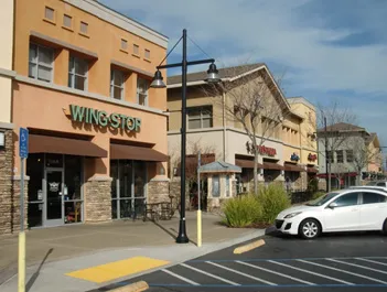
7.4.2 Commercial Districts
Section titled “7.4.2 Commercial Districts”Design Guidelines
- Commercial districts adjacent to residential neighborhood areas should be concentrated in centers (nodes) rather than spread thinly along frontages of major roads in typical “strip mall” fashion.
- 🚶 Commercial districts should be located so that all residential neighborhoods and employment centers have convenient access to appropriate commercial activity so as to reduce auto usage and promote alternative modes of travel.
- Commercial districts should include a wide spectrum of uses to serve the new community’s commercial activity needs and contribute to the economic vitality of the community.
- 🚶 Commercial districts should vary in size from community commercial districts with large anchor stores and grocery stores that serve the entire community to neighborhood commercial districts that may have a small grocery or convenience store, pharmacy or health center, and serve the nearby neighborhood.
- 🚶 For the convenience of residents, community commercial districts should be located no more than one (1) mile apart from each other. Neighborhood commercial districts should be no more than ½ mile from another neighborhood commercial district or the nearest community commercial district.
- To create a sense of place while contributing to the vitality of the district, commercial districts should be designed around well-defined active communal spaces that include a central place, such as a large courtyard, main street or plaza. These communal spaces could be sites for special events.
- 🚶 To maximize connectivity within the commercial districts and so support pedestrian activity, the overall vehicular and pedestrian circulation pattern in larger commercial districts should be a grid or modified grid pattern that include roadways and driveways. As much as possible, a major roadway such a thoroughfare or arterial should not separate residential areas from commercial areas.
- Design of commercial district plans and elements, shall conform to the Commercial Design Guidelines in Chapter 4.0.
Communal spaces should be located throughout the commercial district.
Driveways with diagonal parking increase connectivity within the commercial district.


7.4.3 Office, Business Park, Institutional, and Industrial Developments
Section titled “7.4.3 Office, Business Park, Institutional, and Industrial Developments”Design Guidelines
- 🚶 To encourage public transit use, high intensity business districts should be located within ¼ mile of public transit.
- 🚶 High intensity business districts should be located near major residential and commercial areas and have auto, pedestrian and bicycle linkages to those areas.
- For the convenience of its employees, business districts should have supporting user facilities such as dining and day care.
- 🚶 Business districts shall have a clear master plan framework and design aesthetic that also incorporates a landscape theme and elements contributing to the health and wellness of employees and patrons.
- Heavy industrial uses, such as manufacturing or processing, should be located near railroad lines and/or major thoroughfares. These uses should be buffered where appropriate, from residential, commercial and high intensity business districts to eliminate or reduce impacts to these areas.
- Office, business park, institutional, and industrial developments shall meet the design standards at the building district, complex, and individual building level as described in Chapter 5.0.
Business office park with accessible commercial services

7.4.4 Residential Neighborhoods
Section titled “7.4.4 Residential Neighborhoods”Design Guidelines
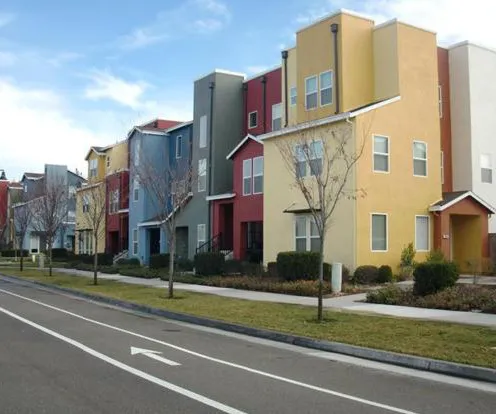
- To encourage income diversity within a master plan community, there should be a variety of housing types and densities, and could include single family homes, duplexes, triplexes, accessory dwelling units, townhomes, condominiums, and apartments in a variety of settings.
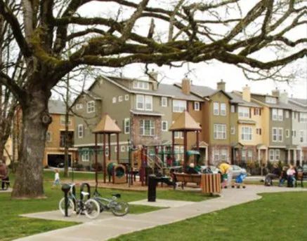
- 🚶 For the convenience of its residents and to encourage pedestrian and bicycle activity, residential neighborhoods should include neighborhood parks and schools that are located together or separately in central locations, with safe pedestrian and bicycle access.
- Residential neighborhoods should plan for neighborhood-oriented institutional uses such as churches, day care centers, health centers, and private schools.
- 🚶 If the overall project includes employment centers, then the project should provide connections and facilities to encourage pedestrian, bicycle, and transit use between employment centers and residential neighborhoods. Strive to locate residential neighborhoods within walking distance (1/2 mile) of employment centers.
- 🚶 Residential neighborhoods should provide strong connections to major project or community amenities, such as community centers and regional trails systems.
- Medium and high density residential developments should be integrated into the community in a transit-supportive fashion such as locating apartments next to shopping centers that are served by transit lines.
- Residential densities should increase as development meets a community or neighborhood center in order to maximize the number of potential customers that are near the community or neighborhood center.
- In environmentally sensitive areas and areas abutting land intended to remain rural, provide appropriately lower densities and preserve open spaces by clustering units close to roads and existing developments.
- 🚶 Residential neighborhoods should have a variety of housing types in a grid or modified grid street pattern to enhance walkability and connectivity. Block lengths should be 500 feet or less. Blocks of greater than 500 feet should have mid-block crosswalks and pass-throughs.
- Residential units that are used to meet Housing Element Program A4 requirements are required to have at least a certain percentage of its residential units to be built at a density that is equal to or exceeds the current Housing Element’s “default density”. This “default density” is considered appropriate to accommodate the development of future affordable housing.
- Alleys can remove garages from the streetscape and can improve the streetscape of a residential neighborhood.
- 🚶 Streets that are main routes to neighborhood focal points such as schools and parks shall be “complete streets” with safe access for all users, including pedestrians (sidewalks), cyclists (bike lanes), transit and vehicles. Complete street landscaping shall include trees to provide shading and enhance the users experience while contributing to improving air quality and the surrounding environment.
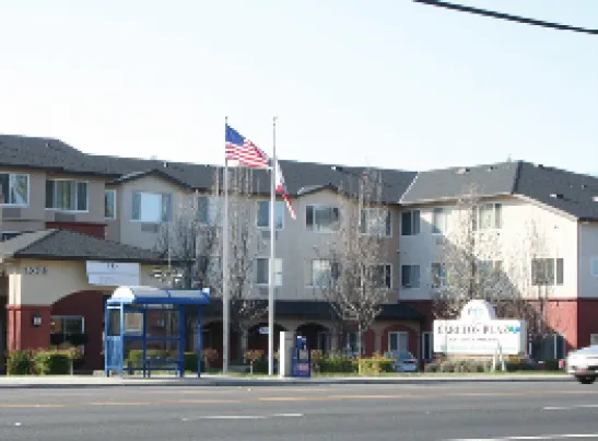
- 🚶 Housing that accommodates elderly, special needs, a range of income levels and preferences should be available, and incorporate active design elements.
- Residential neighborhood design of plans and elements shall conform to the Design Guidelines for Single Family Chapter 2.0 and Multi Family Chapter 3.0.
Neighborhoods organized around parks
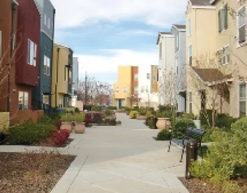
Long residential blocks could be broken up with walkways that are attractive to pedestrians.
Housing that accommodates the housing needs of the elderly and other special needs groups should be provided.
7.4.5 Parks, Open Space and Drainage/Flood Facilities
Section titled “7.4.5 Parks, Open Space and Drainage/Flood Facilities”Design Guidelines
- Size, type, and location shall be sized and located as to support the community master plan goals.
- 🚶 To encourage sufficient usage, parks and open space should be strategically located in or near residential areas and commercial districts and be accessible via roadways, transit routes, and off-road pedestrian and bicycle trails and paseos.
- 🚶 Parks and open space areas should be used as methods to connect communities and neighborhoods and provide alternative modes of travel via sidewalks and trails.
- Open space areas could be used to delineate community or neighborhood boundaries.
- 🚶 Parks and open space should be integrated into neighborhoods to encourage outdoor recreation and preserve natural habitats.
- Neighborhood parks are encouraged to be centers of neighborhood activity and could be combined with schools, community recreation centers, libraries and other civic uses.
- 🚶 Parks and open space areas should include linear parkways with off-street trails integrated with the transportation system. Public safety is a high priority and Crime Prevention Through Environmental Design (CPTED) principles should be applied to the design of off-street trails.
- Flood protection and drainage facilities shall be designed to provide multiple public benefits wherever possible. Facilities shall include multi-purpose improvements consisting of recreation, the environment, storm water runoff, water reclamation, flood control, etc. Attractive joint use basins, such as parks (in addition to Quimby land dedication requirements) or parkways with trails that also convey stormwater to water quality basins or similar facilities and provide some water quality treatment are examples of desired multiple public benefit facilities.
- 🚶 Open space should be connected to provide habitat corridors through urban environments.
Walkways or off-street trails should connect residential areas with parks and open spaces.
7.4.6 Transportation Systems
Section titled “7.4.6 Transportation Systems”Design Guidelines
- 🚶 Design the circulation system with multiple routes by: 1. creating direct, short and simple linkages between residential neighborhoods and activity centers; 2. reducing the need to use arterial streets for local trips; and 3. combining circulation routes with other community elements (e.g. pedestrian and bicycle paths through parkways).
- 🚶 Transportation needs of the community should be served by an integrated and balanced system for vehicular, transit, bicycle, and pedestrian use.
- 🚶 Master plans should provide direct and efficient connections between internal transportation infrastructure (including roads, pedestrian and bicycle facilities, trails and transit routes) and existing, planned or proposed transportation infrastructure adjacent to the Master Plan boundaries.
- 🚶 To encourage transit usage, high density residential and commercial mixed-use projects (vertical or horizontal) should be located within walking distance (¼ mile) of a transit center.
- Development should reflect the use of average residential and commercial densities that maximize transit system ridership.
- 🚶 The streetscape design of the circulation system should clearly portray the street hierarchy with attention to traffic calming and pedestrian safety.
Separated pedestrian sidewalks and well-marked Class II bicycle lane on residential neighborhood street.
7.4.7 Sustainability
Section titled “7.4.7 Sustainability”Design Guidelines
- 🚶 The master plan as a whole and in its parts shall support sustainable design principles that reflect those delineated in the Sacramento County 2030 General Plan, and the Active Design guidelines highlighted throughout the Countywide Design Guidelines and further described in Appendix D of these guidelines. Sustainable Design elements shall be used that contribute to improving the human, economic and environmental health of the community.
- Use Chapters 2.0, 3.0, 4.0, 5.0, and 6.0 of the Sacramento County-wide Design Guidelines to indicate sustainable design strategies at the project level.
Figure 7.1: Components of a New Community
Section titled “Figure 7.1: Components of a New Community”