Downtown Rio Linda SPA
Sacramento County Zoning Code
Downtown Rio Linda Special Planning Area Ordinance
Section titled “Sacramento County Zoning Code Downtown Rio Linda Special Planning Area Ordinance”Adopted November 17, 2015
Amended July 16, 2020
Adopted by SCZ-2015-0008 / ZMA #5644 / PLNP2013-00145
Amended by SCZ-2020-0004 / PLNP2019-00128 (2019 Zoning Code Update)
ACKNOWLEDGEMENTS
Section titled “ACKNOWLEDGEMENTS”Sacramento County
Board of Supervisors
District 4 Supervisor, Roberta MacGlashan
Department of Community Development
Leighann Moffitt, AICP, Planning Director
Tricia Stevens, Principal Planner
Christine Kudija, AICP, Senior Planner, Willdan Consultant
Carol Gregory, Ph.D., Associate Planner
Keri Blaskoski, Service Area Manager
Ciara Atilano, Planning and Environmental Review Intern
Rio Linda / Elverta
Community Planning Advisory Council
Rio Linda Visions Task Force
Consultant
AECOM
Minor Revisions Following Adoption on November 17, 2015:
Section titled “Minor Revisions Following Adoption on November 17, 2015:”- Figure 2.8 corrected with cars going in correct direction
- Figure 2.14 corrected with cars going in opposite directions
- Dry Creek River corrected to Dry Creek Road
- Special Events on Park District Property
- Language omitted related to street section for Rio Linda Boulevard
CHAPTER 1 | INTRODUCTION
Section titled “CHAPTER 1 | INTRODUCTION”1.1 How To Use This Document
Section titled “1.1 How To Use This Document”The Downtown Rio Linda Special Planning Area (SPA) Ordinance updates and revises the boundaries of the 1989 Rio Linda Business District Special Planning Area (SPA) to regulate development and land use in the Downtown Rio Linda Business District. The Ordinance provides development standards or performance criteria intended to facilitate development, and addresses the following elements:
- Design of public areas, streetscape, landscape, and gateway entries common throughout the SPA
- Compatibility with existing development
- Details that define the character of the SPA and each of the contributing Planning Areas
- Conditions unique to the Rio Linda area
The Special Planning Area (SPA) Ordinance shall be used in concert with the County’s Zoning Code and Design Guidelines. The SPA Ordinance serves as a guide for property owners, developers, designers, and the County to improve the quality of development in the community and will result in a more effective design review and project approval process.
The Downtown Rio Linda Special Planning Area (SPA) Ordinance is organized into three chapters:
- Introduction, which describes the purpose and intent of the code and how to use and administer the code;
- The Regulating Plan, which defines the districts within the code and their functions; and
- Development Standards and Design Guidelines, which contains regulations and guidance for development within downtown Rio Linda.
1.2 Background
Section titled “1.2 Background”In 2008-2009, the Sacramento County Neighborhood Services Department in conjunction with the Rio Linda-Elverta Visions Task Force initiated a comprehensive outreach program to engage the Rio Linda community in developing a vision plan for the M Street downtown business corridor. The visioning process involved a community survey, stakeholder interviews, meetings with community groups, a community open house workshop, and presentations of the resulting Rio Linda Vision Plan (Vision Plan) to the Rio Linda Community Council and the Sacramento County Board of Supervisors. In 2010, with funding assistance from the Sacramento Housing and Redevelopment Agency, the Neighborhood Services Department initiated the process of creating a new Special Planning Area (SPA) Ordinance to replace the existing Rio Linda SPA and implement the Vision Plan.
The Special Planning Area (SPA) Ordinance will guide the revitalization of Downtown Rio Linda according to the community’s vision of establishing an attractive and vibrant Downtown main street environment that draws people, activities, and commerce while maintaining the community’s historic small town charm. The SPA Ordinance will strengthen and support continued revitalization of the M Street corridor through downtown Rio Linda while improving Rio Linda’s local economy by encouraging new housing, shopping, civic uses, and jobs; protecting historic, cultural, and natural resources; increasing opportunities for recreation and access to the Dry Creek Parkway; and supporting the County’s infill strategies targeting development in its existing commercial corridors. Notably, the SPA Ordinance will promote both the improvement and adaptive reuse of existing structures and help facilitate new development by removing cumbersome regulations that limit development opportunities. Instead, the SPA Ordinance will allow more flexible mixed-use zoning and development standards that can respond to changing market conditions, improving the economic base of the Rio Linda community. Community-wide and area specific design guidelines will accompany the development standards to strengthen the community’s identity and to establish an attractive, pedestrian-friendly environment within the Downtown center and neighborhood commercial subareas.
1.3 Administration
Section titled “1.3 Administration”The application and review process for the Special Planning Area (SPA) Ordinance is set forth in this section.
1.3.1 Applicability
Section titled “1.3.1 Applicability”The Downtown Rio Linda Special Planning Area (SPA) Ordinance shall apply to all proposed land uses and development within the Rio Linda SPA. When in conflict with the County Zoning Code, the Downtown Rio Linda SPA Ordinance governs; and where the Ordinance is silent, the County Zoning Code shall apply. Definitions in the County Zoning Code apply to terms in this Ordinance.
1.3.2 Existing Uses and Structures
Section titled “1.3.2 Existing Uses and Structures”- Existing uses that become non-conforming when this SPA is adopted may continue to exist in the SPA without the requirement of a Certificate of Non-Conforming Use. Such existing uses may continue to operate indefinitely or the same type of business/use may re-occupy the premises as long as the vacancy period does not exceed 90 days.
- Existing structures that become non-conforming with respect to setbacks, height, and/or other development and design standards may be repaired or remodeled subject to Section 1.3.3.
- Lots that exist as of the date of the SPA ordinance are deemed to be conforming in lot size and shape and shall retain building rights for any use permitted within the SPA.
1.3.3 Cultural Resources Protection
Section titled “1.3.3 Cultural Resources Protection”- Any project subject to Design Review and proposing restoration or re-use of a structure deemed eligible for listing on the Federal Register of Historic Places or the California Register of Historic Resources shall proceed according to the United States Secretary of the Interior's current protocols for treatment of historic resources. See also Section 1.3.5.
- If subsurface deposits believed to be cultural or human in origin are discovered during site preparation or construction, then all work must halt within a 200-foot radius of the discovery. A qualified professional archaeologist, meeting the Secretary of the Interior's Professional Qualification Standards for prehistoric and historic archaeology, shall be retained at the Applicant's expense to evaluate the significance of the find. If it is determined due to the types of deposits discovered that a Native American monitor is required, the Guidelines for Monitors/Consultants of Native American Cultural, Religious, and Burial Sites as established by the Native American Heritage Commission shall be followed, and the monitor shall be retained at the Applicant's expense.
- Work shall not continue within the 200-foot radius of the discovery site until the archaeologist conducts sufficient research and data collection to make a determination that the resource is either 1) not cultural in origin; or 2) not potentially eligible for listing on the National Register of Historic Places or California Register of Historical Resources.
- If a potentially-eligible resource is encountered, then the archaeologist and project proponent shall coordinate with Sacramento County Division of Planning and Environmental Review and arrange for either 1) total avoidance of the resource, if possible; or 2) test excavations or total data recovery as mitigation. The determination shall be formally documented in writing and submitted to Planning and Environmental Review as verification that CEQA provisions for managing unanticipated discoveries have been met.
- Section 5097.98 of the State Public Resources Code and Section 7050.5 of the State Health and Safety Code require that in the event of the discovery of human remains, all work must stop and the County Coroner be immediately notified. If the remains are determined to be Native American, Native American Heritage Commission guidelines shall be adhered to in the treatment and disposition of the remains.
1.3.4 Native Oak Tree Protection
Section titled “1.3.4 Native Oak Tree Protection”The following provisions are in addition to, and do not supersede Sacramento County Code Chapter 19.12, Tree Preservation and Protection:
- Prior to execution of development projects within the SPA area, the project proponent(s) shall submit an arborist report for the project impact areas if trees are present on the site. The report shall include the species, diameter, dripline, and health of the trees, and shall be prepared by an ISA certified arborist. The report shall include an exhibit that shows the trees and their dripline in proximity to the project improvements. The report shall identify any tree that will be removed and quantify the dripline encroachment from project equipment or facilities.
- With the exception of the trees removed and compensated for through Section 1.3.4(c), all healthy native trees that are 6 inches dbh or larger on the project site, all portions of adjacent off-site healthy native oak trees that are 6 inches dbh or larger which have driplines that extend onto the project site, and all off-site healthy native oak trees that are 6 inches dbh or larger which may be impacted by utility installation and/or improvements associated with this project, shall be preserved and protected as follows:
- A circle with a radius measurement from the trunk of the tree to the tip of its longest limb shall constitute the dripline protection area of each tree. Limbs must not be cut back in order to change the dripline. The area beneath the dripline is a critical portion of the root zone and defines the minimum protected area of each tree. Removing limbs that make up the dripline does not change the protected area.
- Any protected trees on the site that require pruning shall be pruned by a certified arborist prior to the start of construction work. All pruning shall be in accordance with the American National Standards Institute (ANSI) A300 pruning standards and the International Society of Arboriculture (ISA) 'Tree Pruning Guidelines.'
- Prior to initiating construction, temporary protective fencing shall be installed at least one foot outside the driplines of the protected trees within 100-feet of construction related activities, in order to avoid damage to the tree canopies and root systems. Where encroachment occurs, temporary high visibility protective fencing shall be installed a maximum of one foot outside the work areas in order to minimize damage to the tree canopies and root systems.
- Any removal of paving or structures (i.e. demolition) that occurs within the dripline of a protected oak tree shall be done under the direct supervision of a certified arborist. To the maximum extent feasible, demolition work within the dripline protection area of the oak tree shall be performed by hand. If the certified arborist determines that it is not feasible to perform some portion(s) of this work by hand, then the smallest/lightest weight equipment that will adequately perform the demolition work shall be used.
- No signs, ropes, cables (except those which may be installed by a certified arborist to provide limb support) or any other items shall be attached to the protected trees. Small metallic numbering tags for the purpose of preparing tree reports and inventories shall be allowed.
- No vehicles, construction equipment, mobile home/office, supplies, materials or facilities shall be driven, parked, stockpiled or located within the driplines of protected trees.
- No grading (grade cuts or fills) shall be allowed within the driplines of protected trees, except for the minimum required for construction and streetscape improvements.
- Drainage patterns on the site shall not be modified so that water collects or stands within, or is diverted across, the dripline of any protected tree.
- No trenching shall be allowed within the driplines of protected trees. If it is absolutely necessary to install underground utilities within the dripline of a protected tree, the utility line shall be bored and jacked under the supervision of a certified arborist.
- The construction of impervious surfaces within the driplines of protected trees shall be stringently minimized. When it is absolutely necessary, a piped aeration system per County standard detail shall be installed under the supervision of a certified arborist.
- All portions of any masonry wall that will encroach into the dripline protection area of any protected tree shall be constructed using grade beam wall panels and posts set no closer than 10 feet on center. Any wrought iron fencing shall be similarly installed, with posts set no closer than 10 feet on center. Posts shall be spaced in such a manner as to maximize the separation between the tree trunks and the posts in order to reduce impacts to the trees.
- Trunk protection measures, per Sacramento County standards, shall be used for all protected trees where development or construction activity, including installation of masonry walls or wrought iron fences, occurs within 10 feet of the trunk of a tree.
- No sprinkler or irrigation system shall be installed in such a manner that sprays water or requires trenching within the driplines of protected trees. An aboveground drip irrigation system is recommended.
- Landscaping beneath oak trees may include non-plant materials such as bark mulch, wood chips, boulders, etc. The only plant species which shall be planted within the driplines of oak trees are those which are tolerant of the natural semiarid environs of the trees. A list of such drought-tolerant plant species is available at the Department of Environmental Review and Assessment. Limited drip irrigation approximately twice per summer is recommended for the understory plants.
- To the maximum extent feasible, all on-site healthy native oak trees shall be protected and preserved. Any substantial (>20%) encroachment and/or removal of native oak trees shall be compensated by planting native trees (valley oak/Quercus lobata, interior live oak/Quercus wislizenii, blue oak/Quercus douglasii, and California black walnut), equivalent to the dbh inches lost, based on the ratios listed below, at locations that are authorized by the Department of Planning and Environmental Review. On-site preservation of native oak trees that are less than 6 inches (&6 inches) dbh, may also be used to meet this compensation requirement. Encroachment of over 20 percent within the dripline radius of native trees will require compensatory mitigation based on the percentage of encroachment multiplied by the dbh. Encroachment over 50 percent will require compensation for the entire tree.
Equivalent compensation based on the following ratio is required:
- one preserved native oak tree & 6 inches dbh on-site = 1 inch dbh
- one ‘deepot’ seedling (40 cubic inches or larger) = 1 inch dbh
- one 15-gallon tree = 1 inch dbh
- one 24-inch box tree = 2 inches dbh
- one 36-inch box tree = 3 inches dbh
- Replacement tree planting shall be completed prior to the issuance of building permits or a bond shall be posted by the applicant in order to provide funding for purchase, planting, irrigation, and 3-year maintenance period, should the applicant default on replacement tree mitigation. The bond shall be in an amount equal to the prevailing rate of the County Tree Preservation Fund.
- Prior to the approval of Improvement Plans or building permits, a Replacement Oak Tree Planting Plan shall be prepared by a certified arborist or licensed landscape architect and shall be submitted to the Environmental Coordinator for approval. The Replacement Oak Tree Planting Plan(s) shall include the following minimum elements:
- Species, size and locations of all replacement plantings and & 6-inch dbh trees to be preserved;
- Method of irrigation;
- The Sacramento County Standard Tree Planting Detail L-1, including the 10-foot deep boring hole to provide for adequate drainage;
- Planting, irrigation, and maintenance schedules;
- Identification of the maintenance entity and a written agreement with that entity to provide care and irrigation of the trees for a 3-year establishment period, and to replace any of the replacement oak trees which do not survive during that period.
- Designation of 20-foot root zone radius and landscaping to occur within the radius of oak trees & < 6-inches dbh to be preserved on-site.
- No replacement tree shall be planted within 15 feet of the driplines of existing oak trees or landmark size trees that are retained on-site, or within 15 feet of a building foundation or swimming pool excavation. The minimum spacing for replacement oak trees shall be 20 feet on-center. Examples of acceptable planting locations are publicly owned lands, common areas, and landscaped frontages (with adequate spacing). Generally unacceptable locations are utility easements (PUE, sewer, storm drains), under overhead utility lines, private yards of single family lots (including front yards), and roadway medians.
- Oak trees < 6 inches dbh to be retained on-site shall have at least a 20-foot radius suitable root zone. The suitable root zone shall not have impermeable surfaces, turf/lawn, dense plantings, soil compaction, drainage conditions that create ponding, utility easements, or other overstory tree(s) within 20 feet of the tree to be preserved. Trees to be retained shall be determined to be healthy and structurally sound for future growth, by an ISA Certified Arborist subject to Department of Environmental Review and Assessment approval.
- If oak tree replacement plantings are demonstrated to the satisfaction of the Environmental Coordinator to be infeasible for any or all trees removed, then compensation shall be through payment into the County Tree Preservation Fund. Payment shall be made at a rate of $325.00 per dbh inch removed but not otherwise compensated, or at the prevailing rate at the time payment into the fund is made.
1.3.5 Review Process and Interpretation
Section titled “1.3.5 Review Process and Interpretation”Design Review: The County shall use the standards and design guidelines presented in this Ordinance as part of the project review of development proposals in the Downtown Rio Linda SPA. Except for the project categories listed below, prior to the issuance of any building permit, all public and private construction, development, or improvement projects that involve new construction, major additions, and façade improvements that significantly alter the exterior appearance of a historically or locally significant building in the SPA shall undergo Design Review to ensure that the design standards and guidelines are followed.
Modification of historic properties must be consistent with the current version of the Secretary of the Interior’s Standards for the Treatment of Historic Properties. Demolition of properties formally designated as historically significant is prohibited unless such properties are deemed unsafe by Sacramento County. Note: except for the Rio Linda Archway, at the time of ordinance adoption, there are no properties in the SPA either listed or designated as eligible for listing in the California Register of Historic Resources or the National Register of Historic Places. Properties with structures more than 50 years old should be investigated for their cultural/historic importance. A cultural resource study shall be required for any project subject to a use permit or other discretionary entitlement, which proposes demolition of or major changes to a structure more than 50 years old.
A key goal of the community is to simplify the development review process for minor project improvements or changes. Design review is not required for the following project categories:
- Minor improvements to fences, landscaping, or lighting that is consistent with the intent of these Design Guidelines;
- Improvements to existing buildings that do not change the use of the building or alter the exterior appearance of the building;
- Minor additions or improvements as described in ‘Minor Additions/Improvements’ below, excluding signs;
- Public works, utility, and maintenance projects including but not limited to:
- Roadway and landscape maintenance, repaving, rehabilitation of irrigation, tree trimming, mowing, weed abatement, sidewalk repair, parking lot striping, placement of parking, and roadway placards/signs;
- Existing utility improvement and maintenance-under-grounding of utilities; maintenance of utility poles, sewer or water lines, water wells, drainage, and related facilities; and
- Other public work, utility, or maintenance projects as determined by the Director of the Planning and Community Development Department;
- Building demolition and subsequent site grading, and soil remediation projects;
- Structural improvements or repairs to existing buildings or property that are required to protect the welfare, health, and safety of the general public.
The following sections describe the steps to guide project approval for specific types of projects in the SPA that may deviate from the processes in the County Zoning Code including residential to commercial conversions and façade improvements; minor additions; and new construction, major additions, and improvements deviating from this Ordinance.
Residential to Commercial Conversions and Façade Improvements
Along the M Street corridor, a mix of older residential units and commercial uses coexist. In the past, obtaining permits for façade improvements and for the conversion of residential units to commercial uses has been lengthy and resource intensive. This process is intended to streamline both processes in Rio Linda by permitting the standard County administrative review process, subject to meeting certain standards and design guidelines in this Ordinance that ensure façade improvements are compatible with existing surrounding development and commercial conversions have limited impacts to the remaining residential uses.
Minor Additions/Improvements
Minor additions or improvements to existing structures including those that add less than 50% to the existing gross floor area as of the adoption of this Code, remodeling projects, changes to fences, signage, lighting, etc. that do not trigger any applicable environmental review requirements; or that do not result in an increase in the number of dwelling units or increase in the amount of non-residential square footage; and complying with the development standards and intent of this Code may be approved, approved with conditions, or denied administratively by the Director without design review or additional public hearings.
New Construction, Major Additions/Improvements, and Deviations from the Special Planning Area Ordinance
New construction or major additions/improvements to existing structures that add more than 50% to the existing gross floor area as of the adoption of this Code and not meeting any one of the requirements for a minor addition/improvement described above, shall be considered a major amendment and shall be subject to the County’s Design Review process, consisting of the following steps:
- The County’s Design Review Advisory Committee shall review any proposal located within the SPA, and make recommendations to the Planning Director. The recommendation may be a denial, approval, or approval with conditions.
- The Planning Director will act on the development plan review application. If the Director disagrees with the recommendation of the Design Review Committee, the application shall be heard by the Rio Linda-Elverta Community Planning Advisory Council who may make recommendations to deny, approve, or approve the project with conditions.
- The Board of Supervisors shall have the final authority to deny, approve, or approve the project with conditions.
1.4 Project Location and Context
Section titled “1.4 Project Location and Context”Rio Linda is located in the unincorporated area of Sacramento County, south of Elverta and midway between the cities of Sacramento, Citrus Heights, and Roseville (refer to Figure 1.1, ‘Regional Context Map’). Rio Linda can be accessed from the east by exiting Interstate 80 (I-80) at Raley Boulevard/Marysville Boulevard and continuing on to Elkhorn Boulevard. It can be accessed from the west by traveling along Interstate 5 (I-5) to State Route 99/70, then exiting at Elkhorn Boulevard.
The proposed Rio Linda SPA boundary is centered along the M Street/Oak Lane corridor, bound by N Street to the north; L Street and Dry Creek to the south; Curved Bridge Road on the east; and Shady Woods Drive and Second Street to the west (see Figure 1.2 for the project site location).
Figure 1.1, Regional Context Map
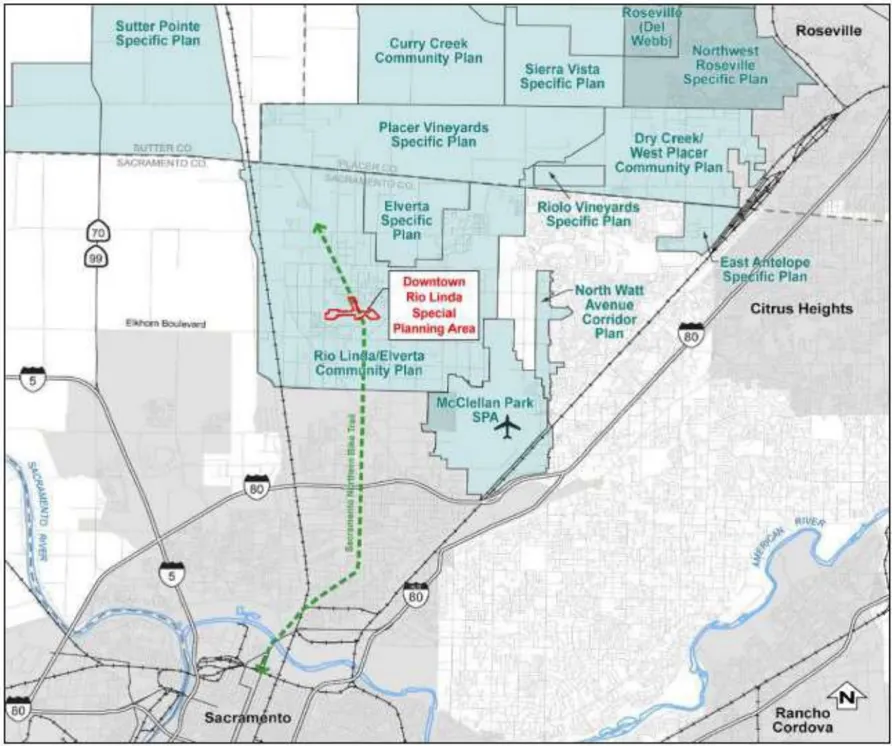
Figure 1.2, Project Boundaries

CHAPTER 2 | THE REGULATING PLAN
Section titled “CHAPTER 2 | THE REGULATING PLAN”The Regulating Plan sets forth the purpose and intent of the development regulations for the Rio Linda SPA, describes the planning area framework, land use and circulation concepts, and lists allowed land uses.
2.1 Purpose and Intent
Section titled “2.1 Purpose and Intent”2.1.1 Special Planning Area
Section titled “2.1.1 Special Planning Area”The purpose of the Rio Linda Special Planning Area (SPA) Ordinance is to implement the Rio Linda Downtown Vision Plan by:
- Creating a vibrant, mixed-use village center that preserves the small town, rural character of the community;
- Removing land use barriers that discourage the development of a mix of new commercial, retail, housing, and civic uses;
- Promoting reuse or façade improvements to older building resources;
- Protecting the natural and agricultural resources in the community;
- Establishing Rio Linda as a destination and place in the County with a thriving downtown and place to celebrate the community’s culture, heritage, the arts, and access to locally grown foods;
- Connecting the community through trails, public transit, and street improvements; and
- Supporting the County’s 2030 General Plan strategy of reducing greenhouse gas emissions and vehicle miles traveled through infill development in existing community centers and corridors.
The vision for the Rio Linda SPA encompasses:
- Establishing a business area at the corner of Rio Linda Boulevard and M Street to accommodate a flexible arrangement of office and commercial uses where there is higher visibility and better access from the community;
- Improving the appearance and vitality of the Downtown core area that still retains its early development patterns, and updating the former industrial and commercial structures in the downtown area to allow greater land use flexibility;
- Introducing more local neighborhood-serving mixed-use development, dispersed within the SPA; and
- Returning M Street to its function as a community main street with a high priority placed on creating a pedestrian-friendly street, with full streetscape improvements.
2.2 Planning Areas
Section titled “2.2 Planning Areas”There are four distinct planning areas that implement the Rio Linda Vision Plan: 1) Gateway Area, 2) M Street Corridor, 3) Village Center, and 4) East Neighborhood Area (see Figure 2.1, Planning Areas). These planning areas support the purpose and intent for the Rio Linda Special Planning Area, as well as the Rio Linda and Elverta Community Plan, and the Sacramento County General Plan. Specifically, the planning areas create a framework for the specific zoning districts, reinforce desirable existing character, and promote desired features for new infill development. Zoning, allowed uses, and development standards are provided to achieve the desired character described for each area. Development standards associated with each zoning designation are supplemented by design guidelines that apply to the planning area as a whole to foster consistent design development.
2.2.1 Gateway Area
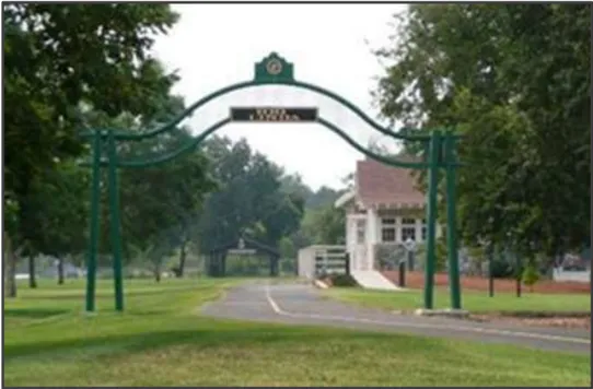
Section titled “2.2.1 Gateway Area”The Gateway Area is focused at the intersection of Rio Linda Boulevard and M Street, which is distinguished by the Rio Linda Archway (California Point of Historical Interest No. 614). The area includes existing businesses on Rio Linda Boulevard and M Street, and several large, undeveloped parcels affording opportunities for infill development.
The area will serve as the major western gateway into Rio Linda’s commercial mixed-use areas. It is envisioned to have a strong commercial mixed-use presence near the intersections of Rio Linda Boulevard and M Street, with buildings constructed at the back of the sidewalk and reduced parking visibility from the street to reinforce a pedestrian oriented commercial character.
This commercial character should be supported by a consistent streetscape treatment, including pedestrian walkways, street trees, and landscaping, to the east and west of the Rio Linda Boulevard and M Street intersection along M Street. Parcels that front onto M Street should support this consistent streetscape character; however, development that is not near the Rio Linda Boulevard and M Street intersection or along M Street may reflect more versatility in site design. Where appropriate to support new development, new local streets and access alleys may be introduced.
Figure 2.1. Planning Areas
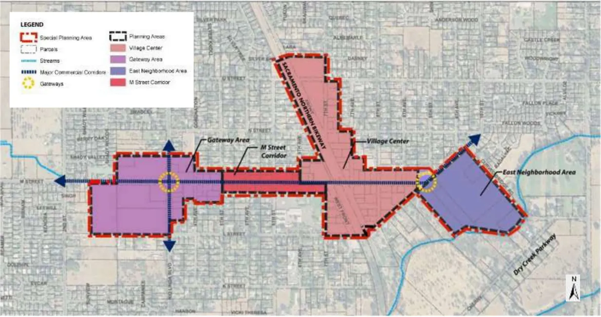
2.2.2 Village Center
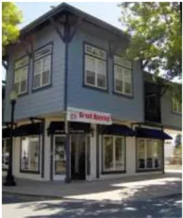
Section titled “2.2.2 Village Center”The Village Center, located at the intersection of M Street and Front Street, is the heart of Rio Linda’s business district along M Street. Several older, character-contributing commercial and industrial structures occupy this segment of M Street and intersecting streets in the Village Center (see ‘Preserving Existing Character’ in the Design Guidelines).
New infill development in the Village Center should be designed to reflect the existing architectural, commercial, civic, and recreational fabric to make this a unique place in the community-more vibrant, economically viable, and a unique local/regional destination. The Village Center is envisioned as the center of the Rio Linda community that will continue to exhibit the historic, small town ambience that locals have come to enjoy while providing a diverse mix of uses, services, entertainment, recreation, and culture that can be enjoyed by the entire community.
The Village Center is bisected by the Sacramento Northern Bikeway (the former Northern Electric railroad line) right-of-way, which runs northwest-southeast and parallels Front Street. Older buildings, originally designed to face the railroad tracks, now front on the bikeway.
Streetscape improvements described in the Gateway Area above should be continued on M Street through the Village Center, with particular attention given to safe and convenient pedestrian crossings of M Street, and access to the bikeway. The streetscape is envisioned to end at a new eastern gateway at the junction of M Street and Oak Lane.
2.2.3 East Neighborhood Area
Section titled “2.2.3 East Neighborhood Area”The East Neighborhood Area on Oak Lane includes a late-1960s-era underutilized commercial center at the eastern edge of the historic downtown. The area also includes several existing homes on large lots to the west and south of the and multi-family housing on the west side of the commercial center. The property has the potential to be ‘repurposed’ through rehabilitation and enhancement of existing buildings, and/or the construction of new buildings on the site.
Based on the property’s location, re-use options could also include residential town homes, cottage homes, senior housing or other uses located behind the commercial center. Adjacent to Curved Bridge Road, the East Neighborhood Center could include the addition of an eastern access. Residential development on the property would benefit from nearby views of the Dry Creek Parkway and the access to open space that it provides.
2.2.4 M Street Corridor
Section titled “2.2.4 M Street Corridor”The M Street Corridor is located between the Gateway Area and the Village Center, and includes existing homes, a place of worship, and an elementary school campus. Existing homes along the M Street corridor have consistent shallow setbacks from the street that should be maintained to retain the existing neighborhood character and intimacy of M street within the corridor area.
The M Street Corridor is envisioned as a visual connection between the two main commercial areas, Gateway Area and Village Center, with streetscape improvements on M Street as a contributing feature. Streetscape improvements in the corridor will slow traffic, enhance pedestrian safety and access, and support transit accessibility. New parking strategies are included.
Although some infill development is possible, this area is primarily envisioned for adaptive reuse of existing buildings. The use of residential buildings for professional office use is encouraged. New construction should be consistent with the shallow front setbacks of existing buildings, or should be located at the back of the sidewalk to contribute to the coherence of M Street.
Figure 2.2. Zoning Districts
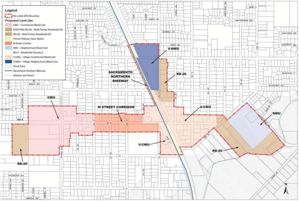
2.3 Land Use Zones
Section titled “2.3 Land Use Zones”The zoning districts described in Table 2.1 and shown in Districts support the vision for each of the planning areas described above. Section 2.3.6 lists allowed and prohibited uses for each zone.
TABLE 2.1
| LAND USE ZONES PLANNING AREAS | ZONING DISTRICTS |
|---|---|
| Gateway Area | • Residential-5 (RD-5) (no zone change) • Residential 20 (RD-20) • CommercialMixed-Use(CMU) |
| M Street Corridor | • No zone changes, but corridor overlay standards apply |
| Village Center | • Residential 20 (RD-20) • Village Neighborhood Mixed-Use(V-NMU) • Village Commercial Mixed-Use (V-CMU) |
| East Neighborhood Area | • Residential 20 (RD-20) • NeighborhoodMixed-Use(NMU) |
2.3.1 Residential Zone
Section titled “2.3.1 Residential Zone”Residential 20 (RD-20; Density Range RD-5 - RD-20)
This land use zone allows for a variety of single-family and multifamily residential development with a development density range of 5-20 dwelling units per acre. It is proposed for portions of the Gateway Area, Village Center, and East Neighborhood Area as suitable for additional residential development located near existing and proposed commercial mixed-use development.
Multi-family Residential 20 (RD-20) is an existing zoning designation for several properties in the Village Center and East Neighborhood areas, and has been retained because it is consistent with the community’s vision for the SPA to ‘encourage development of a variety of housing types’ that can add to the predominantly single-family housing stock currently found in Rio Linda. The SPA adds a property in the Gateway Area to the RD-20 zoned land to serve as a transition between nearby residential neighborhoods and the commercial mixed use (CMU) area. Again, the SPA will permit a density range to encompass existing single-family residences developed at lower densities.
The purpose of the RD-20 zone is to promote opportunities for housing variety in the SPA, including senior housing, townhomes, and green court residential development, and to locate housing within easy walking distance of nearby goods and services.
Residential development in this zone should contribute to the distinctive character of each planning area in the SPA. Where residential development in this zone is adjacent to M Street or Oak Lane, it must also be consistent with the character of these adjacent respective streets, as defined in Chapter 3 of this document.
The design of RD-20 residential development should be coordinated with the standards and guidelines appropriate for the Multi-family Housing Category as identified in the
Multifamily Residential Development Standards of the Updated Sacramento County Zoning Code.
Section 2.3.6(a) sets forth allowed uses for the RD-20 zone district.
2.3.2 Mixed-Use Zone Designations
Section titled “2.3.2 Mixed-Use Zone Designations”Neighborhood Mixed-Use (NMU)
The NMU zone allows for local-serving mixed-use areas that allow a variety of goods and services, employment, and housing supporting the Rio Linda community and nearby neighborhoods. Development in the NMU zone should be complementary in scale and character to adjacent neighborhoods.
New development in the NMU district may include non-residential uses on the ground floor of multi-story buildings (vertical mixed-use) or may occupy buildings with a single use (horizontal mixed-use). Non-residential uses may occupy no more than 50% of the ground floor square footage within this zone, unless approved by special permit from the Zoning Administrator. Non-residential uses should be located so as to be visible from Oak Lane to encourage use.
Single-use residential buildings at 5-20 dwelling units per acre (du/ac) may be constructed in this district. Ground floor units must be designed with entry features (such as stoops) that provide access and enhance activity on the street. Shared parking scenarios between commercial and residential uses are encouraged.
Section 2.3.6(b) sets forth allowed uses for the NMU district. Typical uses may include:
- Single-family and multi-family residential uses (5-20 du/ac), including attached and detached townhomes, garden apartments, and condominiums.
- Retail uses including clothing, toy, media, and book stores;
- Convenience services including banks, drug stores, beauty shops;
- Medical, business, and professional offices;
- Restaurants, cafes, and coffee shops; and
- Civic uses such as a library, theater, senior center, or community center.
Village-Neighborhood Mixed-Use (V-NMU)
The V-NMU zone applies within the Village Center, which includes many older structures and reuse opportunities. The V-NMU zone is similar to the NMU zone in character, design, and permitted uses. The V-NMU has two additional requirements:
- Non-residential development should be located at street level along Front Street, with residential development above or at the rear.
- Redevelopment and reuse of existing buildings should be considered to retain and enhance the established character of the Village Center.
Section 2.3.6(c) sets forth allowed uses for the V-NMU district.
Village-Commercial Mixed-Use (V-CMU)
The V-CMU district applies within the downtown commercial core of the Rio Linda community. New mixed-use infill development and reuse of existing buildings are encouraged in the Village Commercial center. The V-CMU district allows a mix of uses with office or residential uses above ground-floor retail or lobby spaces.
Uses supported in the V-CMU district should be consistent with the character of the Village Commercial center.
Section 2.3.6(d) sets forth allowed uses for the V-CMU district. Typical uses may include:
- Single-family and multi-family residential uses (15-25 du/ac, >25 du/ac with use permit), including live-work housing and senior housing;
- Business professional offices;
- Small retail and service shops;
- Restaurants and cafes;
- Entertainment uses (such as a theater or music hall);
- Civic uses (such as a library);
- Home occupation uses; and
- Recreational uses.
Development in the V-CMU district must enhance the pedestrian experience along the Downtown commercial main streets on M Street, Front Street, and West Front Street, with frontage at the back of the sidewalk and storefront windows and entrances along the street. Plazas, parks, courtyards, or other approved open space must also be provided. Shared parking and on-street parking are given priority in the V-CMU district, with parking located primarily on-street, or in surface lots at the rear or side of buildings.
Ground floor street frontage along M Street in the V-CMU zone should be predominantly commercial. Residential or office professional uses may be located above or behind ground floor commercial, but is not required. For parcels not fronting onto M Street, residential development may be increased to 100% of the property. Residential uses in the V-CMU zone must comprise no greater than 50% of ground floor square footage, and up to 75% of the square footage in the zone overall.
2.3.3 Commercial Mixed Use
Section titled “2.3.3 Commercial Mixed Use”Located at the busy intersection of Rio Linda Boulevard and M Street, the Gateway Area is envisioned as a mixed use area offering shopping, services, employment, and housing options. The Commercial Mixed Use (CMU) zoning designation is therefore intended to foster a commercial center around this important intersection that incorporates goods and services for residential through-traffic as well as local pedestrians.
Section 2.3.6(e) sets forth allowed uses for the CMU district . Typical uses may include:
- Medium-density single-family and multi-family residential uses, including small lot single-family homes; attached and detached townhomes, and garden apartments.
- Medical, business and professional offices;
- Grocery, specialty food, and health food stores;
- Pet and pet supplies;
- Pharmacies and drug stores;
- Retail stores, such as clothing, books, stationery, gifts;
- Beauty salons, health spas, and physical training centers;
- Restaurants, cafes, and coffee shops; and
- Gasoline service stations
Buildings fronting onto Rio Linda Boulevard and M Street should be located toward the front of the parcel, at the back of the sidewalk, with parking located to the side or rear. Development elsewhere in the Gateway Area may be accessible via local streets. All nonresidential and residential property should be interconnected by local streets or access drives and pedestrian walkways.
Nonresidential and residential development in the CMU zone may be in vertical or horizontal (single-use) formats. Residential development may be combined with nonresidential uses, located either above or behind nonresidential development. Residential uses may also be constructed as single-use developments. Overall, residential should not exceed 30% of Gateway Area land uses.
Drive-through uses, such as gas stations, pharmacies, fast food, etc., should be designed to separate pedestrian walkways and areas from the drive-through aisle. Decorative elements, such as low decorative masonry or stone walls, trellises, or other elements should be used to screen drive aisles while maintaining visibility for drivers and pedestrians. Refer to the Countywide Design Guidelines, Chapter 4 for additional guidance.
2.3.4 M Street Corridor
Section titled “2.3.4 M Street Corridor”The primary purpose of the M Street Corridor is to promote a consistent street appearance along M Street, and to improve the quality of the pedestrian experience. Streetscape improvements, illustrated in Section 2.4, specify sidewalk, street tree, parking, and traffic calming improvements that will enhance the visual quality and pedestrian comfort of M Street.
The M Street Corridor applies to the parcels fronting onto M Street between the CMU and V-CMU zones. This area is comprised of established businesses, residences, and civic/institutional buildings with few vacant lots, and the zoning district provides additional development standards. Adaptive reuse of single-family residences to general office uses is allowed in this area, subject to administrative review.
Any new construction or additions to existing buildings in the M Street Corridor should be designed for consistency with existing buildings. The setbacks of new construction should be an average of existing setbacks. Likewise, the height and rooflines of infill structures should complement those of existing structures along the corridor. For specific building guidelines, see the M Street Corridor Design Guidelines.
Section 2.3.6(f) sets forth allowed uses for the M Street Corridor district.
2.3.5 Natural Stream Combining Zone (NS)
Section titled “2.3.5 Natural Stream Combining Zone (NS)”The Natural Stream Combining Zone is applicable to the portion of the East Neighborhood Area located within the designated Dry Creek Parkway flood zone. The purpose of this overlay is to protect persons, structures, and property from damage due to flooding; protect the recreational value of the Dry Creek Parkway; and preserve water quality.
The Natural Stream Combining Zone, as defined in the Sacramento County Zoning Code, provides standards for properties within the Sacramento County 100-year FEMA AE Floodplain for Area 8, Dry (North), which is subject to a one percent chance of inundation in any given flood year. Based on its inclusion in the FEMA AE Floodplain, the Natural Stream Combining Zone designation specifies the required placement and construction standards for structures, parking lots, and other appurtenances in the floodplain area. Per the zone’s standards, the lowest floor (including basement) must be elevated to or above the Base Flood Elevation, which is the elevation to which water is expected to rise during a flood event. For detailed uses and standards, refer to Section 4.6, Natural Stream Combining Zone District, of the Sacramento County Zoning Code.
2.3.6 Allowed Land Uses
Section titled “2.3.6 Allowed Land Uses”The list below outlines permitted, conditional and prohibited uses in the Downtown Rio Linda SPA. For conditional uses, the permit level and approval authority are indicated in parentheses following each use category:
- CB = Conditional Use Permit, Board of Supervisors
- CP = Conditional Use Permit, Planning Commission
- MC = Minor Use Permit, Zoning Administrator
- TZ = Temporary Use Permit, Zoning Administrator
- CZ = Conditional Use Permit, Zoning Administrator
Notwithstanding the uses and permit requirements listed below, special events are permitted by right in the Downtown Rio Linda SPA provided that the events are located on Rio Linda Elverta Recreation and Park District (Park District) property and are conducted in accordance with Park District regulations and approval processes.
a. RD-20
Section titled “a. RD-20”Allowed uses are those permitted and conditional in the RD-20 zone (Zoning Code Table 3.1, Allowed Uses).
b. Neighborhood Mixed Use (NMU)
Section titled “b. Neighborhood Mixed Use (NMU)”Allowed uses are those permitted and conditional uses in the Limited Commercial (LC) zone with the following exceptions:
Permitted Uses:
- Mixed Use Developments
- Single Family Residences
Conditional Uses:
- General Retail over 6,000 square feet (CZ)
Prohibited Uses:
- Adult Uses
- Auto-Related Uses, including Auto Service Station, Auto Repair and Car Wash
- Bars
- Check Cashing Facilities
- Drive-through Facilities
- Gun Sales
- Hotel, Motel
- Indoor Recreational Facilities
- Liquor Stores
- Nightclubs, Dance Halls
- Pawn Shops
- Recycling Centers
- Repair Services
- Tattoo Shops
c. Village-Neighborhood Mixed Uses (V-NMU)
Section titled “c. Village-Neighborhood Mixed Uses (V-NMU)”Allowed Uses are those permitted and conditional uses in the Limited Commercial (LC) zone with the following exceptions:
Permitted Uses:
- Mixed Use Developments
- Single Family Residences
Conditional Uses:
- Drive-Through Facilities (CZ)
- General Retail over 25,000 square feet (CZ)
- Indoor Recreational Facilities(MC)
- Multi-Family Uses over 20 units per acre (CP)
- Theater (CZ)
Prohibited Uses:
- Adult Uses
- Auto-Related Uses, including Auto Service Station, Auto Repair and Car Wash
- Bars
- Check Cashing Facilities
- Gun Sales
- Hotel, Motel
- Liquor Stores
- Night Club, Dance Halls
- Pawn Shops
- Repair services
- Tattoo Shops
d. Village-Commercial Mixed Uses (V-CMU)
Section titled “d. Village-Commercial Mixed Uses (V-CMU)”Allowed uses are those permitted and conditional uses in the Limited Commercial (LC) zone with the following exceptions:
Permitted Uses:
- Mixed Use Developments
- Single Family Residences
Conditional Uses:
- Drive-Through Facilities (CZ)
- General Retail over 50,000 square feet (CZ)
- Indoor Recreation Facilities (MC)
- Liquor Stores (CP)
- Multi-Family Uses over 20 units per acre (CZ)
- Pawn Shops (CZ)
- Tattoo shops (CZ)
Prohibited Uses:
- Adult Uses
- Auto Service Station
- Carwash
- Check cashing Facilities
- Gun Sales
e. Commercial Mixed Use (CMU)
Section titled “e. Commercial Mixed Use (CMU)”Allowed uses are those permitted and conditional uses in the Limited Commercial (LC) zone with the following exceptions:
Permitted Uses:
- Mixed Use Developments
- Single Family Residences
- Light assembly, manufacturing or fabrication of small high-tech or electronic components that does not produce external smoke, odors, vibration or noise beyond the perimeter of the building (For APN 206-0171-041 only).
Conditional Uses:
- Auto Service Station (CB)
- Car Wash (CZ)
- Drive Through Facilities (CZ)
- Flex-Space - Warehousing/Storage and Light Assembly, Light Manufacturing and Processing in conjunction with Offices consistent with such uses allowed in the General Commercial (GC) zone and as defined in Zoning Code Section 7.3, ( For APNs: 206-0210-019 and 038 only ) (CP)
- General Retail over 50,000 square feet (CZ)
- Liquor Stores (CP)
- Pawn shops (CZ)
- Tattoo Shops (CZ)
Prohibited Uses:
- Adult Uses
- Check Cashing Facilities
- Gun Sales
- Major Auto Repair
f. M Street Corridor
Section titled “f. M Street Corridor”Allowed Uses are those permitted and conditional in the RD-20 zone with the following exceptions:
Permitted Uses:
- General Retail under 6,000 square feet
- Private Social Centers
- Religious Institutions
- Social Rehabilitation Center (APN 206-0172-011 only)
Conditional Uses:
- Eating and Drinking Uses (CZ)
- Entertainment and Recreation Uses under 6,000 square feet (CZ)
- Financial Services (CZ)
- General retail over 6,000 square feet and business services (CZ)
- Offices (CZ)
- Personal Services (CZ)
Prohibited Uses:
- Check Cashing Facilities
2.4 Transportation and Circulation
Section titled “2.4 Transportation and Circulation”This section addresses the street and streetscape design within the Rio Linda SPA, focusing on vehicle, bike, and pedestrian circulation paths and the design and character of the public area street/streetscape. The streetscape consists of the areas between the building lines on either side of the street and includes the street, the pedestrian walkways, street plantings, onstreet parking, bicycle paths, and the improvements or amenities that facilitate the use of the street including street furniture, bus shelters, signage, and landscaping.
Consistent with the policies in the Rio Linda and Elverta Community Plan, the standards in this section are established to enhance accessibility through and within the community by balancing circulation needs, emphasizing trip reduction measures, and accommodating multiple access routes. A quality streetscape environment is also critical to creating a pedestrian-friendly business district along M Street that is comfortable and safe for local residents as well as attracts visitors from outside the community. The standards in this section shall be used in conjunction with public area, transit, and parking design guidelines presented in Chapter 3.
2.4.1 Street and Streetscape Design
Section titled “2.4.1 Street and Streetscape Design”Street and streetscape design shall be guided by the Street Plan in Figure 2.3, by the street section designs in Figures 2.4-2.14, and the standards of this section. The street designs that follow maintain the existing street section right-of-ways in Rio Linda.
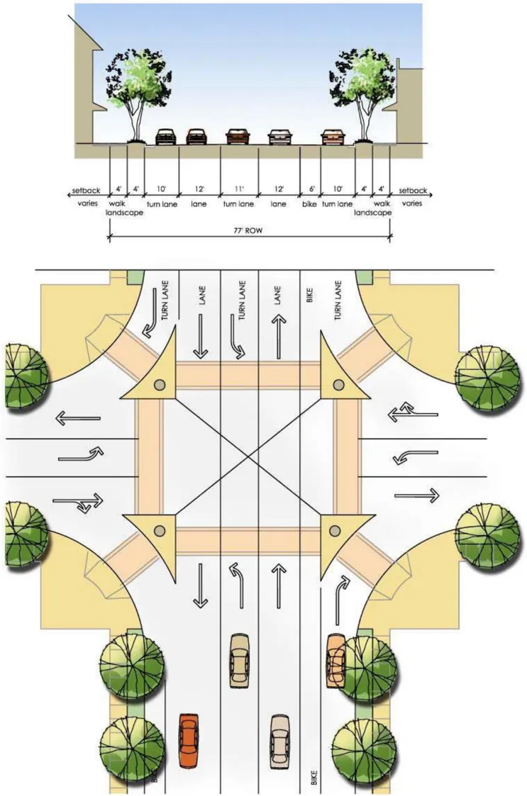
Rio Linda Boulevard
Section titled “Rio Linda Boulevard”Within the SPA, Rio Linda Boulevard is 77 feet at intersections with a turn lane, bike lanes, and sidewalks. The arch at the intersection of Rio Linda Boulevard and M Street is a natural gateway into the Downtown Rio Linda business district, which helps to slow traffic and frames the intersection. No changes to the existing four-way stop traffic-control at this intersection are required upon adoption of the SPA. However, as buildout occurs within the SPA and environs, the Sacramento County Department of Transportation will routinely monitor traffic counts along Rio Linda Boulevard and determine whether a traffic signal is warranted, and whether signal timing at other affected intersections must be changed to accommodate increased vehicle traffic.
Additional measures to promote a more pedestrian-friendly environment on Rio Linda Boulevard at this intersection could include re-designing this portion of the boulevard with narrower vehicle lanes that maintain the existing function of the street, preserving the archway in place, while accommodating larger on-street bike lanes, a landscaped parkway strip, sidewalk, and a generous landscaped gateway at the intersection of M Street within the existing street right-of-way.
Ground floor commercial development at this intersection should be built at or close to the back of the sidewalk along M Street and Rio Linda Boulevard to enhance the pedestrian-scale setting, although portions of the buildings are encouraged to be recessed and the sidewalk width increased to accommodate street furniture such as seating, signage, or other pedestrian amenities.
Any auto service station introduced to this intersection shall incorporate pedestrian circulation elements. Refer to Countywide Design Guidelines for further guidance.
Figure 2.3. Street Plan
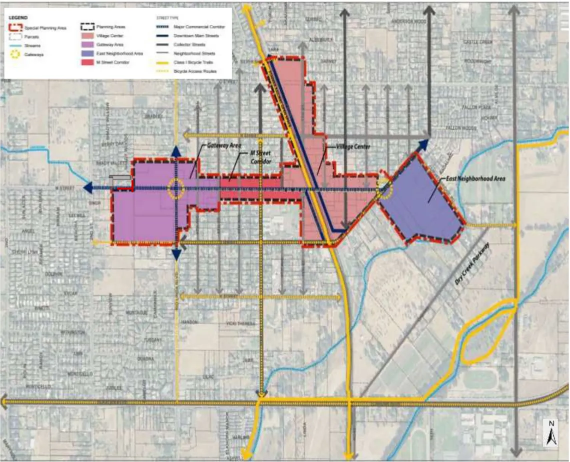
Figure 2.4. Rio Linda Blvd. at the Intersection of M Street
M Street
Section titled “M Street”M Street is a widely used, major east-west neighborhood collector that serves the commercial areas of the Rio Linda community. The approximately 50’ right-of-way along M Street shall be improved to accommodate:
- 11-foot travel lanes;
- On-street parking on both sides of the street;
- Bulb-outs and enhanced cross walks at intersections, and
- A minimum 8-foot wide sidewalk and landscape zone, however wider sidewalks are encouraged by recessing portions of the buildings to accommodate street furniture such as café seating, additional landscaping, signage, or other pedestrian amenities.
Buildings and ground floor uses shall be designed to front and create a continuous public realm edge on the street. The character of M Street may vary depending on the adjacent activity on the street (refer to the street sections in Figures 2.5-2.7).
Downtown Main Streets
Section titled “Downtown Main Streets”Front Street and West Front Street are the two north-south Downtown main streets in the SPA. These main streets serve the historic downtown area and front along the Sacramento Northern railroad right-of-way. These wide streets, varying from a 74 foot right-of-way, north of M Street, to 80-foot right-of-way, south of M Street, shall be designed as two-lane streets with wide sidewalks, generous landscaping along the street, with seating areas, enhanced cross walks, and on-street parking including diagonal parking. Refer to Figures 2.8 and 2.9 for the street sections along Front Street and West Front Street.
Sacramento Northern Bikeway
Section titled “Sacramento Northern Bikeway”Much of the former Sacramento Northern Electric Railroad right-of-way through downtown Rio Linda is now owned by Sacramento County, and is part of the Sacramento Northern Bikeway. The Bikeway extends from the American River trail in the City of Sacramento to Elverta Road.
The number of streets crossing this right-of-way shall be minimized to improve the effectiveness and efficiency of this corridor for alternative transportation. The park blocks within the Sacramento Northern Bikeway right-of-way shall be enhanced with landscaping, pedestrian amenities, and community facilities to serve as a central green amenity, major bicycle and pedestrian corridor, and focal point and gathering place within the community.
Figure 2.5. M Street, Between 2nd Street and 6th Street
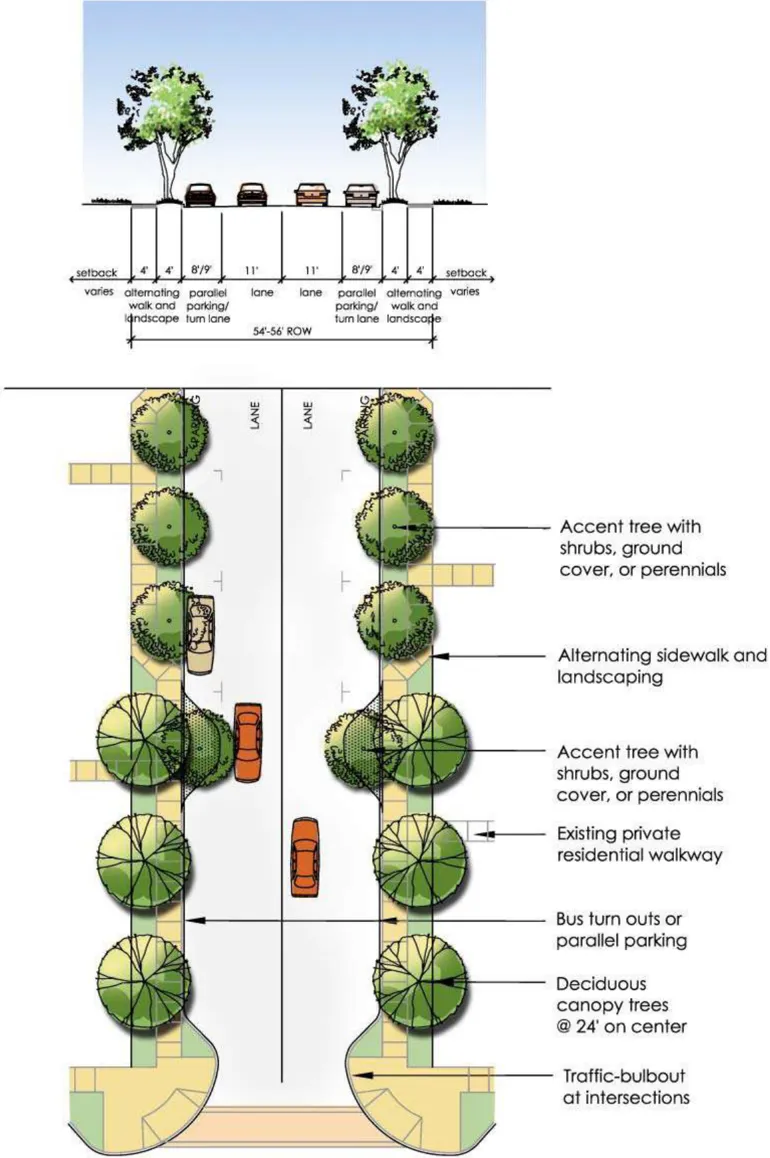
Figure 2.6. M Street, Between 6th Street and 7th Street
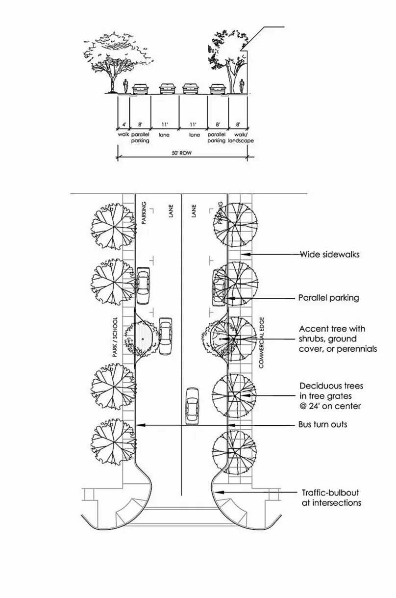
Figure 2.7. M Street, Between 7th Street and 9th Street
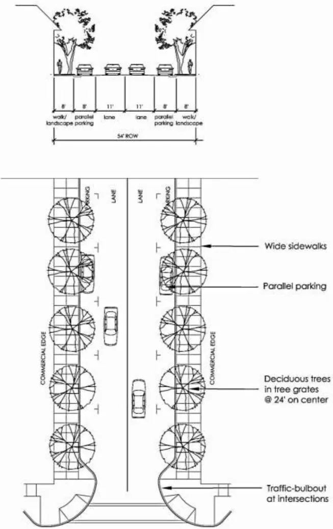
Figure 2.8. Front Street, North of M Street
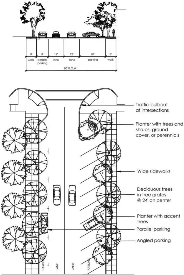
Figure 2.9. Front Street, South of M Street
North-South Neighborhood Streets
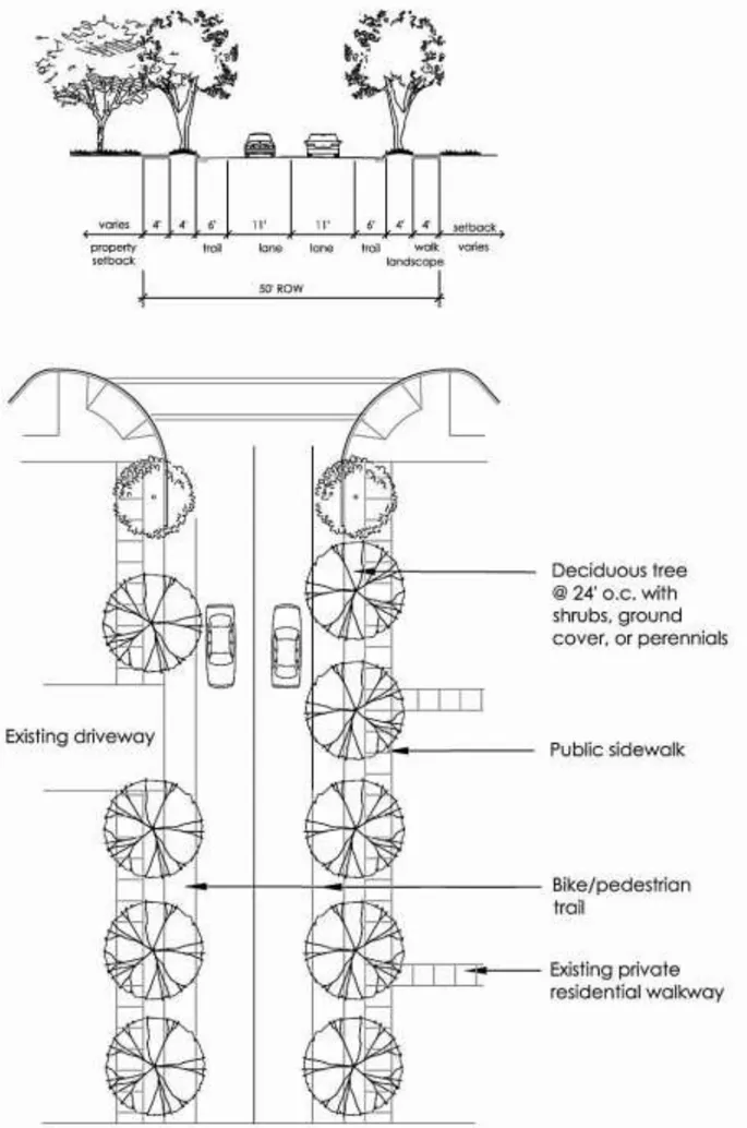
Section titled “North-South Neighborhood Streets”North-south neighborhood streets adjoining M Street, within the SPA, typically have a 50foot right-of-way and vary from improved streets with curb, gutter, and sidewalk to more rural roads with paved streets and no sidewalks. Neighborhood streets in the SPA shall be maintained in their rural appearance, and may be improved with ADA-compliant surfacing adjacent to on-street parking (refer to Figure 2.10 for a typical example of a north-south neighborhood residential street). North-south neighborhood streets adjoining commercial development are encouraged to include parallel or diagonal parking to serve the business areas along M Street (refer to Figure 2.11 for a typical example of a north-south neighborhood street, accommodating commercial development).
Bicycle Access Routes (K Street/L Street/N Street/6th Street, Oak Lane, and Curved Bridge Road)
Section titled “Bicycle Access Routes (K Street/L Street/N Street/6th Street, Oak Lane, and Curved Bridge Road)”An integrated system of bicycle access routes is needed to serve the Rio Linda SPA. L Street, Oak Lane, Curved Bridge Road, and other key streets such as K Street, N Street, and 6 th Street provide continuous access through the Rio Linda community and can enhance and provide safe bike connections. These streets are generally more residential in character, and have lower traffic volumes than the commercial access corridors along M Street and Rio Linda Boulevard. Street sections for a typical residential neighborhood street bicycle route and collector street bicycle routes such as Oak Lane and Curved Bridge Road are shown in Figures 2.12 - 2.14.
Figure 2.10. North-South, Residential Street
Figure 2.11. North-South, Commercial Street
Figure 2.12. Typical Residential Neighborhood Street Bike Access
Figure 2.13. Oak Lane Bike Access
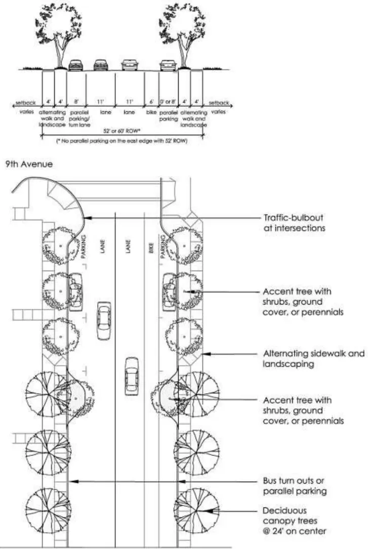
Figure 2.14. Curved Bridge Road Bike Access
CHAPTER 3 | DEVELOPMENT STANDARDS AND DESIGN GUIDELINES
Section titled “CHAPTER 3 | DEVELOPMENT STANDARDS AND DESIGN GUIDELINES”3.1 Development Standards
Section titled “3.1 Development Standards”3.1.1 Development Standards Summary
Section titled “3.1.1 Development Standards Summary”The development standards in Table 3.1 below regulate the building placement, setback, frontage, building envelope, parking, and landscape requirements for each zoning district.
TABLE 3.1 DEVELOPMENT STANDARDS BY ZONE DISTRICT1,4,8
Section titled “TABLE 3.1 DEVELOPMENT STANDARDS BY ZONE DISTRICT1,4,8”This table has been split into multiple tables to comply with accessibility requirements. The following five tables shall be referred to as Table 3.1. Development Standards by Zone District.
Lot Requirements
| STANDARD | RD-20 | NMU/V-NMU | V-CMU | CMU | M Street Corridor9 |
|---|---|---|---|---|---|
| Minimum Lot Size (street/corner) | N/A | N/A | N/A | N/A | 6,000 sf |
| Residential Density (dwelling units/acre) | 10-20 du/ac | 12-20 du/ac6 | 15-20 du/ac6 | 12-25 du/ac | 12-25 du/ac |
| Single Use Non-Residential Floor Area Ratio | N/A | 0.25-0.5 | 0.25-0.75 | 0.25-1.0 | 0.25-0.5 |
| Mixed Residential and Non-Residential Floor Area Ratio | N/A | 0.25-0.5 | 0.25-1.0 | 0.25-1.0 | 0.25-0.5 |
Setback Requirements and Recommended Build-to Lines2,3,10 (minimum, unless otherwise noted)
| STANDARD | RD-20 | NMU/V-NMU | V-CMU | CMU | M Street Corridor9 |
|---|---|---|---|---|---|
| Front and Side Street | 20 ft | 0 ft min.- 20 ft max. | 0 ft min.- 20 ft max. | 0 ft min.- 20 ft max. | 0 ft min.- 20 ft max. |
| Build-to-line from back of sidewalk on M Street10 | 50%10 | 60%10 | 70%10 | 70%10 | 60%10 |
| Side, Interior and Rear Adjacent to residential | 5 ft.(1 story) | 5 ft.(1 story) | 5 ft.(1 story) | 5 ft.(1 story) | 5 ft.(1 & 2 story) |
| Side, Interior and Rear Adjacent to non-residential | 15 ft.(2-3 story) | 15 ft.(2-3 story) | 15 ft.(2-4 story) | 20 ft (1 story) 40 ft (2 story) 60 ft (3 story) |
0 ft (non-res) |
| Rear Adjacent to residential | 20 ft7 | 20 ft | 20 ft | 20 ft | 20 ft |
| Rear Adjacent to non-residential | 20 ft7 | 0 ft | 0 ft | 0 ft | 0 ft |
Structure Height (maximum)
| STANDARD | RD-20 | NMU/V-NMU | V-CMU | CMU | M Street Corridor9 |
|---|---|---|---|---|---|
| Main Building | Per Zoning Code for RD-20 | 45 ft. (3 stories) | 55 ft. (4 stories) | 45 ft. (3 stories) | 24 ft. (2 stories) |
| Accessory Building | Per Zoning Code for RD-20 | N/A | N/A | N/A | 15 ft. (1 story) |
Encroachment Into public right-of-way (maximum)
| STANDARD | RD-20 | NMU/V-NMU | V-CMU | CMU | M Street Corridor9 |
|---|---|---|---|---|---|
| Architectural Features (awnings, bay windows, upper floors) -Front | 3 ft | 3 ft | 3 ft | 3 ft | 3 ft |
| Architectural Features (awnings, bay windows, upper floors) -Side adjacent to street | 3 ft | 3 ft | 3 ft | 3 ft | 3 ft |
| Porches, patios, stoops, terraces, balconies -Front | 8 ft | 6 ft | 6 ft | 6 ft | 6 ft |
| Porches, patios, stoops, terraces, balconies -Side | 3 ft | 3 ft | 3 ft | 3 ft | 3 ft |
| Porches, patios, stoops, terraces, balconies -Rear | 8 ft | 6 ft | 6 ft | 6 ft | 6 ft |
Landscaping Requirements (minimum)
| STANDARD | RD-20 | NMU/V-NMU | V-CMU | CMU | M Street Corridor9 |
|---|---|---|---|---|---|
| Minimum landscape coverage | 30% | 20% | 20% | 20% | 20% |
Trash and Recycling Enclosures and Loading Docks
| Standard | Requirement |
|---|---|
| Minimum Setback of Trash and Recycling Enclosures | 24 ft. from any public street; 25 ft. from residential zoned property; 15 ft. from any private street. All outside trash storage and collection facilities shall be enclosed by a solid masonry wall or view-obstructing fence at least one foot taller than the trash container(s). |
| Minimum Setback of Loading Docks | 25 feet from the boundary of an adjacent residential property. Acoustical study required for Loading Docks less than 75 feet from residential property. |
Notes:
- Where standards are unspecified in Table 3.1, Sacramento County Zoning Code development standards and design guidelines shall apply.
- All setback areas visible from public streets and areas shall be landscaped. Required planter or landscaped areas may include pedestrian walks, steps, and similar hard surface areas provided that such hard surface does not cover more than 25% of the required landscaped area. Ornamental or landscaping rock and gravel areas, artificial turf, or areas covered with other artificial materials shall be considered hard surface areas for the purposes of this provision.
- Exceptions for Mechanical Equipment: Mechanical equipment may be located in the required rear yard or interior side yard provided no structure or equipment shall occupy more than 200 square feet of the required yard area, or shall be located within 5 feet of any property boundary, or extend more than 12 inches above the finished grade. All vents, flues, doorways, or other openings shall be oriented away from the adjacent property boundary. Landscaping shall be provided to screen any portion of such use which extends above ground level.
- Parking may be reduced pursuant to Sacramento County Zoning Code Chapter 6, Administration.
- Landscape coverage is measured as the total square footage of hardscape and landscape areas divided by the area of the lot. Common open space and outdoor amenities can include common patios, small common greens, pools, pedestrian walkways, tot-lots, and recreation areas. It does not include areas used for vehicular access and parking.
- Over 20 units/acre permitted with Conditional Use Permit.
- Default to RD-20 County Zoning Code Standards.
- Parking - Default to County Zoning Code except on M Street.
- On Street Parking may be counted for meeting parking requirement in M Street Corridor.
- ‘Build-to’ standards are preferred but are not required. Project proponents are encouraged to develop properties so that a ‘sea of parking’ does not separate storefronts from the sidewalk and street. Where possible, parking in front of buildings should be kept to a maximum of two ranks of parking stalls, with the remainder on one side of the building.
3.2 SPA Design Guidelines
Section titled “3.2 SPA Design Guidelines”3.2.1. Introduction
Section titled “3.2.1. Introduction”The guidelines and standards in this section are intended to provide guidance to property owners and design professionals so that properties are developed consistent with the goals of the community expressed in the Rio Linda Vision Plan . These design guidelines apply to all new construction in the SPA and exterior modifications to existing buildings. In addition, new construction and major improvements to existing buildings that alter the exterior appearance of the building or change the use of the building shall be subject to Design Review, prior to the issuance of any building permits. Refer to Section 1.3, Administration, for additional guidance on the Design Review process. The guidelines and standards in this section are the basis for design review, serving to clarify the County’s expectations, and make the Design Review process more predictable for property owners and developers. These guidelines will also apply to projects that are not subject to the Design Review process.
How to Use the Guidelines
Section titled “How to Use the Guidelines”The guidelines include two sections:
- General SPA Design Guidelines. These apply throughout the Rio Linda SPA. While some attention has been given to site design, the general guidelines primarily promote the creation of cohesive public areas connecting the districts and encouraging the creation of a comfortable, attractive, and active community fabric. Since most of the planning area allows mixed-use development and some multifamily housing, the guidelines are intended to apply to all uses, whether mixed-or singleuse. However, specific guidelines or sections occasionally apply to specific uses.
- Planning Area Guidelines. These address unique conditions within the four planning areas in the SPA. The planning area guidelines supplement the general guidelines; therefore, the general guidelines should be reviewed first for their applicability, followed by application of the relevant planning area guidelines. Two of the planning areas, the M Street Corridor and the Village Center, have many existing buildings. The guidelines for these planning areas identify design techniques to ensure that new construction and additions are designed and constructed to complement existing buildings.
The guidelines are worded either as recommendations or requirements:
- Statements that are worded as ‘should,’ ‘may,’ ‘are encouraged,’ or ‘are recommended’ address design approaches that are desirable, and should be followed whenever feasible. These guidelines allow flexibility in meeting their intent for any specific project.
- Statements that are worded as ‘shall’ or ‘must’ are requirements that must be included in a project’s design.
In addition, some of the guidelines are illustrated with examples of desirable design. These examples are not intended to exclude other approaches to meeting the intent of the guidelines, nor should they be construed as favoring particular architectural styles, themes, or elements. Illustrated examples are primarily intended to serve as visual reinforcement of the written guidelines and exemplify specific design attributes.
3.2.2. General SPA Design Guidelines and Standards
Section titled “3.2.2. General SPA Design Guidelines and Standards”The design guidelines in this section apply throughout the SPA, to promote consistent design that enhances the quality and appearance of Downtown Rio Linda while reflecting the community’s values and local style.
Site Design and Circulation
Section titled “Site Design and Circulation”Site design considers the internal relationships between buildings, other structures, landscaping, parking, and other development features within a project site, and the relationship of the project site to the street and adjacent properties. These standards are intended to ensure buildings are sited to define and contribute to the creation of a safe and vibrant streetscape environment along M Street and throughout the SPA.
- Building Orientation and Frontage Requirements
Buildings within the SPA should contribute to a pedestrian-friendly streetscape environment through building placement and orientation that defines the relationship between public and private areas (such as sidewalks and public spaces) public areas.
Design Guidelines
- New buildings in the SPA should be constructed near or along the front property lines. Zero-setback lines are encouraged in the Downtown Village Center and commercial areas, compatible with adjacent development. In other areas along M Street and in Neighborhood Mixed-Use areas and residential areas, setbacks should be consistent with the average setback distances of other buildings on the block. Refer to the Development Standards Table in Section 3.1 for the build-to-line guidelines for each zoning district.
- Variations in building setbacks from the requirements contained in the development standards table are allowed public areas for wider sidewalk or pedestrian zones, enhanced building entrances, gateways, plazas, landscaping, dining areas, and other pedestrian amenities.
- Shallow building setbacks, no greater than 20 feet, in combination with landscaping and sidewalks along the street should define the public space along M street, Front Street, West Front Street, and other primary pedestrian paths.
- Building entrances should generally be oriented towards M Street and other primary streets to create a visually appealing and inviting pedestrian atmosphere.
- Primary building entrances should overlook streets, plazas, or courtyards.
- Views to plazas, trails, or other public spaces are encouraged. Buildings adjacent to the Sacramento Northern Bikeway should be designed with windows overlooking the trail to provide passive security.
- Circulation and Access
Circulation within the SPA must accommodate various methods of travel, including public transit, cars, bicycles, and pedestrians in a manner that is safe and efficient, with minimal conflicts between cars, cyclists, and pedestrians. Refer also to Section 2.4, ‘Street Design’ for the design of the overall circulation system and streets serving the SPA. Crosswalks, traffic calming, and other pedestrian improvements are addressed in the streetscape section.
Design Guidelines
General Site Circulation:
- Vehicle and pedestrian circulation should be separated whenever possible and pedestrian access clearly marked.
- Site circulation shall allow and facilitate emergency access to the site and to all buildings.
- All pedestrian circulation walks shall be designed to provide access in compliance with the American with Disabilities Act (ADA), California Title 24, and County standards.
Vehicle Access:
- Vehicle access should be provided from side streets, and alleys or parallel streets separated from the primary pedestrian path, when possible.
Bicycle Circulation:
- To ensure safe bicycle access routes to the Downtown and businesses in the SPA, designated bicycle routes shall be provided along L Street, Oak Lane, Curved Bridge Road, N Street, and 16th Street to connect to existing bicycle routes on the Sacramento Northern Bikeway. Due to the limited right-of-way area and higher volume traffic on M Street, designated bicycle circulation is not recommended on M Street.
- Bicycle lanes must be clearly marked with pavement striping.
- Neighborhood trails or bicycle routes connecting to the Sacramento Northern Bikeway or the Dry Creek Parkway should be clearly identified by appropriate signage.
Pedestrian Circulation:
- Where pedestrian routes cross motor vehicle routes, they should be clearly marked with a different pavement treatment or signage.
- Pedestrian circulation routes must provide clear access to primary and secondary building entrances. Internal pedestrian circulation within developments should connect to nearby public sidewalks, paths, and/or trails, where available.
- Pedestrian routes in surface parking lots should be clearly marked with striping or alternative paving. Walkways adjacent to parking lots should incorporate shade trees and landscaping.
- Pedestrian activity should be supported by street amenities that increase comfort and use, such as benches, shade trees, and seating.
Parking and Service Areas
Section titled “Parking and Service Areas”This section describes the parking design in relation to land use, streetscape, and site design in the SPA. Included in this section is an overview of the parking approach for the SPA and the design of off-street parking areas including landscaping. Refer to Table 3.2 of this Ordinance and the County Zoning Code Chapter 5-9, Parking Standards, for the number of off-street parking spaces required for each land use; this number may be reduced as a condition of Development Plan Review or Special Permit Review pursuant to County Zoning Code Chapter 6. For standards on off-street parking or bicycle parking, not addressed in this Ordinance, refer to Section 5.9 of the Sacramento County Zoning Code.
Requirements for adequate parking should be carefully balanced with the objectives of this SPA to encourage infill development, reuse and improvement of existing buildings and properties within the SPA, and implement streetscape improvements described in Section 2.4.1. Adequate parking in the SPA is needed to serve existing and potential future businesses to ensure that parking in the Downtown and other areas of the SPA do not spill over into adjacent residential neighborhoods or create a nuisance for neighboring uses. However, the County encourages creative and flexible approaches to meeting parking needs in Downtown Rio Linda as described below.
The parking design for the Rio Linda SPA is intended to achieve the following objectives:
- Reduce curb cuts and driveways on M Street to increase the amount of on-street parking and improve circulation and safety on this street;
- Encourage development of diagonal or perpendicular parking on side streets in proximity to business uses;
- Reduce on-site parking requirements for office, retail, and commercial uses by providing alternative means of complying with parking requirements;
- Identify and develop shared parking areas or structures that are convenient and accessible to Downtown Rio Linda to encourage people to park once during their visits downtown; and
- Enhance the design of parking areas to contribute to the overall character/appearance of the community
- Parking Location
Standards for the location of parking are intended to respect varied site conditions within the SPA while enhancing downtown streetscapes, especially along M Street, Front Street, West Front Street, and other commercial or primary pedestrian streets (primary streets) are designated in Figures 2.5 - 2.11.
To ensure parking is appropriately designed and sited, the following factors should be considered in the design and development of off-street parking in the SPA:
-
Ingress and egress and potential conflicts with vehicle and pedestrian traffic;
-
Reinforcing the street edge and a pedestrian environment;
-
On-site circulation and service vehicle areas;
-
Configuration and appearance of parking areas with a layout that is organized and safe for vehicles and pedestrians;
-
Natural surveillance, access controls to prevent opportunities for crime and undesirable activities; and
-
Shading and landscaping to improve pedestrian comfort, break up large paved areas, and promote compatibility for adjacent land uses.
Design Guidelines
The guidelines below are intended to balance the need for parking with a safe and comfortable bike/pedestrian environment that minimizes pedestrian conflicts and the prominence of vehicle parking on primary streets and commercial areas.
General Siting:
- Parking should be conveniently located near non-residential uses
- Locate off-street parking areas and access behind or to the side of buildings, when possible, to reinforce the desired pedestrian-orientation along M Street and through Downtown Rio Linda. Bring buildings to the front or close to the sidewalks along M Street and other primary streets to help frame and enhance the pedestrian zone and experience.
- Parking in front of buildings along M Street or other public streets may be permitted with a landscape buffer between the sidewalk and parking area to provide shade and screening. Front parking will be allowed when site conditions make it infeasible to place parking along the side or at the rear of buildings. For example, lot size or shape could make it infeasible to locate parking to the side or rear of building on parcels:
- With existing buildings with frontage parking;
- In which a new building fronting M Street is proposed; or
- With frontage on two streets (such as corner or through lots) in which parking must be located along one street frontage.
Parking, Access and Entries:
- Parking should be accessed from alleys or side streets, when feasible.
- Minimize curb cut to make sidewalks and pedestrian areas safer by consolidating building sites and reducing the number of access drives from major roadways. Shared driveway access is encouraged when practical to reduce vehicle and pedestrian interactions.
- Along M Street, provide access to residences from alleys or side streets whenever possible to reduce traffic and parking, to limit the number of driveways/curb cuts, and to create a more pedestrian-friendly street.
On-Street Parking:
- Where possible, on-street parking should be provided in front of ground-floor retail/commercial uses.
- On-street parking is the preferred form of parking along M Street and other primary streets. Bicycle parking should be provided to supplement vehicle parking.
- On side streets, on-street parking should be striped for diagonal parking spaces to accommodate as much parking demand in Downtown as possible and in place of parking in front of buildings along M Street whenever possible. To maintain a narrow street section, diagonal parking at a sixty-degree angle should be used.
-
- Parking Lot Shading
Parking lot shading requirements shall incorporate the Sacramento County Zoning Code and Design Guidelines shade requirements.
Design Guidelines
- Lighting, landscaping, hardscape, fencing, parking layout, and pedestrian paths should assist drivers and pedestrian in navigating through surface parking areas. Entrances, exits, and areas that serve as forecourts for entrances, may be suitable locations for special paving materials.
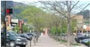
Separate pedestrian paths in parking areas are encouraged.
- Parking lots adjacent to a public street or visible from the street and pedestrian areas should be landscaped to soften the visual impact of parked vehicles. Screening may consist of any combination of a landscape strip with low landscaping such as shrubs and groundcover along the front setback line, street trees, and low walls (a maximum of three feet high). A trellis or seating added to a low wall can also improve the pedestrian environment along the street.
- Adjacent properties should be screened from parking lots.
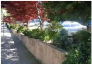
Low walls separate parking areas from public areas.
- Required Off-Street Parking and Bicycle Parking
The general requirements for off-street parking in the SPA are summarized in Table 3.2 below. For all civic uses, uses not associated with a parking requirement in this code, bicycle parking requirements and standards not otherwise addressed in this Ordinance, refer to Section 5.9 of the Sacramento County Zoning Code. Refer to Chapter 6 of the Sacramento County Zoning Code for parking reduction procedures.
- Shared Parking
To accommodate parking for future development, shared parking arrangements between adjacent businesses and/or developments are strongly encouraged when possible and shall be based upon the Urban Land Institute’s current guidance for shared parking or other systems approved by the Planning Director.
- Service Areas
Design Guidelines
- Service areas should be located at the rear of buildings.
- Trash enclosures, loading docks, utility equipment, and similar features shall be located where they do not detract from the appearance of the site, when possible. However, where visible from a side street or neighboring property, such features should be screened using an enclosure made of similar material to the building, as well as landscaping that is harmonious with the site and building architectural design.
Public Areas and Streetscape
Section titled “Public Areas and Streetscape”The streetscape comprises the area between the front property line and the back of the curb. Good streetscape design contributes greatly to defining a corridor’s appearance and attracting visitors. It also provides a comfortable and pleasant pedestrian environment for residents and visitors. Consistent streetscape improvements add predictability and rhythm to the pedestrian experience, and help to unify irregular building siting.
The County will work with the community to pursue funding opportunities for a Streetscape Master Plan, monumentation, and future streetscape improvements, landscaping and wayfinding signage.
- Landscaping and Streetscape Design
Landscaping and streetscape design can be used to establish a unified design theme throughout the SPA to visually link the four Planning Areas. Guidelines in this section supplement the Street Design Standards in Section 2.4. Landscaping within the public areas should be designed to complement existing public and private landscaping in the SPA.
Design Guidelines
- Street trees shall be planted in all publicly accessible pedestrian areas to provide shade during the hot summer months and improve the overall appearance of the SPA. Street trees should be planted on the street and in gathering places such as plazas and parks.
- Primary street trees should be large canopy shade trees of sufficient size at maturity to provide shade to pedestrians and parked vehicles.
- Accent trees may be used at intersections, in gathering places, entryways, and other destinations to provide seasonal color and visual interest.
- Landscaping species should primarily consist of native or other climate appropriate, low-water use plants to reduce irrigation needs. When irrigation is necessary, drip irrigation and other low-water input technologies should be used.
- Pedestrian corridors shall have a minimum of four feet of landscaping on either one side of the walkway or alternating from one side of the walkway to the other, with appropriate ground cover and shade trees.
- The Downtown Rio Linda SPA does not supersede the County Tree Preservation and Protection Ordinance (Sacramento County Code Chapter 19.12). Trees that meet the specifications for ‘native oak trees,’ ‘heritage’ or ‘landmark’ status are protected under this ordinance, which sets forth permit requirements for tree removal as well as control measures to mitigate damage to oak trees caused by land development.
- Gateways
Gateways define the entrance to a unique place or experience. Gateways can be created through building form and placement, streetscape amenities, landscaping, monuments, and other prominent features.
The Rio Linda Archway serves as a gateway element at the primary entrance to the SPA at the intersection of Rio Linda Boulevard and M Street. New signage and development at this intersection should be designed to complement the Archway’s gateway function.
A second gateway or other entry feature should be located at the intersection of 9th Street and M Street. Special gateway signage directing visitors into the Village Center from both entrances along M Street can help to define this area as a unique district.
Design Guidelines
- A unique and consistent way-finding signage program shall be incorporated into the gateway locations and carried out throughout the M Street-Oak Lane Corridor to identify key destinations.
- Consistent gateway signage should be supported by complementary landscaping and lighting.
- Primary gateways to Downtown Rio Linda should include gateway monumentation.
- Public art may be incorporated into the gateway design program to identify the Rio Linda SPA.
- Entrance into the Downtown Village Center along M Street should also be clearly defined around the intersections of 6th Street and 8th Street.
Archways can be used to emphasize entrance into a community or neighborhood.
A new public plaza framed by buildings would enhance the civic character of the Village Center.
- Parks, Open Space, and Recreation
Developed public open space currently within the SPA includes Depot Park between Front Street and West Front Street, which encompasses the restored train depot. Mature trees provide shade during hot, summer months, but no seating is currently provided. The Sacramento Northern Bikeway bisects this grassy area providing regional trail connections within the community.
Infill development in the SPA should build on the success of this central public space by including additional public spaces. These spaces can vary by size, location, and function. Suitable examples of public open space desired in Rio Linda include cafe seating for restaurants and cafes, seating areas near office entries, and small public plazas at civic buildings or commercial centers. Open spaces should include pedestrian amenities (seating, shade, landscaping), using high-quality, durable materials.
Design Guidelines
Cafe Seating:
- Cafe seating may be provided on sidewalks provided they do not obstruct pedestrian circulation; a minimum 5-foot wide pedestrian zone must be maintained adjacent to the commercial centers.
- Shade may be provided through awnings at least eight feet in height projecting from buildings, umbrellas, street trees, or other shade structures.
Public Plazas:
- Plazas should be located near activity centers (e.g., shopping areas, offices, civic buildings, and other public use areas) to encourage use and provide places to gather.
- Public plazas should be visible from M Street to promote active use.
Public Art:
- Development proposals that include public open space such as plazas, entryways, or public circulation should include public art from local artists whenever possible. Public art may consist of:
- Stand-alone art that serves as a visual centerpiece,
- Water and landscaping features,
- Fencing or gates, and
- Public amenities such as seating, lighting, and trash receptacles.
Bike Trails:
- Include signage that encourages cyclists to use L Street, N Street, K Street, 6 th Street, and Curved Bridge Road for circulation within the SPA and to access regional trails.
- Construct visible bike trail access within the Village Center through the use of signage and lighting.
- Provide bicycle parking and way-finding signage near bike trail access points to direct visitors to the Village Center and other commercial centers.
Patio seating may be accommodated by variations in building setbacks.
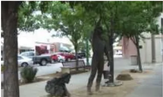
Public art adds points of interest to the public areas.
- Lighting and Pedestrian Amenities
Lighting contributes to safety and the pedestrian experience. It can also be used to highlight architectural detailing or natural features. Cobra-head lighting is currently used on M Street, and some highmast lighting can be found on residential streets. These types of lighting serve a safety function, but do not create an attractive pedestrian environment. Smaller-scale decorative lighting would contribute to a consistent public area theme within the SPA, as well as provide a safe pedestrian experience.
Design Guidelines
- Pedestrian-scaled decorative lighting should be included in streetscape improvements along M Street between Rio Linda Boulevard and 9th Avenue.
- Distinctive accent lighting should be used to highlight architectural elements of a building or particular landscape features, such as water elements.
- Lighting fixtures must be constructed of durable materials, have vandal-resistant covers, and be resistant to tampering.
- Hoods or other design elements should be incorporated into lighting fixtures to avoid light spillover and promote dark sky standards.
- Signage
Signage gives direction to locations of interest, announces entrances into a distinct place, and contributes to a consistent design theme. No unified signage theme or way-finding signage currently exists within the SPA. A consistent signage treatment plan or program should be developed for the SPA in the future as additional development occurs. The Sacramento County Zoning Code, Section 5.10, sets forth sign regulations; the Sacramento Countywide Design Guidelines provide additional signage guidelines.
Design Guidelines
- Sign design should communicate the business type or activity that is being advertised. Effective signs should:
- Be architecturally compatible with the development and the surrounding character of the area;
- Promote the uniqueness of establishments;
- Identify businesses clearly and attractively;
- Enhance their associated building; and
- Be located so as not to create visual clutter.
- Directional signage should be provided along M Street to guide visitors to areas of local interest, including the commercial district, historic depot, park, library, and bike trails.
- All gateway and directional signage should reinforce the overall design theme in the SPA.
- The following types of signage are appropriate for use in the SPA, including gateway monuments, monuments, wall mounted, hanging, and directory signs, as described below.
Decorative, human-scaled lighting will enhance the pedestrian experience and increase safety.


The photos above provide examples of appropriate sign types for use in the SPA.
Gateway Monument Signs: This signage is typically a freestanding sign on a base, and may be designed as a monument or pedestal. Gateway monument signs should be used to distinguish Rio Linda’s gateways. Gateway monument signs are used primarily for identification, and could be used at the entry to the corridor from the West and East Village Centers. Signage should represent the unique character of Rio Linda.
Monument Signs: In addition to their use as gateway signage, monument signage is typically used to identify an entrance of a particular business or commercial center.
Wall Mounted Signs: Wall-mounted signs are suspended from a wall surface for support. Wall-mounted signs should only identify tenant names and addresses. Wall-mounted signs are the preferred signage for businesses along the corridor.
Awning Signs: Awning signs are messages printed on a shaded canvas or other fabric cover that extends above the pedestrian walkway. Awnings provide shelter from the weather and add color and interest along the sidewalk. Awning signs are encouraged as supplemental signage along the corridor.
Blade or Hanging Signs: Blade or hanging signs encroach into the pedestrian right-of-way and are designed to be seen by pedestrians from the walkway below.
Directory Signs: These signs may be used to identify multiple tenants in a single building, such as in an office setting.
Gateway signage should welcome visitors into the SPA.
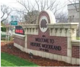
Example of a monument sign in character with the community
Example of an awning sign
Unique hanging signs enliven the streetscape and complement the overall design theme.
- Sign design should communicate the business type or activity that is being advertised. Effective signs should:
- Traffic Calming
Traffic calming techniques are used to increase pedestrian and cyclist safety by slowing traffic, increasing driver awareness of pedestrians and cyclists, and/or manage the interaction of roadway users. Traffic calming measures should be incorporated as streetscape improvements are made to ensure safe pedestrian crossings around the intersections within the SPA. Traffic calming devices should be used in the Village Center, on M Street, and at the intersection of Rio Linda Boulevard and M Street to slow traffic as it passes through these higher volume traffic and pedestrian areas to ensure safe street crossings for pedestrians and bicyclists.
Design Guidelines
- Traffic calming measures must be implemented at all major intersections along M Street, Front Street, and West Front Street to improve the safety and convenience of cyclists and pedestrians. Intersections requiring traffic calming shall be determined as development progresses along the corridor.
- Traffic calming measures in the SPA should include the following:
- Corner bulb-outs/curb extensions on all intersections along M Street;
- Colored or textured pavement to identify pedestrian walkways at street crossings or within the commercial centers and at pedestrian activities areas or public open space; and
- Speed tables with slightly raised crosswalks adjacent to public areas and within the residential streets adjacent to M Street to divert traffic from using these streets as pass-through routes.
- Form and Massing
Design Guidelines
- Most buildings within the SPA are typically one or two stories. New buildings should be no more than four stories. Except along M Street, when more than three stories are proposed, these additional stories should be stepped back to minimize their visual presence from the public right-of-way.
- Architectural elements should be designed into new buildings and renovations to break up building façades and reduce their visual scale on the street. Elements could include:
- Arcades,
- Window awnings,
- Canopies,
- Building recesses, and
- Cornices and other decorative architectural elements.
- Utility boxes, mechanical equipment, and service and delivery areas should be screened from view from the public rights-of-way.
- Materials and Colors
Design Guidelines
- Buildings shall be constructed of high-quality materials that are durable and contribute to the character of the community, pursuant to Section 3.2.3,
- Specific District Design Guidelines. Stucco, brick, stone, terra cotta, tile, nonreflective metal, or other solid façade materials should be used as the primary building material at the ground floor.
- Materials and colors should be used to break up the scale of larger buildings into smaller planes. At least two complementary colors shall be used on each building.
- Building materials should complement those used on significant nearby structures, unless the materials on existing buildings are inconsistent with the other guidelines in this section.
- Earth tones should be used for a building’s primary color, with brighter colors used sparingly to accent architectural features.
- Fences and Walls
Design Guidelines
- Fences in the front yard of residential areas shall not exceed three feet in height and shall be at least 50% transparent.
- Low fences or walls may be used to separate surface parking areas from the public areas to reinforce a consistent street wall.
- Detailing and materials of walls and fences shall reflect the style and character of the building and site. Chain link fences are discouraged and, if proposed, shall be appropriately screened with landscaping.
- Where large expanses of fencing will be unavoidably exposed, they should be screened with upright shrubs or trellises. Trellises shall be constructed of durable materials.
- Fencing adjacent to the Sacramento Northern Bikeway should be no more than 4 feet in height and shall be at least 50% transparent to allow passive surveillance of the trail.
Fencing materials should be compatible with the overall character of the SPA.
TABLE 3.2: OFF-STREET PARKING
| LAND USE | 2015 ZONING CODE REQUIREMENT (ZC Section 5.9) | RIO LINDA SPA REQUIREMENT |
|---|---|---|
| Retail Restaurants and Bars | 4 spaces/1,000 ft 1 space for every 3 seats | 3 spaces/1,000 ft No change |
| Professional Office Medical Office | 3.5 spaces/1,000 ft 2 4.5 spaces/1,000 ft | 3 spaces/1,000 ft 4.5 spaces/1,000 ft |
| Mixed-Use* | Sum of required spaces for all uses (may qualify for space reduction for shared parking) | Sum of required spaces for all uses (see below for shared-parking guidance) |
| Single Family Residential | 2 spaces per dwelling unit | 2 spaces per dwelling unit |
| Multifamily Residential Studio/1 bedroom 2+ bedroom | 1.5 spaces per dwelling unit 2 spaces per dwelling unit | 1 space per dwelling unit 1.5 spaces per dwelling unit |
*The total parking required for mixed use projects is the sum of the commercial and residential parking requirements.
Building Form and Architecture
Section titled “Building Form and Architecture”Building form and architecture addresses the shape and appearance of buildings.
3.2.3. Specific District Design Guidelines and Standards
Section titled “3.2.3. Specific District Design Guidelines and Standards”Overview
Section titled “Overview”During the community outreach for the Vision Plan, Rio Linda residents expressed strong appreciation for the town’s rural character and affirmed that they wish to retain its appeal. Elements that offer a valuable sense of continuity with the town’s history include the presence of nearby open spaces (such as the Sacramento Northern Bikeway and Dry Creek Parkway), rural roadways, and older commercial and industrial structures concentrated in the center of town along the former Sacramento Northern railroad line as well as farmhouses scattered throughout the community. A survey of local planning priorities taken during a visioning workshop for the Rio Linda Vision Plan revealed the local community was overwhelmingly in favor of an ‘Old Town’ architectural theme.
Although there are no officially-designated historic districts or buildings, many older buildings in the downtown area are valued by residents and contribute to Downtown’s character and history. Rio Linda does include one designated landmark structure - the Rio Linda Archway at the intersection of Rio Linda Boulevard and M Street is a designated Point of Interest (No. P614) on the California Register of Historical Resources, and as previously noted, serves as a visual gateway to the community.
Rio Linda’s notable buildings and structures that are architecturally distinctive, local community identifiers, and locally important to community residents, include:
- Rio Linda Fire Station;
- Rio Linda arch over the Sacramento Northern Bike Trail in Depot Park;
- Rio Linda water tower;
- Re-created train depot;
- Troy Park Monument;
- Churches;
- Old Mill site; and
- Rite Auto Body and Towing building (a former movie theater with marquee)
In addition, it is possible to identify an established character in at least two of the planning areas, M Street and the Village Center, as represented by existing development. The character of an area can be identified through site design features and architectural elements, including:
- Relationship of buildings and structures to the lot, to adjoining streets, and to nearby open space
- Number of stories and building size/massing
- Architectural style and elements, including roof design and materials
- Street trees and landscaping
Village Center
Section titled “Village Center”- Character Overview
The Village Center includes a number of small commercial and retail buildings on M or Front Streets. Typical features of commercial buildings in the Village Center include:
- Buildings located along the back of the sidewalk, or separated from the sidewalk or street by small parking lots in front of the buildings;
- One-story typical, with a few two-story buildings;
- Flat roofs with occasional false fronts;
- Typical building materials: brick and concrete masonry, wood siding (particularly vertical wood siding), wood shingle siding, decorative river rock, stucco; and
- Metal, wood, or fabric awnings.
The Rio Linda Fire Station is an older building that retains some of its original character, including the original brickwork and doors.
Existing buildings represent the variety that can be found in Rio Linda’s Village Center, and can serve as examples of the scale, relationship to the street, and materials that can be incorporated into new development in the Village Center. However, these examples are only intended to be suggestive, as infill development in the Village Center need not mimic existing development to complement the existing context. Because Rio Linda’s Village Center includes commercial buildings with varied architectural forms, styles, and elements, new infill development should be designed to be consistent with the overall massing and form of existing commercial buildings. Architectural elements and details on existing buildings can also provide inspiration but may be creatively interpreted.
Successful infill development includes the reconstructed train depot, which houses the Chamber of Commerce and the new fire station. Both buildings incorporate natural materials (wood or stone) that complement the existing materials found in Rio Linda’s commercial buildings without conforming to a prescribed theme or architectural style.
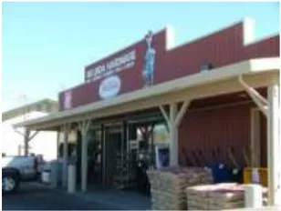
A typical commercial building, with flat roof and false front, wood siding, and an awning
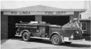
Rio Linda Fire Station, with partial stucco exterior and modified windows and door
Rio Linda Fire Station showing original brickwork
Design Review is required for all public and private construction, development, or improvement projects that involve major new construction, major additions, or façade improvements that significantly alter the exterior appearance of a historically or locally significant building.
Modification of historic properties must be consistent with the current version of the Secretary of the Interior’s Standards for the Treatment of Historic Properties. Demolition of buildings or structures designated as historically significant is prohibited unless the building or structure is deemed unsafe by Sacramento County.
- Form and Massing
Although most structures in the Village Center are one or two stories in height, with the exception of the Rio Linda water tower, the development standards in Table 3.1 allow for a building height limit of four stories in the Village Center. This height limit allows the possible construction of senior housing, residential units over ground floor commercial, or similarly varied housing types that will bring more residents into the Village Center and contribute to the town’s vitality. Any infill development that exceeds two stories must therefore be designed to reduce the visual scale of the building so that it complements the existing context, rather than appearing massive and outsized.
Design Guidelines
- All buildings, whether nonresidential or residential, shall incorporate architectural elements at the ground floor that are scaled to reduce the appearance of mass as seen from the street level. Architectural elements may include:
- Articulated doorways, including inset doorways in commercial buildings, and stoops and porches on residential units
- Windows providing direct visual access to the street
- Horizontal lines, including cornice lines and the use of a different exterior material at the ground floor level to ‘anchor’ the building
- Awnings or sun shades over windows and doors
- Buildings taller than two stories should avoid the appearance of a large, unbroken façade through articulation of the façade above the ground floor. A single façade plane should not exceed 50 feet in width. Variation may include insets, setbacks, and changes in color and materials.
- Rooflines should vary every 75 horizontal feet, at a minimum. The height of the roofline may be varied to create visual interest, whether a flat or pitched.
- Development of large parcels should be sensitive to the scale of smaller nearby buildings, and massing should be broken up accordingly.
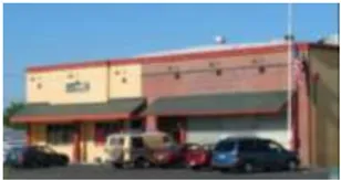
These simple commercial buildings have been articulated with variations in color and materials and the use of awnings and a roof cornice.
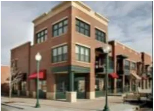
The third story incorporated into the corner of this mixed-use building allows for additional square footage without compromising the building’s human scale. Varied setbacks and rooflines provide visual texture and articulation.
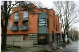
Buildings taller than two stories should be articulated to appear less massive.
- All buildings, whether nonresidential or residential, shall incorporate architectural elements at the ground floor that are scaled to reduce the appearance of mass as seen from the street level. Architectural elements may include:
- Building Orientation and Build-to Lines
Many existing buildings along M Street in the Village Center are located at the back of the sidewalk near the front of the property, helping to create a pedestrian-friendly environment for shoppers and residents. Infill development should emulate this site design along M Street, Front Street, and West Front Street.
Design Guidelines
- Infill development along M Street should be constructed at the back of the sidewalk or near the front of the property. Building setbacks may vary within five feet of the build-to line.
- Infill development constructed at the corners of M Street and Front Street or West Front Street should receive design treatment that locates both elevations to the build-to line at the back of the sidewalk.
- Due to their proximity to the Sacramento Northern Bikeway, buildings on Front Street and West Front Street in the Village Center should be designed with their primary elevations oriented toward the street, and should be located near the front of the property at or near the build-to line, but should also address the Bikeway with architectural features and access points.
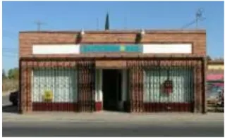
This existing building on M Street displays the site design desired for buildings on M, Front, and West Front Streets with the building constructed to the back of the sidewalk at the front of the property. (The security grill is not recommended as a design feature).
- Materials and Colors
Materials are one of the distinctive aspects of the Village Center, with a significant number of commercial buildings using brick or vertical wood siding, alone or in combination, with brick or masonry as the base material, with siding above. These materials give commercial buildings in Rio Linda a distinctive appearance that sets the Village Center apart from contemporary stucco-faced commercial buildings.
Design Guidelines
- Materials used in new construction in the Village Center should be similar to the existing materials of construction of neighboring buildings.
- Primary building materials should be high-quality, durable, and natural in appearance, including brick, wood, stone, and river rock.
- Untextured stucco may be used in combination with other building materials. For example a durable base material, such as stone, could be used at the ground floor in combination with stucco above. However, for consistency with the majority of existing commercial buildings in the Village Center, stucco should not be the dominant exterior material.
- Decorative materials (e.g., metal, wood trim) that complement the primary building material should be a minor portion of
- the overall surface of the building.
- Highly reflective materials, such as corrugated steel siding, stainless steel, and mirrored glass are inconsistent with the rustic character of the Village Center and should not be used.
- Materials and colors should be used to break up the scale of larger buildings into smaller planes.
- In general, colors should be earth tones, but brighter and/or contrasting accent colors may be used to highlight architectural elements such as trim or awnings.
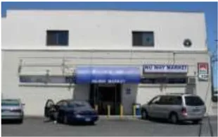
The Nu Way Market includes brick and concrete masonry on the ground floor with wood siding on the second story. The large surface planes of the building should be articulated through the use of color and contrasting use of the two materials.
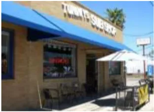
Brick, in a variety of shades, is a common building material in the Village Center.
- At least two complementary colors shall be used on each building.
- Brick, stone, and masonry should be left in their natural state and not painted.
- Any identity-oriented signage on infill construction in the Village Center should not detract from significant buildings and signage.
- New construction details should be appropriate to the character of details found in significant buildings identified in the survey. However, reproduction of historic building details should be limited on new buildings.
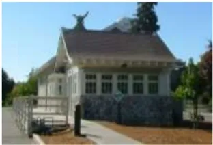
The Chamber of Commerce, housed in the reconstructed Train Depot, is an effective example of new construction that uses durable materials and high-quality construction that complements, but does not mimic materials found on other buildings in the Village Center.
M Street Corridor
Section titled “M Street Corridor”- Character Overview
The M Street Corridor, as defined here, includes the segment between 5 th Street and 7 th Street one to two parcels deep. The area consists primarily of single-family homes and civic uses, including the United Methodist Church and the Rio Linda Elementary School (now closed). Defining features on M Street are primarily derived from the existing single-family homes, including:
- Front entries primarily onto M Street
- Varied front setbacks, some 10 feet or less
- One story in height, typical
- Low, pitched roofs
- Brick, stucco, lap siding typical
- Mature trees and landscaping
The United Methodist Church is of masonry construction with wood siding above, with steeply pitched rooflines. The building does not represent a style that can be easily replicated or emulated by infill development, nor is it similar to the homes on the street, but is of sufficient architectural interest to encourage its preservation.
The streetscape along M Street consists primarily of a narrow, incomplete sidewalk that is periodically obstructed by utility poles. Sidewalks give way to storefront parking in non- residential areas. Mature trees and landscaping within residential yards provide some shade and greenery, but there is not a consistent landscaping treatment along the corridor.
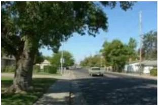
View to west near 6 th St. of homes on M Street, showing varied setbacks and mature landscaping
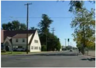
View to east from 6 th Street of the United Methodist Church and Rio Linda Elementary School
Cobra-head street lights provide illumination for drivers but do not create an inviting pedestrian environment. Bus stops along M Street cannot support seating because the sidewalks are too narrow.
Design Review is required for all public and private construction, development, or improvement projects that involve new construction, major additions, or façade improvements that significantly alter the exterior appearance of a historically or locally significant building.
Modification of historic properties must be consistent with the current version of the Secretary of the Interior’s Standards for the Treatment of Historic Properties. Demolition of properties designated as historically significant is prohibited unless the building or structure is deemed unsafe by Sacramento County.
- Building Orientation and Build-to Lines
Most residential properties have a primary entry facing M Street, with more variation among commercial and civic buildings. In addition, there is considerable variation in the width of front setbacks. New infill should be constructed to continue the frontage and setbacks found in the Village Center further along M Street into the corridor area to create a street wall of buildings.
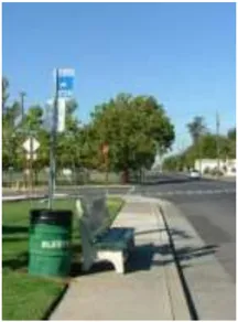
View west toward Rio Linda Elementary School showing narrow sidewalks and lack of space for transit stop amenities.
- New infill construction should have a primary façade and entry that fronts onto M Street. Secondary entries may be accessed from side streets or access drives.
- Infill construction may be located at the back of the sidewalk, near the build-to line, particularly in the case of new commercial or office construction. Alternatively, setbacks may be derived from an average of existing setbacks along the block.
- Building Form and Architecture
- To respect the existing residential context of singlefamily homes, new infill construction should be modest in scale and form, as described below:
- Except where infill construction is adjacent to buildings that are three-story or taller, new buildings should not exceed two stories in height to avoid outsized buildings near existing homes. Taller buildings may also be located near the Village Center and Gateway Area, which have higher floor area ratios and higher height limits than the M Street Corridor.
- New buildings must be articulated (see Village Center, Form and Massing, above) to break the façade into multiple visual planes and provide visual interest.
Gateway Area and East Neighborhood Area
Section titled “Gateway Area and East Neighborhood Area”- Character Overview
The Gateway Area, focused at the intersection of Rio Linda Boulevard and M Street, is characterized by the Rio Linda Archway spanning the intersection, one-story commercial and office buildings on Rio Linda Boulevard south of M Street, several vacant lots on the northwest and southwest corners of this intersection and a vacant commercial building at the northeast corner. Sidewalks are incomplete, there is little to no landscaping or street trees, building setbacks are wide, and parking lots occupy building frontages. Uses in the Gateway area include a convenience store, bar, liquor store, restaurants, professional offices including an optometrist, dentist, chiropractor, and veterinary clinic, residential uses, a recycling center, and parking. With the exception of some commercial structures and the professional offices, most development at this corner intersection includes aging, auto-oriented structures that do not contribute to the Rio Linda community’s architectural character.
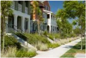
Infill construction such as these townhomes should front onto M Street with entries at or near the build-to line at the back of the sidewalk.
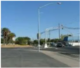
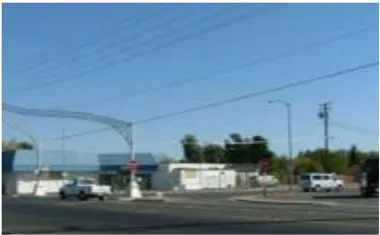
Intersection at Rio Linda Boulevard and M Street, showing vacant properties and parking lots.
The East Neighborhood Area, located between Oak Lane on the north, the north branch of the Dry Creek Road on the south, and Curved Bridge Road on the east, consists primarily of the aging Mar-Val shopping center and some low-rise multi-family units. It is located within the Dry Creek 100-year flood plain. Like the Gateway area, development found on this site is characterized by an auto-oriented development pattern defined by narrow sidewalks and a planting strip, a large-footprint shopping center, shopping-center storefronts that do not relate to the street, and a sea of parking around all four sides of the building with minimal landscaping.
The Gateway Area and East Neighborhood Area, as key intersections marking the western and eastern edge of the SPA business district, should be designed to reinforce the more intimate pedestrian scale found in the Rio Linda community. Consisting of large infill parcels with strong opportunities for development and redevelopment, these sites require streetscape improvements that would enhance these two important gateways, establish a clear and attractive pedestrian linkage, and relate to the surrounding neighborhoods.
Examples of character-defining features include:
- Smaller, scale bungalow-style residential development
- Varied front setbacks with some as shallow as 10 feet or less
- One story, typical
- Low, pitched roofs
- Typical materials include: brick, stucco, and wood siding
- Mature trees
New development or modifications to existing development in these neighborhood commercial areas should be highly compatible with the features of existing surrounding residential development.
Design Review is required for all public and private construction, development, or improvement projects that involve new construction, major additions, or façade improvements that significantly alter the exterior appearance of a historically or locally significant building.
Modification of historic properties must be consistent with the current version of the Secretary of the Interior’s Standards for the Treatment of Historic Properties. Demolition of properties designated as historically significant is prohibited unless the building or structure is deemed unsafe by Sacramento County.
- Site Design and Circulation
For these commercial areas in Rio Linda, efficient vehicle circulation, comfortable pedestrian circulation, and convenient parking are important to attracting visitation and use.
Design Guidelines
- Buildings at the corner of Rio Linda Boulevard and M Street should have their primary building frontage oriented toward M Street.
- On large parcel developments consisting of more than one building, buildings should be clustered to incorporate common outdoor gathering spaces with pedestrian amenities.
- Pedestrian circulation routes and gathering places should be carefully situated to avoid conflict with vehicle traffic especially in the Gateway area. Enhanced intersection improvements are recommended at the intersection of Rio Linda Boulevard and M Street.
- To promote a pedestrian-friendly streetscape environment, parking should not be located in lots in front of businesses.
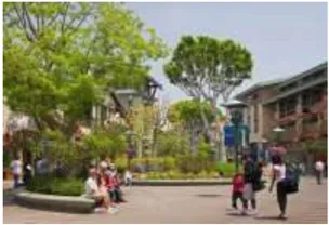
Buildings on large parcels should be clustered to include open space and pedestrian amenities.
- Public Areas Design
Guidelines for public area landscaping, streetscape, signage, lighting, and open space should be consistently applied throughout the SPA. These additional specific standards apply to the Gateway and East Neighborhood areas:
- Gateways to the community should be reinforced for the Gateway area at Rio Linda Boulevard and M Street and for the East Neighborhood area at 9th Street and M Street through the construction of a vertical, signature architectural element, landscaping, public open space, and signage to enhance the sense of arrival to the district.
- Two-story buildings and/or public plazas are encouraged at the intersection.
Individual buildings and tenants in multi-tenant buildings must be connected by shaded pedestrian walkways.
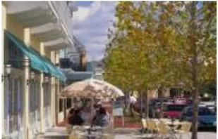
Buildings should be connected by shaded pedestrian walkways.
- Building Form and Architecture
Building designs should include a clear sense of arrival and entry from M Street. The following guidelines are intended to promote commercial/retail development that is pedestrian-oriented and inviting for the local community and visitors.
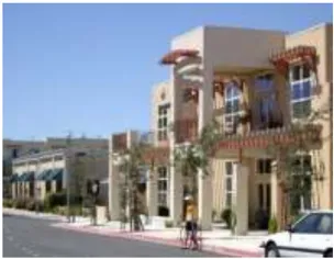
Buildings should have a clearly defined entry on M Street. Vertical elements, awnings, and overhangs can help to enhance entries.
Design Guidelines
- Buildings located along Rio Linda Boulevard and M Street should be oriented toward the street with storefront windows or similar architectural features that add interest and texture to the pedestrian level, and include a public entryway clearly visible from the street.
- Commercial storefronts and entries can be enhanced with awnings, overhangs, and arcades to articulate the entry and provide protection from the weather.
- Buildings in the Gateway Area should be designed to take advantage of the relatively higher visibility provided at this intersection. Vertical architectural elements should be incorporated into new construction to enhance this gateway into Downtown Rio Linda.
- Large buildings should be designed to reduce their scale and bulk through the use of these design techniques:
- Varied building lines and setbacks;
- Varied but compatible building materials, colors, and architectural elements such as case windows, overhangs, awnings, recesses, and changes in the roofline; and/or
- A building base at the pedestrian level that visually anchors the building to the ground plane.
- Where buildings include multiple tenants, individual tenant spaces can be identified through:
- Placement of columns, piers, or pilasters between building bays;
- Varying tenant space with recessed entries;
- Using arcades and roof overhangs; and/or
- Modifying building or roof heights between tenants.
Corner buildings should be two-story and with vertical elements that reinforce the building’s gateway location.