Executive Summary
Sacramento County General Plan of 2005-2030
Executive Summary
Section titled “Sacramento County General Plan of 2005-2030 Executive Summary”Adopted November 9, 2011
Board of Supervisors
Section titled “Board of Supervisors”Phil Serna, District 1
Jimmie Yee, District 2
Susan Peters, District 3
Roberta MacGlashan, District 4
Don Nottoli, District 5
Bradley Hudson, County Executive
Community Planning & Development Department
Executive Summary
Section titled “Executive Summary”The Sacramento County 2030 General Plan will guide growth and development within the unincorporated County over the next 20 years. Key strategies of this updated Plan include a focus on economic growth and environmental sustainability, addressing the issues and needs of existing communities, and establishing a new framework for accommodating the growth of new communities based on smart growth principles. The many individual Elements of the General Plan address the wide variety of issues and proactive actions to be taken by the County to enhance and preserve the quality of life for County residents, enhance our economic strengths, and preserve our agricultural heritage.
The 2030 General Plan builds upon the traditions and frameworks of the County’s prior five General Plans dating back to the first Plan adopted in 1965. This latest update refines many of the important concepts of the previous 1993 General Plan in recognition of changes in demographics, socio-economic shifts, environmental awareness, technological innovation and the regulatory environment. Several former unincorporated communities have become cities since the Plan was last updated including Citrus Heights, Rancho Cordova and Elk Grove while growth in the region has become more dispersed. The national economy, reflected in our local housing and job markets, has gone through periods of extreme fluctuation, with high levels of housing growth in the mid-2000’s and a subsequent recession with record low levels of development activity when this Plan was adopted.
These changes have affected the County’s assumptions and approaches to land use, economic prosperity and growth, employment opportunities, housing needs, transportation, resource conservation and public services. The County’s 2030 General Plan addresses the wide range of topics related to the physical development of the unincorporated County with a planning period of 2005 to 2030. The Plan frames solutions that recognize, despite the current economic downturn, growth will rebound and the County must position itself to take advantage of that growth in employment, housing and commercial activity. To do so effectively, the County must embrace and prioritize a policy framework that encourages greater diversity in its job base and economic growth beyond the historical reliance on the government and construction sectors of our economy.
The Plan retains many of the innovations established in the 1993 General Plan, such as the Urban Services Boundary (USB) and Urban Policy Area (UPA) and a strong link between transportation and land use planning. However, there are numerous new policies that shape overall strategic changes, including economic and environmental sustainability, a greater focus on existing communities, and a new framework for managing growth.
An overarching mission of the update is to address long-term sustainability, both in terms of economic vitality, fiscal stability and environmental stewardship. The Plan includes a new Economic Development Element, highlighting the fact that economic growth and expansion is possibly the most crucial issue facing the County at the present time. The need for fiscal stability was underscored by the current status of the national and local economy and its effect on County residents and County government’s ability to serve its citizens. General Plan Elements reflect the County’s intent to improve and enhance a strong and vibrant economy and its extraordinary communities to allow for the best possible options for environmental and public benefit stewardship. The emergence of environmental sustainability as a key issue stemmed from a growing public awareness and desire to be more “green” and the need to respond to various new state and federal regulations to improve air and water quality, protect sensitive habitat and reduce greenhouse gas (GHG) emissions. This General Plan, in conjunction with the County’s new Sustainability Program, will ensure that growth occurs in both an economically and environmentally sustainable manner.
Thousands of County residents attended meetings, workshops and hearings to help shape this Plan and other related multijurisdictional and regional planning efforts.
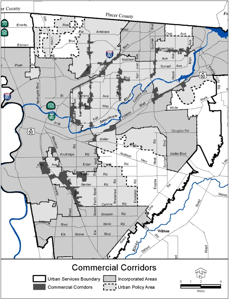
A second key focus of the General Plan is addressing the County’s existing urbanized unincorporated communities. The Plan proposes to revitalize existing mature communities by focusing limited County resources on commercial corridor planning. These commercial corridor plans seek to effect change in both the public realm, such as through street improvements, while establishing a land use framework for the design of new and rehabilitated structures in the private realm along these streets to retain and recapture vitality in these important community areas. Each corridor plan is created with input from local residents and businesses and is unique to that community. The County has moved forward to implement this strategy with five corridor plans adopted and three more in various stages of development as of the end of 2011.
The final key focus is creating a new framework for how the County will manage growth. The County anticipates that after adoption of this Plan, the Board will consider proposals to expand the UPA to create several new communities. Approval of any new community will be based on its ability to meet a robust set of criteria that clearly articulates the County’s expectations for high quality design and the creation of complete communities that offer a range of housing, employment, commercial uses, transportation choices and community amenities. The General Plan sets important and vital standards for the quality design of new communities. This Executive Summary provides background information on the County, describes the legal framework of a General Plan, provides a guide for how the General Plan is organized, highlights the key strategies of the 2030 General Plan, summarizes the Update process and finally includes a section on community profiles of the various unincorporated County communities.

The General Plan is often referred to as a blueprint or ‘constitution’ for new development.
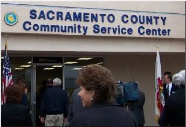
Sacramento County has opened Community Service Centers in the unincorporated area to provide services closer to where residents live and work.
COUNTY BACKGROUND AND GOVERNMENT
Section titled “COUNTY BACKGROUND AND GOVERNMENT”Sacramento County was incorporated in 1850 as one of the original 27 counties of the State of California. It is home to over 1.4 million people, the State legislature and State Capitol. The County covers approximately 990 square miles and is located in the middle of the 400-mile long Central Valley, 87 miles east of San Francisco and 100 miles west of Lake Tahoe. Sacramento County has seven incorporated cities: Sacramento, Elk Grove, Citrus Heights, Folsom, Galt, Isleton, and Rancho Cordova. The County also contains a number of mature communities in the unincorporated area which are described in greater detail at the end of this Executive Summary.
Sacramento is one of fourteen charter counties in the state and is governed by the Board of Supervisors. The County is divided into five districts, with one board member elected from each supervisorial district. A County Executive appointed by the Board of Supervisors runs the day-to-day business of the County. Several Departments and Agencies operate under the County Executive to support the delivery of services throughout the County, including the Community Planning and Development Department.
Counties have many roles in our state, and often serve as agents for the state, delivering front line services mandated at the state level. Those services include such things as running elections, safeguarding public health, providing official document recording services and prosecuting alleged criminals and housing the convicted in jails. A wide variety of social services are provided by counties.
In most counties within California, the vast majority of residents also live within the boundaries of incorporated cities, which provide them with residential services such as waste collection, police, parks, libraries, code enforcement and animal regulation. Sacramento County is unique in that we have a large percentage of residents who live in the county, but not within the boundary of any of our seven incorporated cities. Those residents, who live in the unincorporated area, rely upon the county to provide city-like services to them as well.
QUICK FACTS ABOUT SACRAMENTO COUNTY
Section titled “QUICK FACTS ABOUT SACRAMENTO COUNTY”| People 2010 Census QuickFacts | Sacramento County | California |
|---|---|---|
| Population, 2010 | 1,418,788 | 37,253,956 |
| Population, percent change, 2000 to 2010 | 16.00% | 10.00% |
| Mean travel time to work (minutes), workers age 16+, 2005-2009 | 25.6 | 27 |
| Housing units, 2009 | 552,852 | 13,433,718 |
| Homeownership rate, 2005-2009 | 60.10% | 57.90% |
| Housing units in multi-unit structures, percent, 2005-2009 | 27.10% | 30.70% |
| Households, 2005-2009 | 503,437 | 12,187,191 |
| Persons per household, 2005-2009 | 2.67 | 2.91 |
| Per capita income in past 12 months (2009 dollars) 2005-2009 | $27,033 | $29,020 |
| Median household income, 2009 | $52,502 | $58,925 |
| Persons below poverty level, percent, 2009 | 15.30% | 14.20% |
| Business 2010 Census QuickFacts | Sacramento County | California |
|---|---|---|
| Private nonfarm establishments, 2008 | 28,532 | 8,790,251 |
| Private nonfarm employment, 2008 | 453,536 | 137,429,251 |
| Private nonfarm employment, percent change 2000-2008 | 7.00% | 6.7%1 |
| Nonemployer establishments, 2008 | 85,514 | 2,688,453 |
| Total number of firms, 2007 | 108,960 | 3,425,818 |
| Manufacturers shipments, 2007 ($1000) | 7,282,833 | 491,372,092 |
| Merchant wholesaler sales, 2007 ($1000) | 15,728,050 | 598,456,486 |
| Retail sales, 2007 ($1000) | 15,599,967 | 455,032,270 |
| Retail sales per capita, 2007 | $11,357 | $12,561 |
| Accommodation and food services sales, 2007 ($1000) | 2,252,889 | 80,852,787 |
| Building permits, 2009 | 982 | 35,069 |
| Federal spending, 2008 | 20,795,613 | 2,999,226,301 |
| Geography QuickFacts | Sacramento County | California |
|---|---|---|
| Land area, 2000 (square miles) | 965.65 | 155,959.34 |
| Persons per square mile, 2010 | 1469.3 | 238.9 |
| Climate | - |
|---|---|
| Average Annual MaximumTemperature | 73.6 degrees |
| Average Annual MinimumTemperature | 49 degrees |
| Average Rainfall | 19.6 inches |
| Transportation | - |
|---|---|
| Light Rail System | 37.4 miles |
| Mainline Railroad Tracks | 3 |
| Sacramento International Airport Annual Passengers | 10.4 million |
| Port of Sacramento Shipping | 870,000 short tons of cargo annually |
| Amenities and Educational Facilities | - |
|---|---|
| Regional Parks Districts | 14 |
| Trees | 6 million |
| Major Public & Private Colleges & Universities | 19 |
| Public School Districts | 16 |
| Major Art and Historical Museums | 15 |
| Public Libraries | 26 |
| Hospitals | 10 |
| Leading Agricultural Crops | milk, wine grapes, Bartlett pears, field corn, and turkeys |
A READER’S GUIDE TO THE GENERAL PLAN
Section titled “A READER’S GUIDE TO THE GENERAL PLAN”WHAT IS THE GENERAL PLAN?
Section titled “WHAT IS THE GENERAL PLAN?”California state law requires each city and county to adopt a General Plan ‘for the physical development of the county or city, and any land outside its boundaries which bears relation to its planning’ (§65300). The California Supreme Court has called the General Plan the ‘constitution for future development.’ The General Plan expresses the community’s development goals and embodies public policy relative to the distribution of future land uses, both public and private.
The General Plan contains a set of goals, policies and programs that address important community issues such as housing and transportation needs, economic development, public safety, natural resource protection, sewer and water infrastructure, roadways, schools, and parks. It is the basis for land use and public policy decisions made by the Board of Supervisors and other policy makers. As a long-term guide for future growth, the plan helps both County leaders and residents make decisions about the location, size, and quality of new development, the improvement of existing neighborhoods and commercial areas, the revitalization of commercial corridors, the extension and upgrade of utilities and infrastructure, and the future of the County’s parks, public spaces, and natural areas. It also provides the foundation for other planning documents, public works projects and zoning decisions - all of which must be consistent with the General Plan.
The Plan builds on a long tradition of planning in Sacramento County. Since Sacramento County’s first General Plan was completed in 1965, decisions regarding land development and revitalization, as well as public investments in transportation, public utilities, and parks, have been guided by a General Plan. General Plan 2030 continues this tradition.
State Law mandates that every California county and city develop and adopt “a comprehensive, long-term general plan… for the physical development of the county or city” (§65300)
Citizens, community groups, County agencies and other organizations participated in strategizing for a better future.
WHAT IS THE PLAN’S RELATIONSHIP TO OTHER PLANNING DOCUMENTS?
Section titled “WHAT IS THE PLAN’S RELATIONSHIP TO OTHER PLANNING DOCUMENTS?”The General Plan provides a broad framework and direction for land use planning in the County. However, other planning documents have been adopted by the Board of Supervisors to address planning on a smaller and more detailed scale. They include:
-
Community Plans: Reflect the goals and policies of an individual community, guiding land use matters and development of the community on a more detailed basis than the General Plan.
-
Community Action Plans: More detailed than a Community Plan, they may include discussion above and beyond land use issues, such as economic development, public safety, transportation issues, municipal services, public facilities, community identity, streetscape improvements, etc.
-
Master Plans (aka Specific Plans, Comprehensive Plans): Detailed policy plans that identify allowable land uses and infrastructure needs for a specific geographic area. These plans are focused on implementation and are usually used to carry out specific development projects. Zoning, subdivision, and public works decisions must be in compliance with master plans. Master Plans, while not technically part of the General Plan document, are designed to implement projects consistent with the General Plan, Community Plans or Community Action Plans.
-
Special Planning Areas (SPAs): SPAs are a flexible mechanism to identify zoning and other requirements under unique circumstances. Traditionally, SPA’s were used to apply special zoning standards to site-specific areas. They have been more recently used to implement corridor plans and large master plans.
-
The Sacramento County Zoning Code: One of the most important planning documents relating to the General Plan is the Zoning Code. The Zoning Code specifies immediate uses for land, which is adopted by ordinance and is recognized as local law. It is the primary instrument for General Plan implementation. A priority for implementation of the General Plan update is completing a pending revision to the Zoning Code.
While the General Plan, zoning code and other planning documents adopted by the Board of Supervisors only apply to the County, the County’s General Plan ‘Land Use Diagram’ shows the land uses of other jurisdictions located within the County. Although the County has no control over these land uses, including them emphasizes the County’s role as a leader in countywide planning and regional collaboration efforts. Showing all of the land uses within the County on a single map allows for a comprehensive look at development patterns and transportation systems within the metropolitan area, facilitating coordination of multi-jurisdictional and regional planning efforts.
HOW IS THE GENERAL PLAN ORGANIZED?
Section titled “HOW IS THE GENERAL PLAN ORGANIZED?”The General Plan is organized in three parts:
- Executive Summary: An overview of the General Plan, providing readers with a basic understanding of the larger document. It outlines the plan's purpose, structure and goals.
- Elements: Policies that make up the framework for decision-making regarding growth and development in the County. State law requires that a General Plan contain seven mandated Elements, including Land Use, Circulation, Housing, Conservation, Open Space, Noise and Safety. Optional Elements may also be adopted at the discretion of individual jurisdictions.
- Background Section: An appendix with detailed information and descriptions of existing conditions that shaped the General Plan Elements.
Of these three components, the most important are the Elements because they contain the specific policies and procedures that guide long-term development trends for the unincorporated areas of the County. The Elements are the foundation from which all plans and programs originate. There are 15 Elements in the General Plan, seven mandated by State Law and eight optional, along with a number of policy plans that have been adopted into the General Plan.
HOW ARE THE ELEMENTS ORGANIZED?
Section titled “HOW ARE THE ELEMENTS ORGANIZED?”Each Element is generally organized based on the following framework:
Goal: A directional statement that leads toward an ideal end or condition in the future related to the public health, safety, or general welfare of a community. General plan goals statements in the General Plan are achieved by policies and implementation measures contained within the document.
Objective: An intermediate step toward achieving a goal.
Policy: A specific statement that guides decision-making and is based on General Plan goals and objectives. Policies are created by an analysis of data and represent the commitments of local legislative decision makers.
Implementation Measure: An action, procedure, program, or technique that carries out General Plan policies.
Here is an example of the hierarchical relationship between goals, objectives, policies, and implementation measures:
Goal: A thriving town center that is the heart of a community’s retail and commercial service activities.
Objective: The town center will have neighborhood scale retail and commercial development along with opportunities for mixed-use development, including housing and pedestrian-friendly amenities.
Policy: The County shall not approve discretionary projects or building permits that could impede development of the town center concept for neighborhood scale and mixed use development.
Implementation Measure: The County shall adopt a designation for town centers on the General Plan Land Use Diagram and develop special planning area development standards for zoning and regulating land uses within these town centers.
Table 1.1
Section titled “Table 1.1”| Required Element | Purpose and Goal of the Element (Excerpted from State Law and the State Office of Planning and Research’s General Plan Guidelines) |
|---|---|
Land Use  |
Function as a guide to planners, the general public, and decision makers as to the ultimate pattern of development for the county. It has perhaps the broadest scope of the seven mandatory Elements and is the most visible and often-used element in the General Plan. It plays a central role in correlating all land use issues into a set of coherent development policies. The Element and accompanying ‘Land Use Diagram’ designates the type, density/intensity, and general distribution of land uses in the County, including housing, business, industry, open space, education, public buildings, waste disposal facilities, and other categories. |
Circulation  |
A transportation and infrastructure plan that addresses the circulation of people and goods. It identifies the general location, size and extent of exist- ing and proposed roadways, public transit, pedestrian and bicycle facilities, air transportation facilities, etc. By statute, the Circulation Element must cor- relate directly with the Land Use Element. The Circulation Element also has direct relationships with the Housing, Open Space, Noise and Safety Elements. |
Housing  |
State Housing Element law requires local governments to adequately plan to meet their existing and projected housing needs including their share of the regional housing need. The County’s Housing Element contains a comprehensive assessment of current and projected housing needs for all economic segments and includes policies and action programs for that purpose. Unlike the other mandatory elements, the Housing Element is subject to detailed statutory requirements regarding its content and must be updated every five years. The Housing Element is also subject to mandatory review by a state agency. |
Conservation  |
Provide direction regarding the conservation, development, and utilization of natural and cultural resources including water, forests, soils, rivers, mineral deposits, and aquatic and terrestrial species and their habitats. Its requirements overlap those of the Open Space, Land Use, Safety, and Circulation Elements |
Open Space  |
Guide the comprehensive and long-range preservation and conservation of ‘open space land’ (§65563), including open space for the preservation of natural resources, the managed production of resources (including agricultural lands), outdoor recreation, and public health and safety. |
Noise  |
Limit the exposure of the community to excessive noise levels. Local governments must ‘analyze and quantify’ noise levels and the extent of noise expo- sure through measurement or modeling. Resulting noise level ‘contours’ must be mapped and the conclusions of the Element used as a basis for land use decisions. The Element includes implementation measures and possible solutions to existing and foreseeable noise problems. The Noise Element directly correlates to the Land Use, Circulation, and Housing Elements. |
Safety  |
Reduce the potential risk of death, injuries, property damage, and economic and social dislocation resulting from fires, floods, earthquakes, landslides, and other hazards. Other relevant safety issues, such as airport land use, emergency response, hazardous materials spills, and crime reduction are also addressed. The Safety Element overlaps topics also mandated in the Land Use, Conservation, and Open Space Elements. |
Table 1.2
Section titled “Table 1.2”| Optional Elements | Purpose and Goal of the Element |
|---|---|
Air Quality  |
Improve air quality to promote the public health, safety, welfare, and environ- mental quality of the community. The Element strives for air quality and pollutant reduction from transportation, development and construction, industrial and agricultural activities in the most cost-efficient and sustainable manner feasible that support the other objectives of the General Plan. |
Agricultural  |
Protect and maintain of the County’s agricultural lands, their agricultural productivity and natural resource benefits they provide, and promote and support farming and related industries as a strong and viable sector of the economy. |
Delta Protection  |
Protect and restore the overall quality of the Delta environment, including agriculture, wildlife habitat, and recreational activities; assures balanced conservation and development of land resources, and; improves flood protection. |
Economic Development  |
Provide opportunities for balanced economic growth throughout the County and integrate economic development as a component/consideration in evaluat- ing land use, transportation and other policy issues. Serve as an action plan for the County to proactively address tax base expansion, business creation and retention, business expansion, and corridor redevelopment. Plan and use the County’s land and infrastructure resources in an efficient and productive manner to promote a high quality of life and enhance the fiscal stability of the County. |
Energy  Energy Energy |
Reduce per-capita energy consumption, shift toward using a greater share of re- newable sources of energy, reduce peak demands, and maintain and enhance the general standard of living, the level of employment and quality of the environment. |
Hazardous Materials  |
Proper use, handling, and disposal of hazardous materials to minimize the im- pact of hazardous materials on human health and the environment and enhance emergency response to hazardous material situations. |
Human Services  |
Ensure high quality human services, including those provided by private, not- for-profit and government entities, are available and accessible to all current and future residents of the County. Provides for the delivery of cost-effective, efficient human services as a component of land use planning in order to enhance quality of life and improve the opportunities for fiscal sustainability. |
Public Facilities  |
Establish guidelines for financing, building and maintaining a variety of public facilities, including police and fire stations, city and county offices, electricity and natural gas distribution systems, libraries, and parks. Facilitate creation of a network of public infrastructure, facilities and services to support a high quality of community life, public health and safety, and economic development. |
Table 1.3
Section titled “Table 1.3”| Policy Plan | Purpose and Goal of the POLICY PLAN |
|---|---|
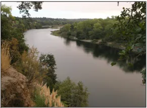
| American River Parkway Plan | Guide land use decisions affecting the Parkway, specifically addressing its preservation, use, development and administration. Protect the Parkway’s natural environment while providing limited recreational and interpretive educational developments to facilitate human enjoyment. |
| Bicycle Master Plan | Guide and influence bikeway policies, programs, and standards to make bicycling in Sacramento County more safe, comfortable, convenient, and enjoyable for all bicyclists. Increase the number of persons who bicycle to work, school, errands, and recreation in Sacramento County. Development of projects included in the plan will enhance biking as a viable transportation alternative, improve quality of life, and reduce traffic congestion, air pollution and GHG emissions. |
| Hazardous Waste Management Plan | Serves as the primary planning document for hazardous waste management within the County, and contains goals, policies and recommended programs for the management, recycling and disposal of hazardous wastes. The HWMP principally governs the coordination and planning of hazardous waste disposal capacity between the County and state. The California Department of Health Services (DHS) must give its approval to the plan before the document becomes effective. |
| Pedestrian Master Plan | Establish goals and strategies to increase pedestrian safety and improve walkability. Development of projects included in the plan will enhance walking as a viable transportation alternative, improve quality of life, im- prove quality of life, and reduce traffic congestion, air pollution and GHG emissions. |
| TOD Guidelines | Guides development of mixed use, pedestrian friendly projects located at strategic points along transit corridors, designed to result in an efficient pattern of development that supports transit and reduces congestion, air pollution and GHG emissions. |
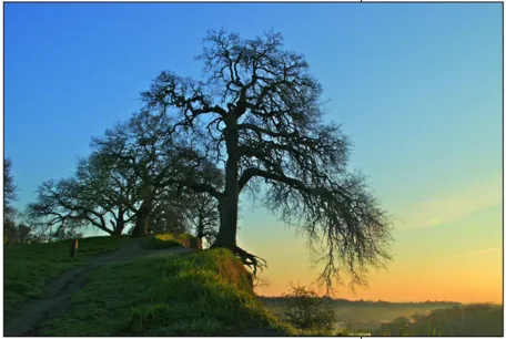
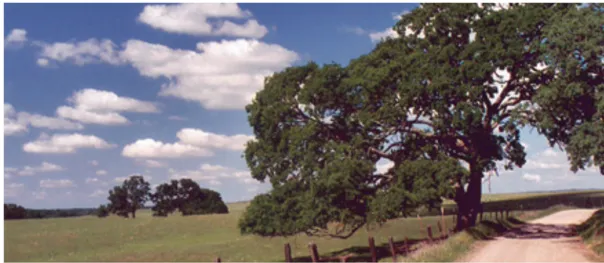
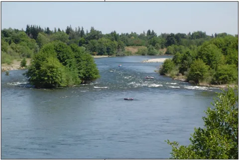
A Hundred Year Oak peering Westward along the American River Parkway
WHAT ARE THE KEY STRATEGIES OF THE GENERAL PLAN?
Section titled “WHAT ARE THE KEY STRATEGIES OF THE GENERAL PLAN?”The following section highlights some of the General Plan’s key strategies to make the County a healthy, safe, prosperous and desirable community. These key strategies, and the programs that put them into action, are the foundation of the Plan.
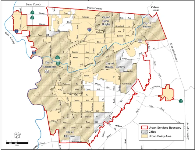
The Urban Policy Area (UPA) is shown in orange and the Urban Services Boundary (USB) is denoted by the red line.
A Sustainable Growth Management Program
Section titled “A Sustainable Growth Management Program”The 2030 General Plan continues to pursue the vision of the 1993 General Plan: promote efficient use of land, encourage economic vitality and job growth, reduce urban sprawl and its impacts, preserve habitat and open space, and protect agricultural and rangeland operations. Two growth boundaries are identified to help implement this vision: the Urban Services Boundary (USB) and the Urban Policy Area (UPA). The USB is the ultimate growth boundary for the unincorporated area. The UPA defines the area within the USB expected to receive urban services in the near term. Together, the UPA and the USB promote orderly growth and the efficient extension of infrastructure and the provision of urban services. They also seek to preserve agriculture and rangelands, critical habitats and natural resources. The 2030 General Plan introduces a new framework for considering requests to expand the UPA; it requires any expansion to meet a series of ‘smart growth’ performance criteria. Refer to the Land Use Element (policies LU-1 and LU-2) and the ‘Amending the Land Use Diagram’ section for more information on the County’s growth boundaries and growth management program.
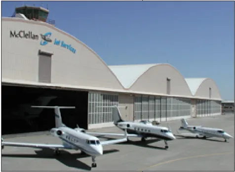
Sacramento County’s ongoing success in creating jobs at McClellan Business Park is hailed as a national model for innovation and a vital transformation from an Air Force Base to a thriving economic engine.
Economic Development
Section titled “Economic Development”Taking actions to ensure a healthy local economy is of vital importance to Sacramento County, including retaining existing business, attracting new industries and business ventures, diversifying the County’s job base and taking actions that improve the tax base. While policies supporting economic development can be found throughout the General Plan, a new Economic Development Element was adopted to highlight the importance of enhancing and sustaining a healthy economy. The new Element serves to provide opportunities for balanced economic growth throughout the County and integrate economic development as a consideration in evaluating land use, transportation and other policy issues. The Element serves as an action plan for County staff and policy-makers. It contains strategies for tax base expansion, business creation and retention, business expansion, job base diversification and commercial corridor revitalization. It calls for the County’s land and infrastructure resources to be planned and utilized in an efficient and productive manner to promote a high quality of life for residents of the County and to enhance the fiscal stability of the County.
Strong Land Use and Transportation Linkage
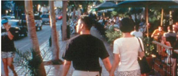
Section titled “Strong Land Use and Transportation Linkage”The General Plan integrates land use and transportation planning as part of a long-term strategy to improve mobility options and efficiency. This program is designed to develop land use patterns that support a connected system of transit and pedestrian facilities, leading to improved transportation options and reduced traffic congestion, air pollution and GHG emissions. Various Elements and policy sections speak to this overall strategy including the components of the plan that advocate for Transit Oriented Developments (TODs) - compact, mixed use developments near transit that will encourage walking and biking, improve local commerce, and help to create the critical mass of people needed to support regional transit services. The Commercial Corridor planning section of the Land Use Element relates to this transit-land use linkage, as well as the Transit section in the Circulation Element that addresses mobility alternatives to the automobile.
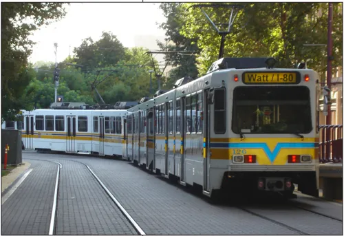
Encouraging more homes, shops and jobs in appropriate areas near transit helps support the County’s investment in light rail and other transit services, while providing residents with more travel choices.
Balanced and Integrated Transportation System
Section titled “Balanced and Integrated Transportation System”This Plan strives for a true ‘multi-modal’ transportation system - an interconnected system of roadways, light rail and bus lines, bike routes and sidewalks that provide residents with transportation options, moves people and goods efficiently and conveniently, reduces pollutants and GHG emissions and enhances economic development and quality of life. The Plan also focuses on creating ‘complete streets’ that provide for safe and efficient travel for all modes. This transportation system will be created over the life of this Plan through a cooperative effort including federal, state, regional and local agencies. The Circulation Element and accompanying Transportation Plan diagram contains a wealth of information regarding the County’s transportation-related plans. For more information, refer to: the County’s Bicycle and Pedestrian Master Plans; Sacramento Regional Transit District’s Transit Action Plan and Short Range Transit Plan; and Sacramento Area Council of Government’s Metropolitan Transportation Plan and Blueprint Vision.
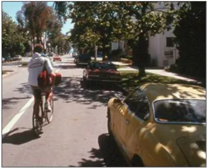
Building ‘complete streets’ is a key strategy of this Plan.
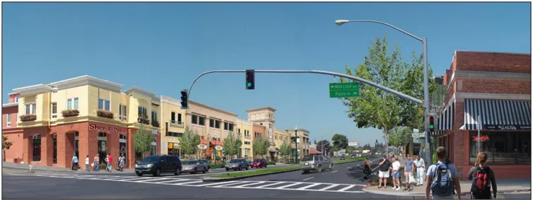
This photo rendering shows potential improvements to the Fair Oaks Boulevard commercial corridor in the County.
Infill and Commercial Corridor Redevelopment
Section titled “Infill and Commercial Corridor Redevelopment”Opportunities for infill exist throughout the urbanized portion of the County and there are vacant and underutilized properties within established communities that are available for reuse or revitalization. The focus now is on revitalization efforts in older commercial corridors to encourage infill development, transportation improvements and blight reduction while providing each corridor with a lively and unique ‘Main Street’ character. Maximizing development opportunities in these areas will support walking, biking and transit; provide residents with new nearby housing, employment and shopping opportunities; improve air quality and reduce GHG emissions; and encourage economic growth. Infill continues to be encouraged in appropriate locations outside of the corridors; however, the Plan recognizes a policy balance between seeking infill and ensuring that development is compatible with existing neighborhoods. This includes a shift away from the 1993 Plan’s requirement that each community provide additional residential holding capacity sufficient to meet that community’s ‘fair share’ of the County-wide target. See the Land Use and Circulation Elements for more information.
Housing Opportunities and Diversity
Section titled “Housing Opportunities and Diversity”The 2030 General Plan seeks to encourage many types of housing, varying in terms of cost, design, size, location, and tenure to meet the needs of all segments of the County’s population. The Plan also acknowledges the Housing Element’s programs to address housing affordable to all income levels in the County. Refer to the Land Use and Housing Elements for more details on residential development. The County began updating its Housing Element in 2011 and anticipates adopting the revised Element by 2013 as required by state law.
A County of Unique, Diverse and Balanced Communities
Section titled “A County of Unique, Diverse and Balanced Communities”The County’s reputation as an exceptional place to live and work is in large part due to the quality of its many diverse communities. With their distinctive character, history, and natural setting, these communities will provide residents with a safe, healthy environment and a strong sense of identity and ownership. These established communities are places where people of all incomes and age groups reside, with a full range of land uses including local shopping, education, employment, entertainment and recreational opportunities. Through preservation, rehabilitation, and new development, the County will offer a wide range of alternatives to meet the demands of an increasingly diverse regional housing market. County investments in transportation improvements, parks, schools, and public facilities will strengthen and reinforce neighborhood character. A collection of community profiles is included at the end of this document.
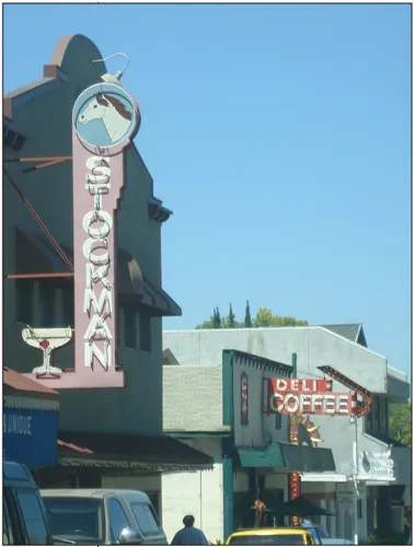
Fair Oaks Village
Environmental Conservation and Sustainability
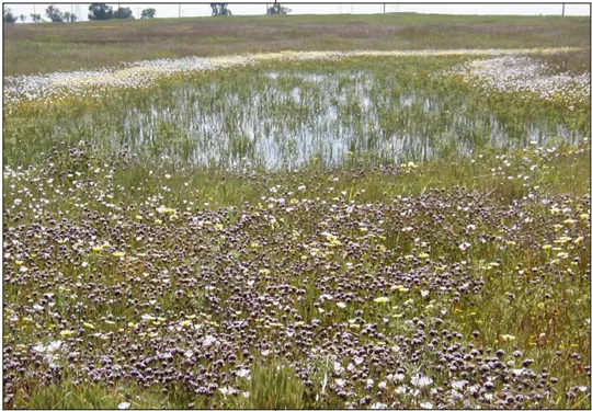
Section titled “Environmental Conservation and Sustainability”The County is committed to intelligent use and/or conservation of consumable and natural resources, agricultural lands and rangelands, critical habitats, natural preserves, and the aquatic and terrestrial species that inhabit natural ecosystems. The General Plan establishes policies that balance sustainable human habitation with conservation of the natural resources in the County. For example, the Conservation and Open Space Elements discuss Habitat Conservation Plans (HCPs), a regional approach to addressing issues related to urban development, habitat conservation and agricultural protection. HCPs consolidate environmental efforts to protect and enhance habitats and provide ecologically viable conservation areas while minimizing regulatory hurdles and streamlining the permitting process for projects that engage in development activities. The County is currently working on the South Sacramento HCP for the area south of Highway 50 including portions of Elk Grove, Galt and Rancho Cordova. If successful, the Plan will facilitate and streamline development through a plan to conserve species via an agreement among state/federal wildlife and wetland regulators, the County, and participating local governments. This agreement will allow land owners to engage in the ‘incidental take’ of listed species in return for conservation commitments from the County and participating local governments.

“Green collar” jobs, such as those related to energy efficiency and renewable energy projects, are a growing sector of Sacramento County’s job base.
A Healthy and Safe Community
Section titled “A Healthy and Safe Community”Hazards can result from the actions of nature or people. The General Plan identifies and assesses the potential for hazards to occur in Sacramento County and formulates measures that provide adequate public preparedness and protection. Safety measures identified in the Plan include conventional police and fire services, disaster planning, crime prevention through community and building design, neighborhood watch programs, and an ample supply of safe, well-designed parks, open space, trails and pathways. Protection from flooding, a major natural hazard, is ensured through continual maintenance of the County’s extensive levee system, drainage facilities and natural waterways. Through these policies, the General Plan aims to reduce threats to public safety, enhance quality of life and encourage sustained economic development. For more information, refer to the Safety, Public Facilities and Hazardous Materials Elements, as well as the County’s Hazardous Waste Management Plan and Floodplain Management Ordinance.
Public Facilities to Serve Existing Communities and Complement New Growth
Section titled “Public Facilities to Serve Existing Communities and Complement New Growth”The General Plan recognizes that public infrastructure and facilities such as water, sewer, roads, drainage, schools and parks must keep pace with population growth and development. The Plan facilitates creation of a network of public infrastructure, facilities and services to support a high quality of community life, public health and safety, and economic expansion. The Plan emphasizes three critical aspects of service provision: adequacy, timing and equitable financing. Every significant development proposed must prepare a Public Facilities/Infrastructure Master Plan to identify required major infrastructure improvements necessary to support the proposed development, and to present a detailed plan for the phasing of capital improvements, identifying the extent, timing and estimated costs of all necessary infrastructure. Look in the Public Facilities and Circulation Elements for more information regarding public facilities and infrastructure plans.
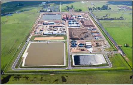
The County’s new Vineyard Surface Water Treatment Plant will provide clean and safe drinking water to both current and new County residents.
Lead Regional Collaboration
Section titled “Lead Regional Collaboration”Many of the critical planning issues facing Sacramento County are not limited by the County’s boundaries, but are regional in nature. Planning issues relating to air quality, water quality, housing, traffic congestion, transit, loss of agricultural lands, waterway protection and natural resource preservation affect the County of Sacramento, yet the County cannot address them alone. The General Plan reflects the County’s intent to assume a leadership role in dealing with these regional issues while fostering cooperation between cities and other federal, state, regional and local agencies and organizations.
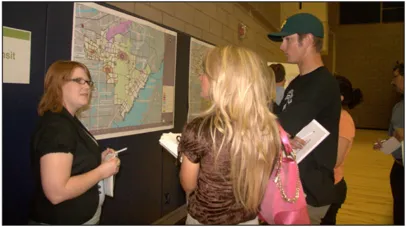
Citizens Involvement and Participation
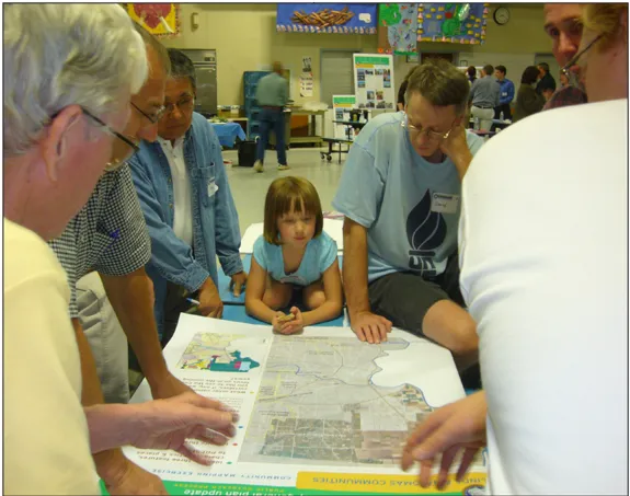
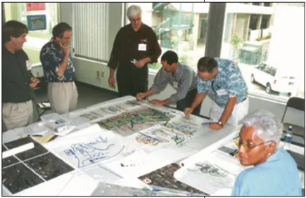
Section titled “Citizens Involvement and Participation”The General Plan was shaped by extensive community participation, through focus groups, workshops, hearings and widespread outreach efforts. Community Planning Advisory Councils (CPACs) were created in the unincorporated area of the County to facilitate and invite direct citizen participation in the planning process. The CPACs provide a forum for the review of proposed amendments to plans, zoning matters and use permits. Residents also play a central role in creating and/or updating Community Plans and Community Action Plans for their locality through comprehensive planning and visioning exercises. Additionally, the County has opened Community Service Centers in the unincorporated area in order to improve customer service to its citizenry and provide vital services closer to where residents live. Community participation is further encouraged through offices of each member of the Board of Supervisors and through direct contact with County departments.
General Plan Update Process
Section titled “General Plan Update Process”The General Plan Update process was carried out over a seven year period and required extensive input from the public, stakeholders representing various interests, the Community Planning Advisory Councils (CPAC), Planning Commission, Board of Supervisors, County staff, and various local, regional, state and federal agencies and organizations. These participants helped define the issues addressed in the update process, discussed the opportunities and challenges facing the County, and proposed specific changes to the General Plan. Over the course of the Update process, more than 180 public workshops and hearings were held, including:
- 26 public workshops with the Board of Supervisors
- 4 public workshops with the Planning Commission
- 10 large public outreach meetings held throughout the County
- 12 public focus group meetings
- 50+ CPAC meetings
- 16 Planning Commission adoption hearings
- 22 Board adoption hearings
This extensive public outreach created an interactive and iterative process that brought together people from all walks of life to shape the County’s plan for future growth.
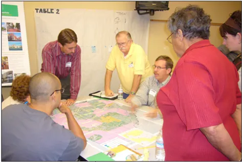
Public outreach was an essential part of creating this Plan - more than 180 public workshops and hearings were held to shape this General Plan, along with hundreds of individual meetings with members of the public and other stakeholders.
SACRAMENTO COUNTY UNINCORPORATED COMMUNITY PROFILES
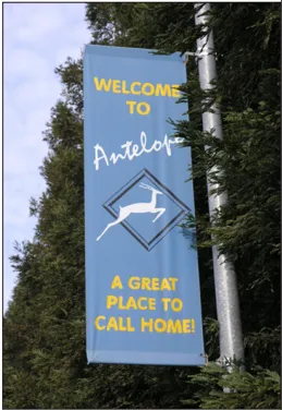
Section titled “SACRAMENTO COUNTY UNINCORPORATED COMMUNITY PROFILES”Antelope
Section titled “Antelope”Antelope is a residential community of over 46,000 residents located approximately 18 miles northeast of downtown Sacramento and five miles southwest of Roseville. Located at the northern edge of Sacramento County, Antelope is bounded by the Sacramento-Placer County line to the north, Antelope Road to the south, the Southern Pacific Railroad line to the east, and Dry Creek to the west. Antelope was established in the mid-1800s by Chinese immigrants who worked for the railroad. Planning policies that have guided growth include the Antelope Community Plan, adopted in 1985 and the subsequent East Antelope Specific Plan, adopted in 1995. Antelope is home to numerous park facilities provided primarily by the Sunrise Park and Recreation District along with the Cherry Island golf course and soccer complex on the western edge of the community. One large vacant property remains to be developed at the northwest intersection of Don Julio and Elverta Roads.
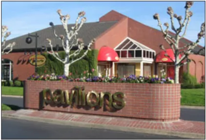
Arden Arcade
Section titled “Arden Arcade”The Arden-Arcade community is located at the heart of Sacramento County and is marked by the convergence of several major freeways and thoroughfares. Arden-Arcade is a major contributor to the local economy and includes nearly 40 distinct neighborhood areas and a number of shopping areas such as Country Club Plaza, Country Club Centre, Pavilions and Town and Country Village. Covering 21-square miles, the area and was part of the original 44,000-acre Haggin land grant given to John Sutter by the Mexican government. The Arden-Arcade Community offers a range of housing options, everything from apartments to mansions. California State University, Sacramento (CSUS) is located just west of the Arden Arcade boundary and the western portion of the community has particularly strong housing and commercial ties to the university. Much of Arden-Arcade began to develop in the 1940’s with the Town and Country Village shopping center (the first suburban shopping center in Northern California). Most of the population growth in Arden-Arcade occurred up through the 1960’s & 70’s, when it is estimated that 75-80% of the Community was developed with urban uses.
Arden-Arcade is now one of the most fully developed areas of urban Sacramento with a population of approximately 92,000. Arden-Arcade is bound by the American River to the south, Interstate 80 to the north, Ethan Avenue to the west and Mission Avenue on the east. Planning documents guiding development in the Arden Arcade Community area include the original 1980 Community Plan and the 2006 Community Action Plan. Two Special Planning Areas (SPAs) have been adopted to implement this General Plan’s commercial corridors strategy including the Fulton Avenue and Auburn Boulevard SPA’s.
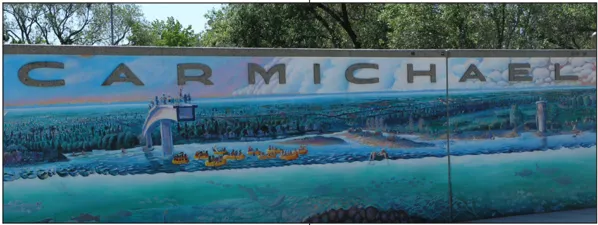
Carmichael and Old Foothill Farms
Section titled “Carmichael and Old Foothill Farms”Carmichael and Old Foothill Farms is a fully developed community of approximately 95,000 residents located 10 miles northeast of downtown Sacramento. The community encompasses approximately 10 square miles and is bounded by Mission Avenue on the west, the American River on the south, San Juan Avenue on the east, and by the City of Citrus Heights on the north. The first settlers of Carmichael lived on 10-acre parcels, but following World War II, the community experienced rapid growth and its rural character began changing to a more suburban nature. Carmichael maintains its village feel, featuring a number of small shops, restaurants and recreational activities. The Old Foothill Farms area is home to American River College while Carmichael features Ancil Hoffman Park along the American River, home to the 77-acre Effie Yeaw Nature Center preserve. The community offers a complete range of homes, from apartments and townhouses to beautiful residences overlooking the American River and its parkway. Fair Oaks Boulevard is one of the community’s major commercial corridor featuring shops, restaurants and services. A corridor plan was created for the boulevard including a portion of Manzanita Avenue that designates distinct local planning districts, including the creation of a Special Planning Area for the ‘Main Street District’ that functions as the community’s town center. Planning documents governing Carmichael include the 1975 Carmichael Community Plan, the 2006 Carmichael Community Action Plan, and the Fair Oaks Boulevard Corridor Plan.
Cordova
Section titled “Cordova”The Cordova Community is home to many miles of the American River Parkway and other natural parklands, situated in roughly the geographic center of Sacramento County about 9 miles east of the central business district of the City of Sacramento. The incorporated City of Rancho Cordova governs areas within the City. However, approximately 46,000 residents remain in the unincorporated portion of the Cordova community in neighborhoods such as Rosemont, Independence at Mather, Butterfield/ Riviera East, and Gold River. Mather Field (previously Mather Air Force Base) is a major air cargo/civilian airport with a developing business park. The southern portion of Mather Field includes Independence at Mather and existing open space resources including a vernal pool preserve; additional development of the planned Mather Field Regional Park and further economic development are anticipated. GenCorp Inc., parent company of Aerojet, is the region’s largest corporate landowner with ap-proximately 13,000 acres located at the eastern boundary of the community. Folsom Boulevard and the Folsom Light Rail l i ne run through the center of the community, parallel and adjacent to Highway 50 with access to retail, offices and a variety of housing types. Planning documents include the 2003 Cordova Community Plan, the award-winning Easton Master Plan and the pending Folsom Boulevard Transit Area Plans.
Cosumnes
Section titled “Cosumnes”Cosumnes is a beautiful rural area that features awe-inspiring open space, valuable agriculture and rangelands, critical habitats and ecosystems such as blue oak woodlands and vernal pool grasslands. Cosumnes is home to nearly 11,000 people living in rural communities such Sloughhouse, Wilton and the master planned community of Rancho Murieta. At the southwestern edge of the community is the Kiefer Landfill. Cosumnes also features a large portion of the Cosumnes River, the only undammed river on the west slope of the Sierra. It f lows through one of the biologically richest regions in California’s Central Valley on its way to its confluence with the Mokelumne River and the San Joaquin Delta. It is bounded approximately by U.S. Highway 50 on the north, the Elk Grove-Galt School District boundary on the south; the boundary between Sacramento County and Amador and El Dorado counties on the east; and Grantline Road and Sunrise Boulevard on the west. The City of Folsom is anticipated to annex the very northern portion of the community area. Just to the south of that, the approval of hard rock mining in the northern portion of the community will provide aggregate resources for the region. An application for a new master planned community northeast of Kiefer Landfill, known as Cordova Hills, is currently being processed by the County.

The Delta community is characterized primarily by its quiet rural lifestyle and is unique as a getaway from the hurried pace of much of the remainder of Sacramento County. The 162 square mile area is crisscrossed by numerous waterways, which divide the land into distinct islands or tracts. The area includes the incorporated City of Isleton, but roughly 6,000 residents live in the legacy communities of Locke, Ryde, Courtland, Freeport, Hood and Walnut Grove. The community hosts two well-known festivals, the Pear Fair in Courtland and the Crawdad Festival in Isleton. Agriculture and outdoor recreation/tourism are the prominent activities that take place in the Delta area with fishing and boating examples of common recreation activities. The Delta is one of the most fertile regions of the County and accounts for much of the County’s $356 million in agricultural production. Major planning activities are occurring in the Delta by the State and Federal Governments related to water supplies and environmental issues. This effort’s co-equal goals are water reliability and habitat restoration while still protecting, enhancing and sustaining the unique cultural, historical, recreational, agricultural and economic values of the Delta, and addressing flood protection, continued socio-economic sustainability of agriculture and its infrastructure, and legacy communities in the Delta. The outcomes of these planning actions are likely to shape the future of the County’s Delta community.
Fair Oaks
Section titled “Fair Oaks”Fair Oaks is a well-established community of nearly 31,000 residents. It consists of a mix of suburban and semi-rural neighborhoods spanning over 10 square miles. The area is home to rolling hills and numerous native oaks that add to its quality of life. The views of the American River Bluffs and the surrounding attractions of the Nimbus Fish Hatchery and Folsom Dam also add to the distinctive character of Fair Oaks. Fair Oaks’ uniqueness also stems from its existing business core and town center, known as the Fair Oaks Village. The village is home to narrow winding roads, rolling hills, an open-air amphitheatre, and a plaza of historic buildings full of unique galleries and shops. The village shares the similar characteristics one could find in a small town atmosphere. The village area is also the site of the annual Chicken Festival, an event honoring the community’s famous and ever present fowl that roam the streets of Fair Oaks. The Fair Oaks community is bounded by the American River on the south, San Juan Avenue on the west, Madison Avenue on the north, and Blue Ravine on the east.
Natomas
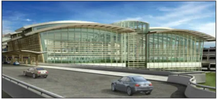
Section titled “Natomas”The Natomas community includes the City of Sacramento’s South and North Natomas communities as well as a large area remaining within the unincorporated County. Natomas is bounded by the Sutter County line to the north, the Sacramento River to the east, the American River to the south, and the West- ern Pacific Railroad line to the east. Del Paso Boulevard divides the area into North and South Natomas. The City’s North Natomas community grew very rapidly in recent years into a complete new community of new residential and commercial developments including the Sacramento Kings professional basketball team. In the unincorporated area, Sacramento County has just opened the new terminal at the Sacramento International Airport, which is anticipated to be a significant benefit to regional residents and businesses. Further expansion of the airport may occur in the next decades. In addition, a large planned industrial area, called Metro Air Park is located immediately east of the Airport. Development in Natomas is on hold until the Natomas Levee Improvement Program’s (NLIP) major improvements to the levees along the Sacramento River are completed. The area along the Sacramento River will provide for a wide range of recreational activities enhanced by improvements associated with the NLIP. Finally, the County and City of Sacramento have been engaging for many years in the Natomas Joint Vision planning process, which envisions a plan for both new communities within the unincorporated portion of the basin and permanent protection of existing open space.
North Highlands
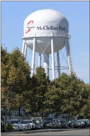
Section titled “North Highlands”North Highlands is a diverse, family-oriented and active suburban community of 43,000 residents that is located approximately 10 miles northeast of downtown Sacramento. The community was formally established with the opening of the North Highlands post office in July of 1952 and grew with the development of the McClellan Air Force Base (now known as McClellan Business Park). McClellan Business Park is one of the largest business parks in California and will ultimately employ up to 34,000 individuals. In recognition of the area’s aviation past, the community is home to the Aerospace Museum of California, which features one of the finest collections of aircraft and aviation memorabilia in the west. The North Highlands - Foothill Farms area is bounded by Antelope Road to the north, the city of Citrus Heights to the east, Arcade Creek and the city of Sacramento to the south, and on the west by Sacramento and McClellan Park, 28th Street, and Dry Creek. Major planning efforts underway include the North Watt Corridor Plan and the West of Watt Visioning Study. In addition, the County adopted the North Highlands Town Center plan in 2008 and improvements are currently being installed to implement this Plan.
Orangevale
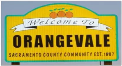
Section titled “Orangevale”Orangevale is a well-establ i shed community of nearly 34,000 residents in northeastern Sacramento County. Known for its great schools and high quality of life, Orangevale has become a very desirable location. In the late 1800s, Orangevale became the state’s first successful Colony with several small farms providing high quality produce. The area was also once home to Native Americans and many protected artifacts remain. It boasts some of the best views of mountain vistas and is home to many native oaks that populate the area. Adjacent to the Folsom Lake State Recreation Area, Orangevale residents and visitors can partake in recreational activities nearby such as visiting the American River Parkway and Nimbus Fish Hatchery, or playing sports at the Orangevale Community Park. Since 1963, Pow Wow Days has brought Orangevale residents and visitors together for several days of games, live entertainment, food, carnival and a parade. The 10 square mile Orangevale community is bounded by the Sacramento-Placer County line to the north, Madison Ave to the south, Folsom City to the east, and Kenneth Avenue and Fair Oaks Boulevard to the west. Recent Planning activities include the Greenback Lane - Orangevale Vision.
Rio Linda and Elverta
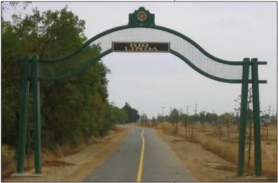
Section titled “Rio Linda and Elverta”The Rio Linda and Elverta community spans approximately 19 square miles and is home to over 20,000 County residents. It is located in the north central section of Sacramento County and is bounded on the north by the Sutter and Placer County boundaries, on the west by the Western Pacific Railroad and Steelhead Creek (formerly Natomas East Main Drainage Canal), on the south by the City of Sacramento, and on the east by McClellan Park, 28th Street and Dry Creek. In addition to typical suburban and multi-family housing types, these two communities have large rural residential areas and an active equestrian community. The Community Plan was adopted in 1998 and provided the opportunity for additional development in a portion of the Elverta area. Subsequently, the Elverta Specific Plan was adopted; development activity is pending. In addition, the County has developed the Dry Creek Parkway which is a major amenity bisecting the community with the Gibson Ranch park located at the northern end of the Parkway and near the Cherry Island soccer complex and golf course.
Southeast
Section titled “Southeast”The southeastern portion of Sacramento County prides itself on vast amounts of open space. The majority of the area is rural in nature, featuring l it t le commercial and no urban development. Agricultural Residential development dominates the area, where hobby farms and rural estates blend in with the pastureland, vineyards and open fields. Smaller communities, such as Herald, are scattered about the area with over 2,300 residents in the unincorporated area. The Southeast County is home to Rancho Seco Recreation Area, with excellent boating, fishing and camping opportunities, as well as the decommissioned Rancho Seco Nuclear Power Plant. SMUD constructed a 500-megawatt Cosumnes Power Plant that will ultimately serve nearly 450,000 single-family homes. The Southeast Area is bounded on the north by the Elk Grove-Galt School District boundary, in the south by the boundary between Sacramento county and San Joaquin County, on the east by the boundary between Sacramento County and Amador County, and on the west by the Cosumnes River (excluding the City of Galt).
South Sacramento
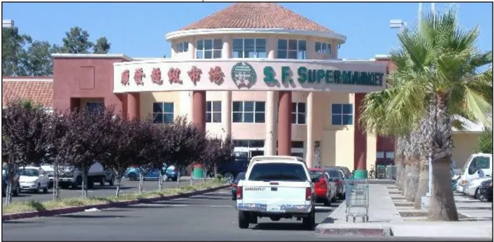
Section titled “South Sacramento”South Sacramento is a kaleidoscope of ethnic and cultural diversity with just under 82,000 residents. The suburban growth of South Sacramento began with the major road of Stockton Boulevard that traverses the area, used from the earliest days of the ‘gold mining’ period for land transportation to Stockton and for rural, farm associated travel. The old town of Florin, located at Florin Road and the Southern Pacific Railroad tracks had its beginnings in the 1880’s. These neighborhoods have easy access to State Highway 99 that runs North-South the length of South Sacramento Community. This suburban area, having shared boundaries on three sides with the City of Sacramento, is well balanced with shopping centers, small neighborhoods with affordable housing, and international flare and flavors including several Asian marketplaces. The Florin Mall has recently undergone transformation and is now known as the Florin Towne Center and is anchored by a WalMart Supercenter. Recent Planning activities include adoption of the Old Florin Town Special Planning Area as well as the pending Florin Road Corridor Plan.
Vineyard
Section titled “Vineyard”The 42 square-mile Vineyard area is located ten miles from downtown Sacramento in the geographic center of Sacramento County. It is bounded by Jackson Highway and Kiefer Boulevard on the north, Calvine Road on the south, Grantline Road on the east, Elk Grove-Florin Road on the west. Vineyard is currently home to over 24,000 residents, with many more expected once several planned new communities are built out. The northern border of the Vineyard area is shared with the former Mather Air Force Base, which had a significant impact on the area when in operation. The Vineyard community has been the focus of several master plans to create new neighborhoods as an outcome of the 1993 General Plan. These plans include the Vineyard Springs Comprehensive Plan, the North Vineyard Station Specific Plan and the Florin Vineyard Gap Comprehensive Plan. Of these three areas, only the Vineyard Springs area has seen significant development. Build out of these plans will likely occur over the next decade.