Espana East PD
Sacramento County Zoning Code
Espana East Planned Development Ordinance
Section titled “Sacramento County Zoning Code Espana East Planned Development Ordinance”Adopted August 2, 1967
Z-67-38
Adopted by ZMA #2384
SECTION 1.
Section titled “SECTION 1.”Section 2 of Ordinance No. 534, as amended, is amended to change the zone of the property described in Exhibit “A”, attached hereto and made a part hereof, as follows:
To: R-1-B, Single Family Residential and Duplex Zone (PD)
SECTION 2.
Section titled “SECTION 2.”The Board of Supervisors hereby determines:
That “Espana East” Planned Unit Development will carry out the intent of the General Plan; that it is of sufficient size and is designed so as to provide a desirable environment within its boundaries; that it is compatible with existing and proposed land uses in the surrounding areas; that exceptions to the standard requirements of the Basic Zoning Ordinance are justified by the design of the development; the arrangement of dwellings is justified by larger and more usable open spaces; that there is adequate assurance that all public improvements will be installed at the scheduled times as required by the Department of Public Works; that there is adequate assurance that the development schedule will be met; that existing and proposed utility services are adequate for the uses and densities proposed.
SECTION 3.
Section titled “SECTION 3.”The tentative development plan of “Espana East” Planned Unit Development is hereby adopted and shall consist of the following exhibits hereto attached and made a part of this Ordinance for all purposes:
- Exhibit B - Site Layout
- Exhibit C - Photograph of Elevation
- Exhibit D - Conditions
EXHIBIT A
Section titled “EXHIBIT A”PARCEL 289-190-08 Beginning at a corner of an existing R-1-B zoning district boundary located at the northwesterly corner of Lot 35 of Citrus Heights Addition No. 16; running thence easterly along the northerly line of said Lot 35 N. 89° 02’ 30” E. 189.93 ft; thence S. 11° 19’ E. 770.58 ft. more or less to an existing R-1-B zoning district boundary line located on the northwesterly right-of-way line of Fair Oaks Boulevard; thence S. 57° 47’ W. along said right—of—way line 200 ft. more or less to the westerly line of said Lot 35; thence N. 11° 19’ W. 876.08 ft. more or less along said lot line to the point of beginning.
ACTION: R-1-B to R-1-B(PD)
EXHIBIT B
Section titled “EXHIBIT B”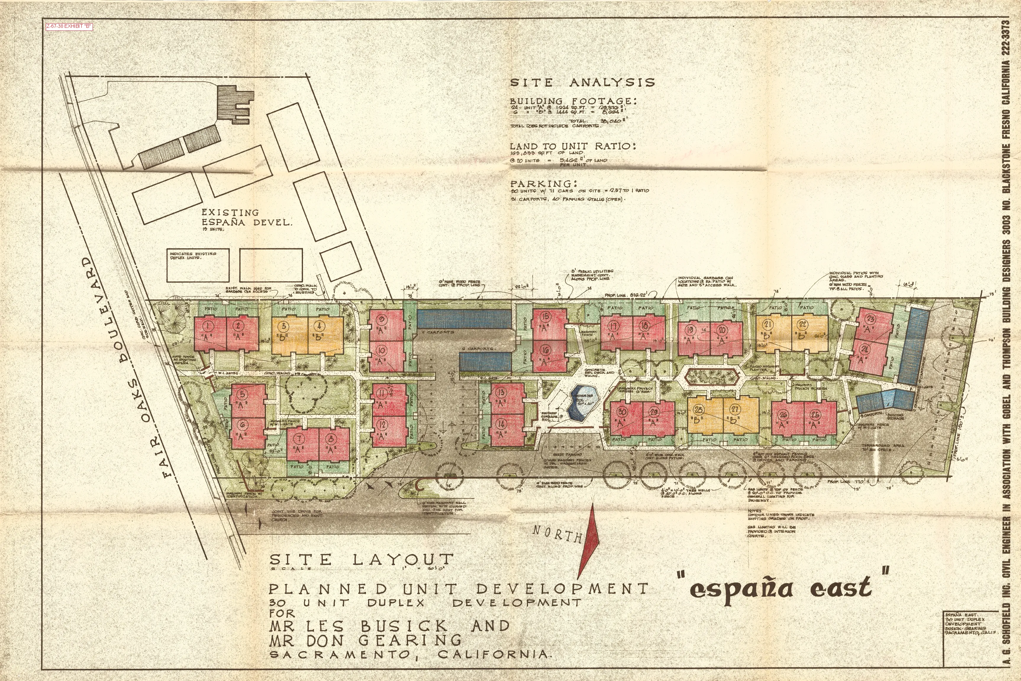
EXHIBIT C
Section titled “EXHIBIT C”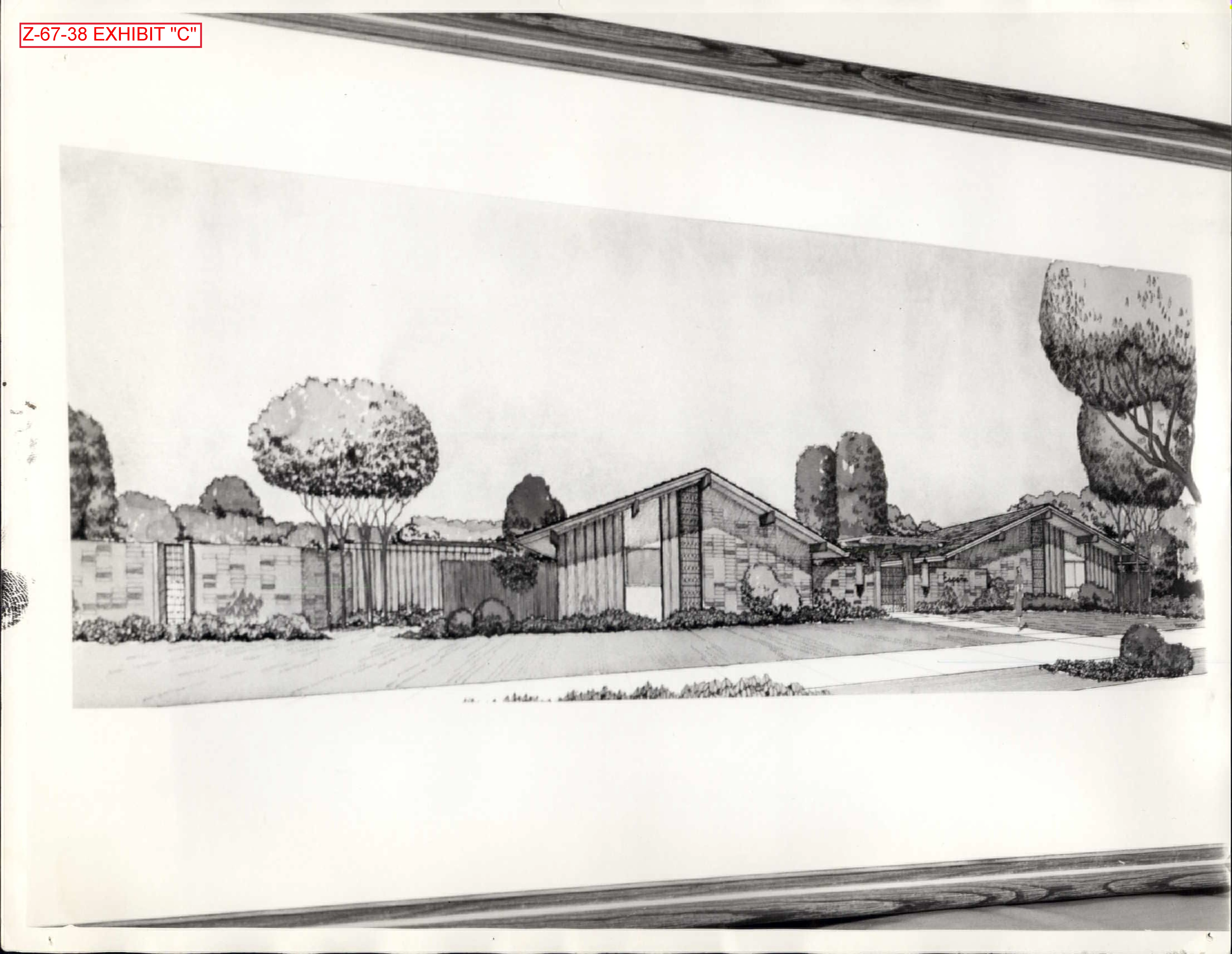
EXHIBIT D: CONDITIONS
Section titled “EXHIBIT D: CONDITIONS”- There shall be a joint use easement on a perpetual basis for the driveway.
- Provide a gate in the fence in the northern portion of the property to allow emergency vehicular access.
- Provide the required fencing around the pool.
- Include in the development plan a cross—easement for pedestrian and service access along the western edge of this property and the eastern edge of the previous unit.
- Provide drainage easements and install drainage facilities to the satisfaction of the Public Works Department including any fee required by Ordinance No. 1 of the County Water Agency.