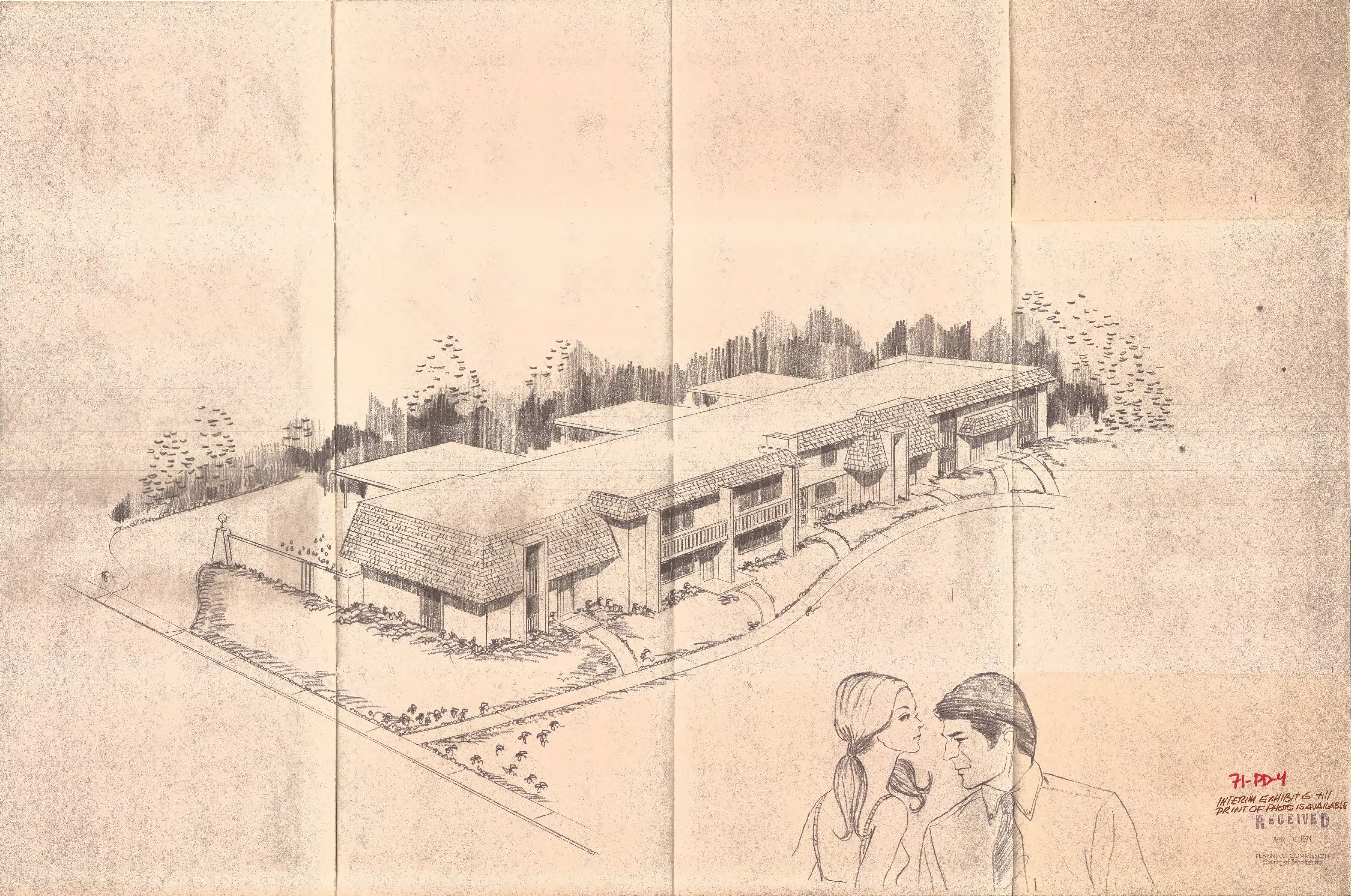
Casitas El Camino PD
Sacramento County Zoning Code
Casitas El Camino Planned Development Ordinance
Section titled “Sacramento County Zoning Code Casitas El Camino Planned Development Ordinance”Adopted June 2, 1971
71-PD-4
Adopted by ZMA #2768
SECTION 1.
Section titled “SECTION 1.”Paragraph 35 of Subsection B of Section 2 of Ordinance No. 534, as amended, which incorporated Comprehensive Zoning Plan, Unit No. 340/176, is amended to change the real property described in Exhibits 1 and 2 on said comprehensive zoning plan to R-2A (PD) Multiple Family Residential (Planned Development) Zone. Exhibits 1 and 2 are attached hereto and are incorporated herein and made a part of this ordinance.
SECTION 2.
Section titled “SECTION 2.”Exhibits “A” through “G”, inclusive, described generally in this section and attached to this ordinance are included herein and made a part of this ordinance to regulate the property described in Exhibits 1 and 2. The exhibits are on file in the office of the Clerk of the Board of Supervisors and are part of this ordinance as if fully set forth herein.
Exhibits:
- “A” Development Plan
- “B” Phasing Plan
- “C-1” through “C-4”, inclusive - Typical elevations
- “D-1” through “D-4”, inclusive - Typical floor plans of residential units
- “E” Typical floor plan and elevation of recreational building
- “F” Layout plan of pool and recreation building
- “G” Picture of typical wall installation
SECTION 3.
Section titled “SECTION 3.”The location, configuration, and arrangement of the buildings shall be as shown on Exhibit “A”. The set back distances, the distances between building clusters and between building clusters and exterior boundary lines of the Planned Unit Development shall not be less than the distances shown on Exhibit “A”.
SECTION 4.
Section titled “SECTION 4.”The location, configuration, and arrangement of the public streets, driveways, walkways, parking areas, and carports shall be as shown on Exhibit “A”. The parking stalls shall conform to the parking standards set forth in Subsection C, Section 19 of Ordinance No. 534, as amended. The number of parking spaces shall not be less than the number shown in the tabulation set forth in Exhibit “A”.
SECTION 5.
Section titled “SECTION 5.”The dwelling units constructed within the property described in Exhibits 1 and 2 shall substantially conform to the elevations and floor plans set forth in Exhibits “C-1” through “C-4” and Exhibits “D-1” through “D-4”. It is the intent of the Board of Supervisors to permit the developer to construct any combination of the several floor plans and elevations shown in Exhibits “C-1” through “C-4” and “D-1” through “D-4” within any of the clusters of dwelling units indicated on Exhibit “A”, and to permit the developer to choose to construct one or two story dwelling units on any lot within the Planned Unit Development except that the developer shall construct one story dwelling units on those lots indicated as one story on Exhibit “A”; provided, however:
- The number of dwelling units shall not exceed 122 units;
- The number and configuration of dwelling unit clusters shall conform to the number and configuration set forth in Exhibit “A”;
- The number of dwelling units within each cluster shall not exceed, but may be less than, the number of dwelling units set forth in Exhibit “A”.
The Board of Supervisors recognizes that in construction of the project, minor deviations from the location and configuration of the project as shown on the development plan (Exhibit “A”) may occur. The Board having considered this possibility, the Board of Supervisors has determined that insubstantial deviations from the development plan (Exhibit “A”) do not constitute an amendment to the plan and delegates to the Planning Commission the authority to approve any such changes.
SECTION 6.
Section titled “SECTION 6.”The location, configuration, and arrangement of the landscaping, pool, putting green, shuffle board, recreation and common areas shall be as shown on Exhibit “A”. The total common area of the Planned Development may exceed but shall not be less than the area designated in the tabulation shown on Exhibit “A”. The location of the cabana shall be as shown on Exhibit “A”; and the layout, elevations, and floor plans of the cabana and pool shall be as shown on Exhibits “E” and “F”.
SECTION 7.
Section titled “SECTION 7.”The location of the wall shall be as shown on Exhibit “A”, and shall be six (6) feet in height except that such wall shall conform to the requirements of Chapter 12.12 of the Sacramento County Code, and shall be of similar construction to that shown in Exhibit “G”.
SECTION 8.
Section titled “SECTION 8.”The sequence of development of the Planned Development shall be as set forth in Exhibit “B”. Construction of Phase I shall begin not later than twelve (12) months from the effective date of this ordinance, and the entire project shall be completed not later than sixty (60) months from the effective date of this ordinance. The Board of Supervisors hereby delegates to the Planning Director the authority to amend the sequence of the construction schedule, provided, however, that the Planning Director shall not be authorized to extend the construction schedule for more than two years.
SECTION 9.
Section titled “SECTION 9.”Developer and/or the owners shall record a subdivision map of the property described in Exhibits 1 and 2.
SECTION 10.
Section titled “SECTION 10.”During the public hearings on this ordinance the Planning Commission and the Board of Supervisors determined that:
- The proposed development will carry out the intent of the General Plan.
- The proposed development is of sufficient size and is designed so as to provide a desirable environment within its own boundaries.
- The proposed development is compatible with existing and proposed land uses in the surrounding area.
- Exceptions to the standard requirements of the Basic Zoning Ordinance are justified by the design of the development.
- The arrangement of dwellings and mixing of dwelling types is justified by larger and more usable open spaces.
- There is adequate assurance that all public improvement will be installed at the scheduled times as required by the Public Works Department.
- There is adequate assurance that the development schedule will be met.
- The existing or proposed utility services are adequate for the uses and population densities proposed.
SECTION 11.
Section titled “SECTION 11.”The variance provision of Section 21 of said Ordinance No. 534, as amended, shall not apply to this ordinance.
SECTION 12.
Section titled “SECTION 12.”Violation of the provisions of this ordinance or exhibits made part of this ordinance shall be deemed a violation of the Basic Zoning Ordinance No. 534, as amended.
SECTION 13.
Section titled “SECTION 13.”The Articles of Incorporation and Bylaws of the Homeowner Association, a California corporation, the prospective owner of the common area, shall be approved by the County Counsel prior to the issuance of the building permit for any dwelling unit.
SECTION 14.
Section titled “SECTION 14.”The Declaration of Covenants, Conditions and Restrictions which relate to the common area shall be approved by the County Counsel prior to the issuance of any building permits for dwelling units.
SECTION 15.
Section titled “SECTION 15.”This ordinance shall take effect and be in full force on and after thirty (30) days from the date of its passage hereof, and before the expiration of fifteen (15) days from the date of its passage it shall be published once with the names of the members of the Board of Supervisors voting for and against the same, said publication to be made in a newspaper of general circulation published in the County of Sacramento.
PASSED AND ADOPTED by the Board of Supervisors of the County of Sacramento, State of California, this 2nd day of June 1971, by the following vote, to wit:
- AYES: Supervisors, KLOSS, PHELAN, SHEEDY, GUALCO
- NOES: Supervisors, NONE
- ABSENT: Supervisors, NONE
- ABSTAINED: Supervisors, MELARKEY
Chairman of the Board of Supervisors of Sacramento County, California
(SEAL)
ATTEST: Clerk of the Board of Supervisors
In accordance with Section 25103 of the Government Code of the State of California, a copy of this document has been delivered to the Chairman of the Board of Supervisors, County of Sacramento.
Filed June 2, 1971 by Mary Ashley, Deputy Clerk, Board of Supervisors.
Publish in the Sacramento Legal Press 6/10/71. Send one affidavit and two publication bills with notice attached to each.
EXHIBIT 1
Section titled “EXHIBIT 1”All that portion of Lot 43, as shown on the official “Plat of Greenwood”, recorded August 17, 1914 in Book 15 of Maps, Map No. 10, records of said County, described as follows:
BEGINNING at a point on the North line of said Lot 43, and the centerline of El Camino Avenue located South 89° 00’ West 232.00 feet from the Northwest corner of Upham Court, according to the official plat thereof, recorded July 29, 1953 in Book 35 of Maps, Map No. 8, Sacramento County Records, and running thence from said point of beginning, South 01° 51’ East 660.00 feet; thence South 89° 00’ West 270.00 feet; thence North 01° 51’ West 660.00 feet to the North line of said Lot 43, and the centerline of said El Camino Avenue; thence along said line North 89° 00’ East 270.00 feet to the point of beginning. (ARB 5)
EXHIBIT 2
Section titled “EXHIBIT 2”PARCEL 1:
All those portions of Lot 43 as shown on the “Plat of Greenwood”, recorded August 17, 1914 in Book 15 of Maps, Map No. 10, records of said County, described as follows:
BEGINNING at the Northwest corner of Upham Court, according to the official plat thereof, recorded July 29, 1953 in Book 35 of Maps, Map No. 8, Sacramento County records, said Northwest corner being on the center line of El Camino Avenue and running thence South 01° 51’ East 660.00 feet along the West line of said Upham Court to the Southwest corner thereof, thence South 89° 00’ West 232.00 feet; thence North 01° 51’ West 660.00 feet to the North line of said Lot 43 and the center line of said El Camino Avenue; thence along said line North 89° 00’ East 232.00 feet to the point of beginning.
PARCEL 2:
All those portions of Lot 43 as shown on the “Plat of Greenwood”, recorded August 17, 1914 in Book 15 of Maps, Map No. 10, records of said County, described as follows:
BEGINNING at a point on the North line of said Lot 43 and the center line of El Camino Avenue located South 89° 00’ West 502.00 feet from the Northwest corner of Upham Court, according to the official plat thereof, recorded July 29, 1953 in Book 35 of Maps, Map No. 8, Sacramento County records, and running thence from said point of beginning South 01° 51’ East 660.00 feet; thence South 89° 00’ West 158.00 feet; thence North 01° 51’ West 660.00 feet to the North line of said Lot 43 and the center line of said El Camino Avenue; thence along said line North 89° 00’ East 158.00 feet to the point of beginning. (ARBS 4 AND 5 A)
EXHIBIT “A”
Section titled “EXHIBIT “A””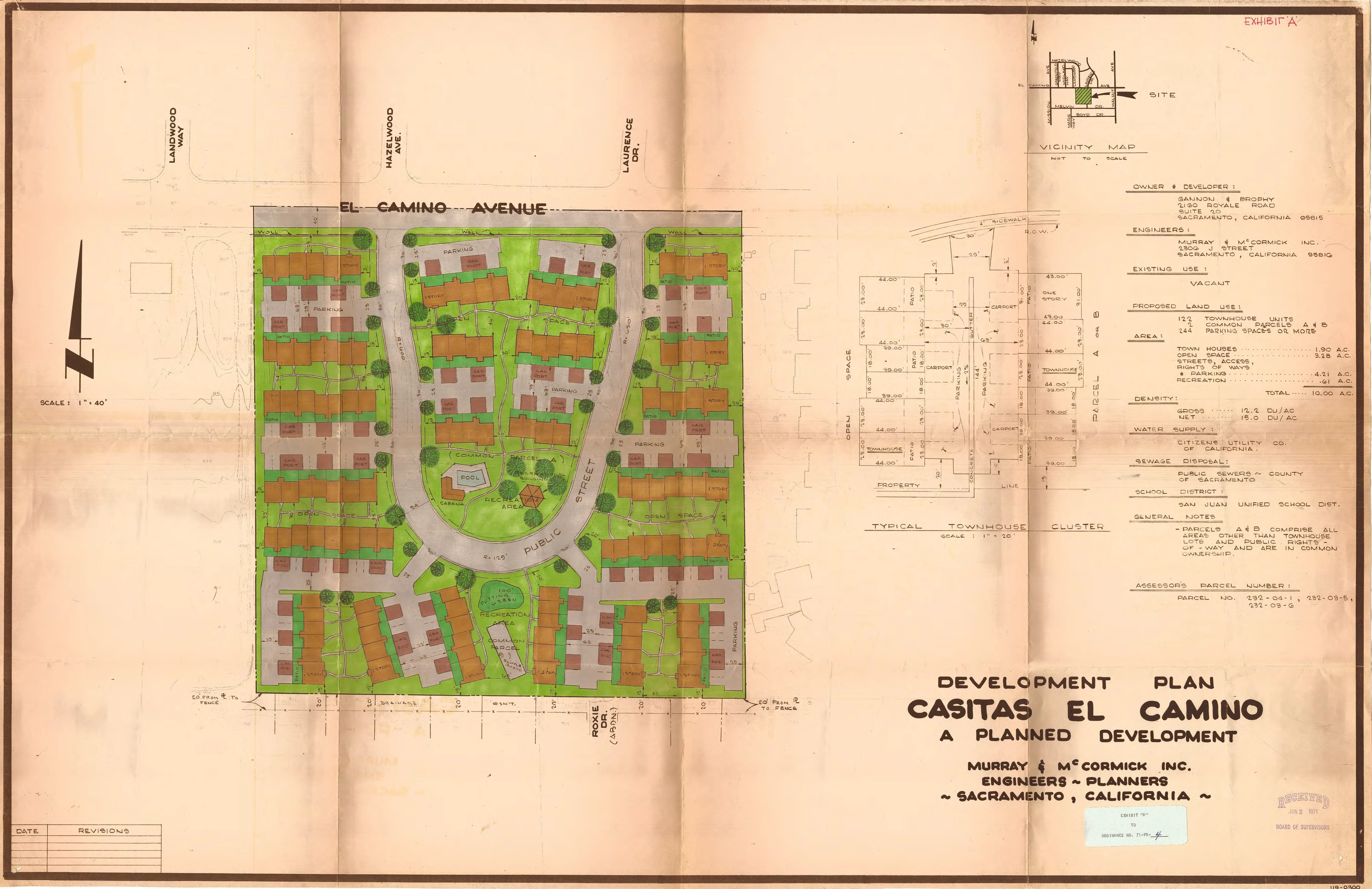
EXHIBIT “B”
Section titled “EXHIBIT “B””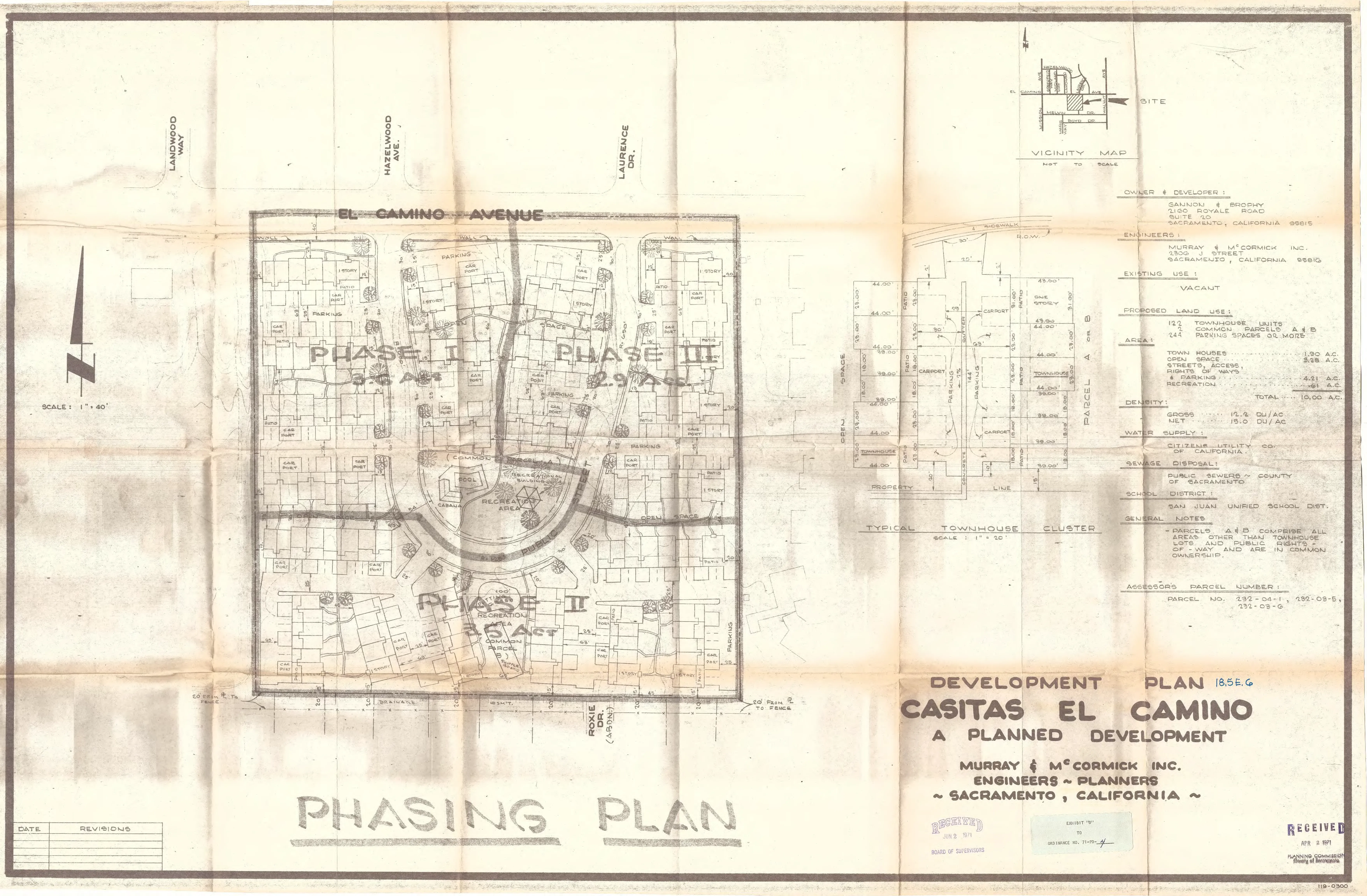
EXHIBIT “C-1”
Section titled “EXHIBIT “C-1””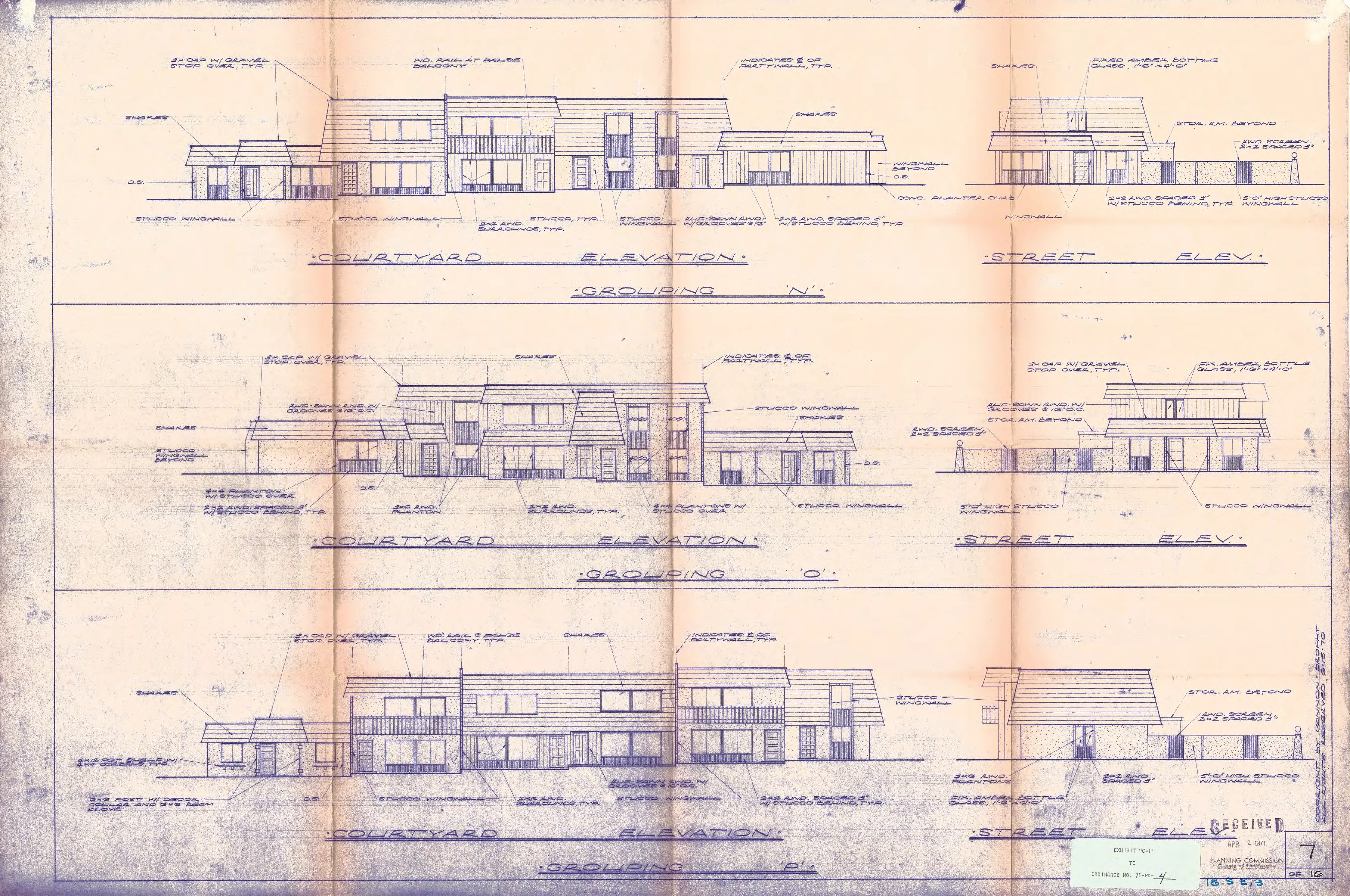
EXHIBIT “C-2”
Section titled “EXHIBIT “C-2””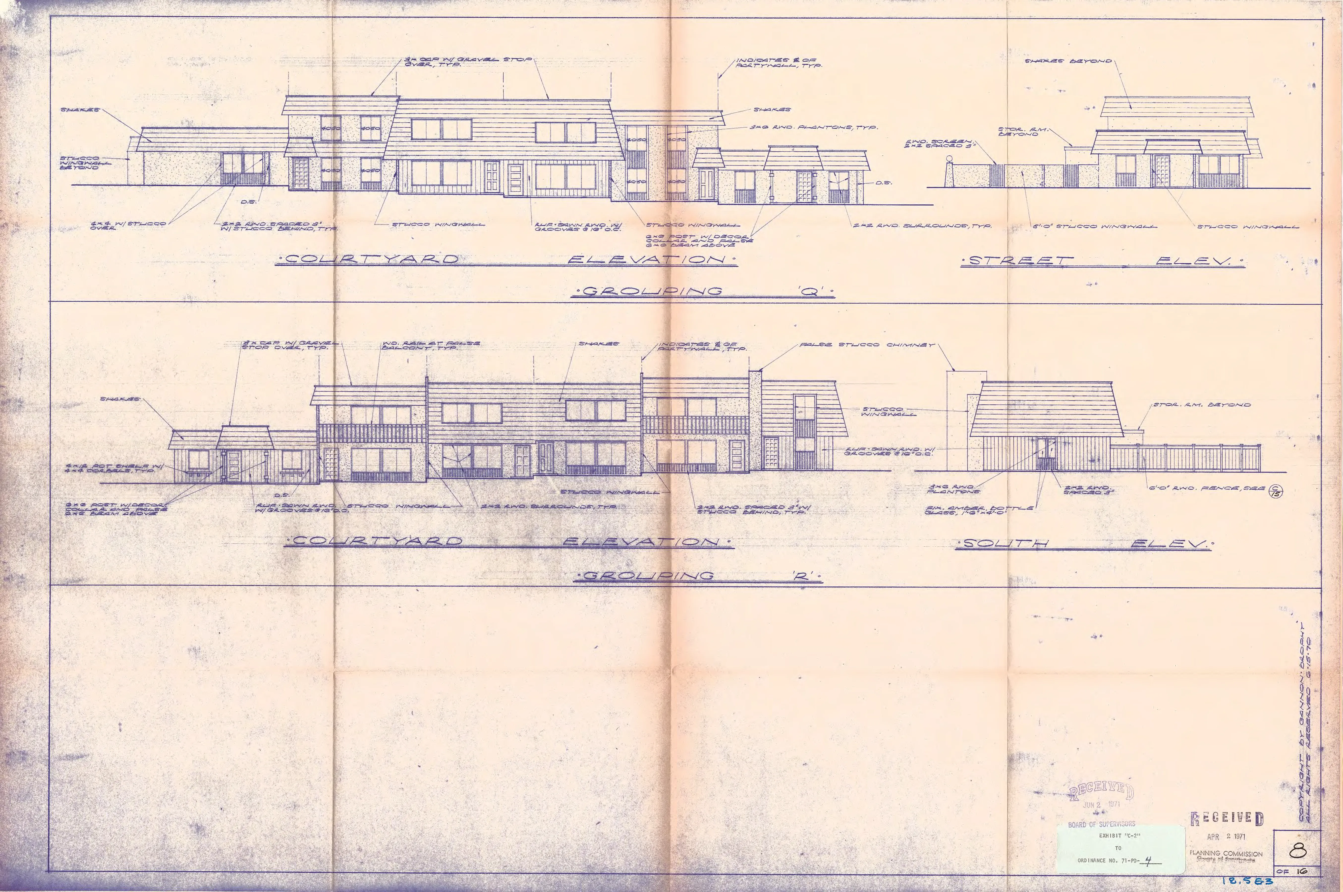
EXHIBIT “C-3”
Section titled “EXHIBIT “C-3””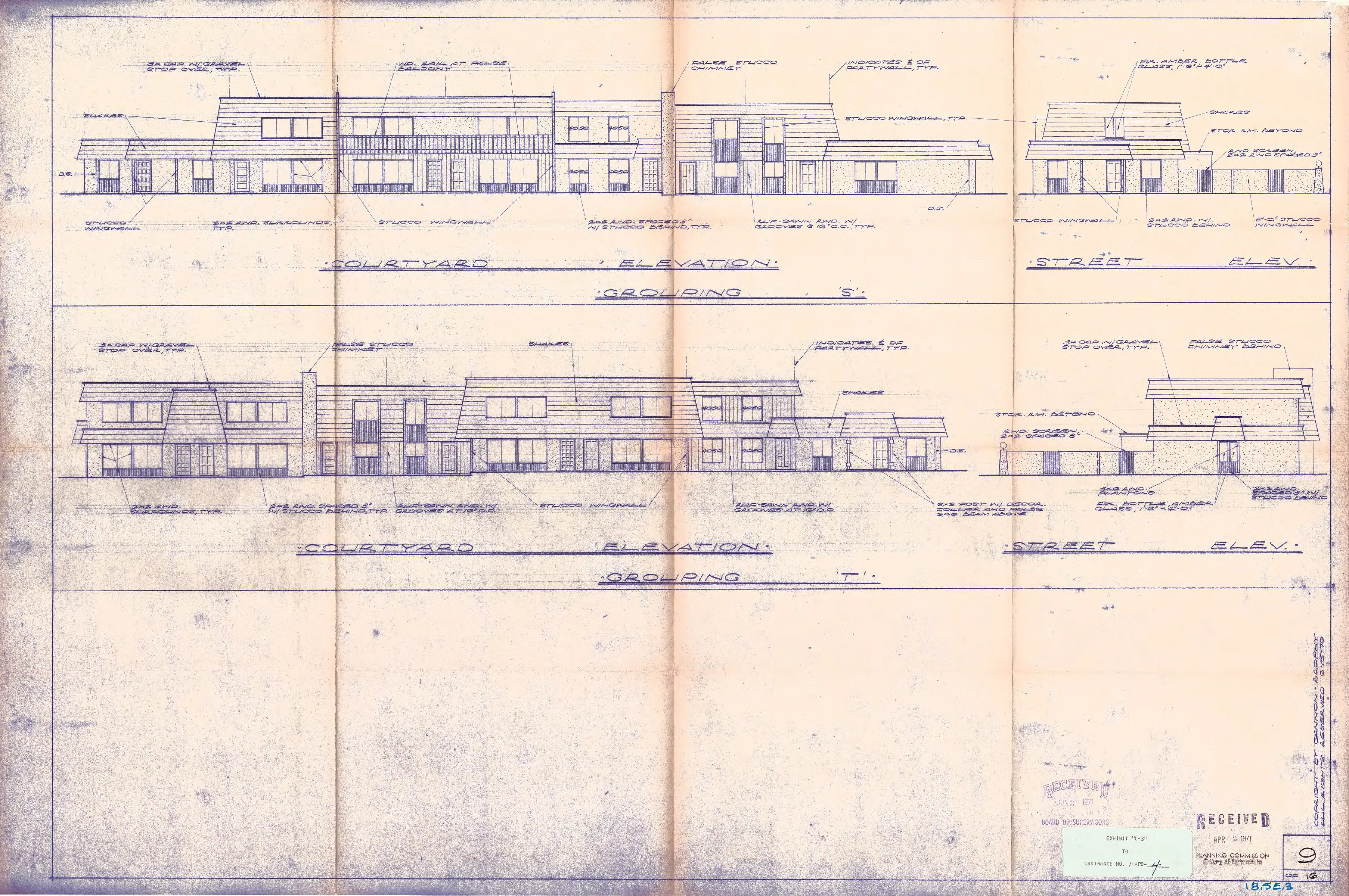
EXHIBIT “C-4”
Section titled “EXHIBIT “C-4””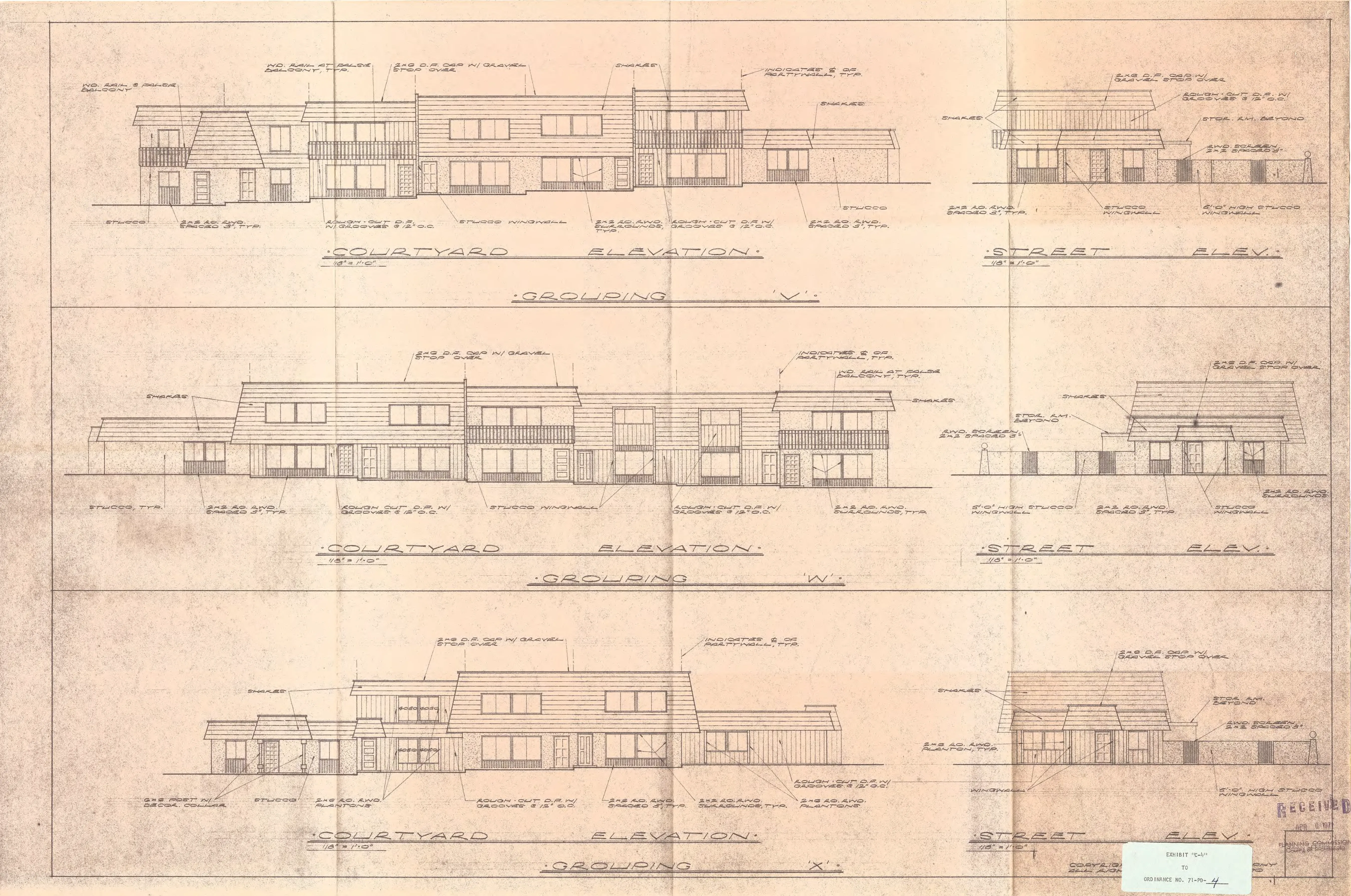
EXHIBIT “D-1”
Section titled “EXHIBIT “D-1””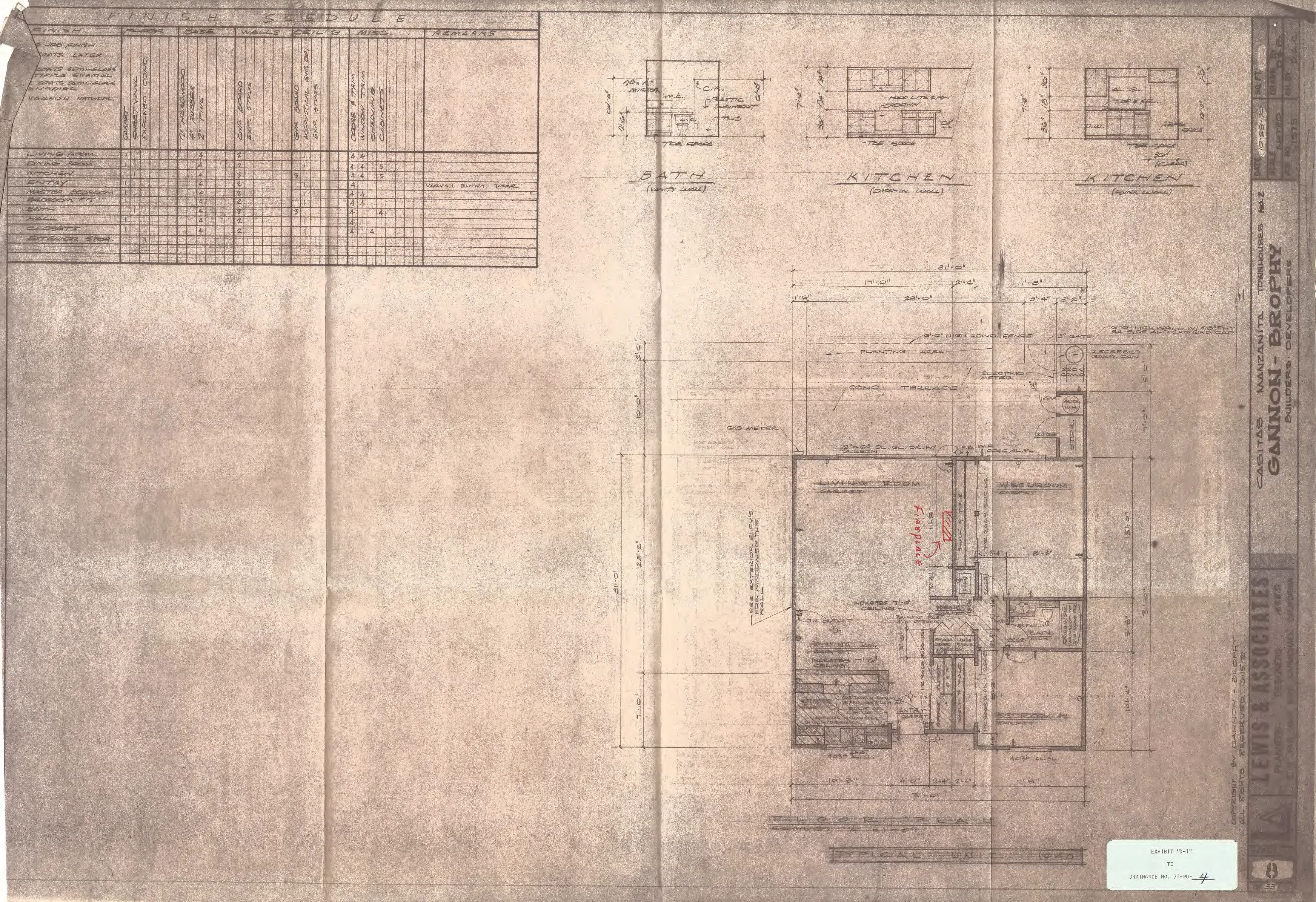
EXHIBIT “D-2”
Section titled “EXHIBIT “D-2””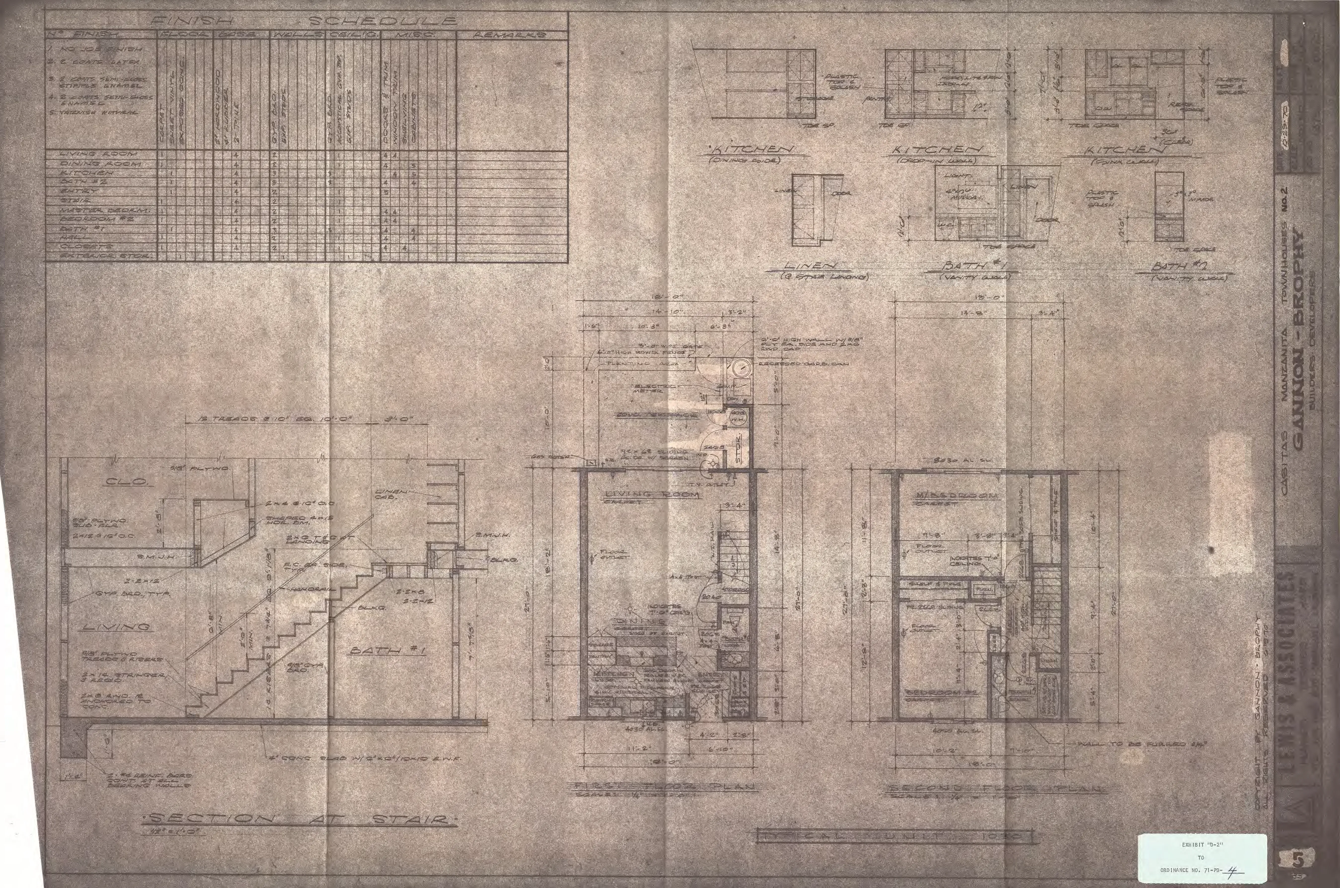
EXHIBIT “D-3”
Section titled “EXHIBIT “D-3””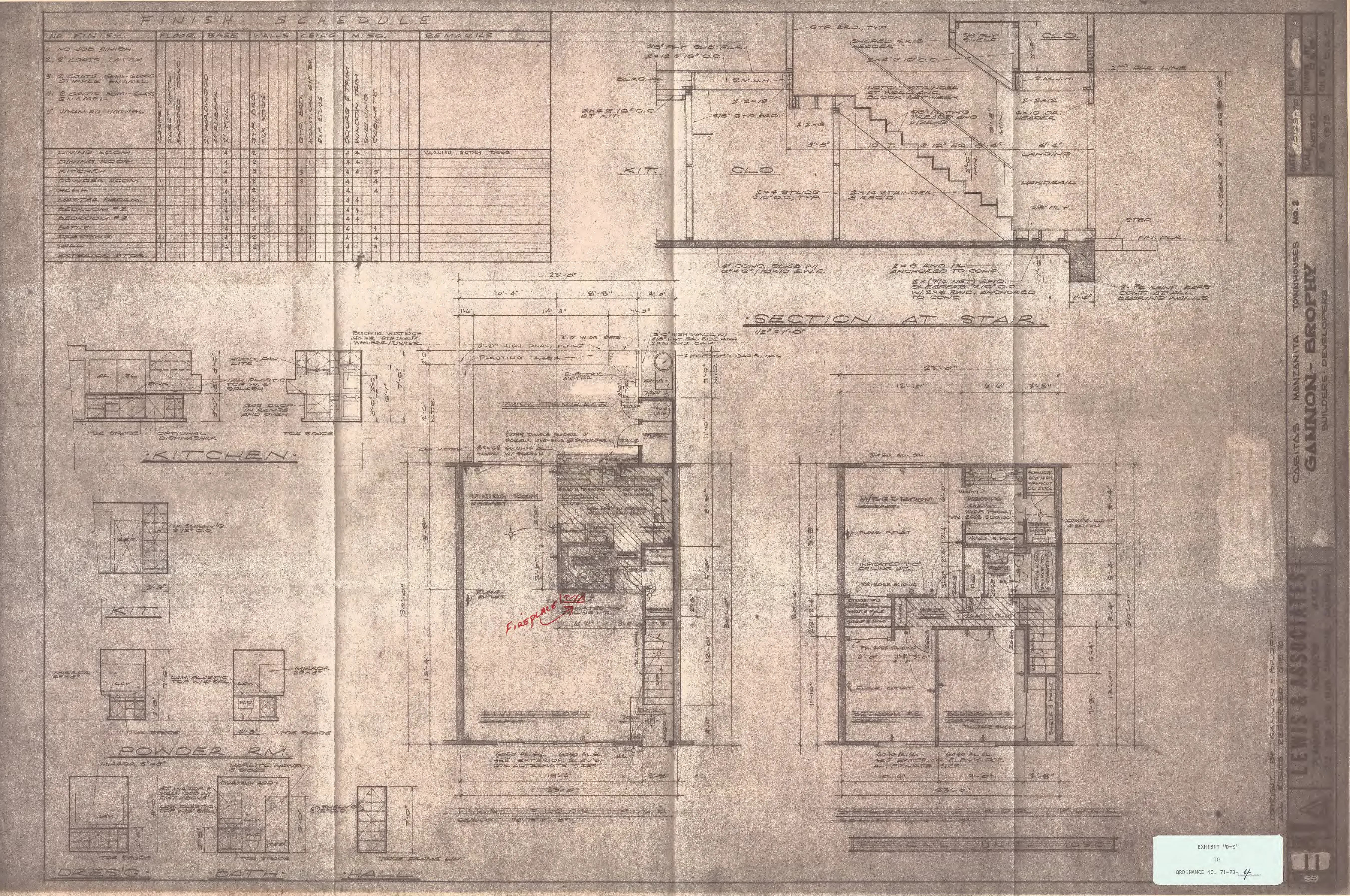
EXHIBIT “D-4”
Section titled “EXHIBIT “D-4””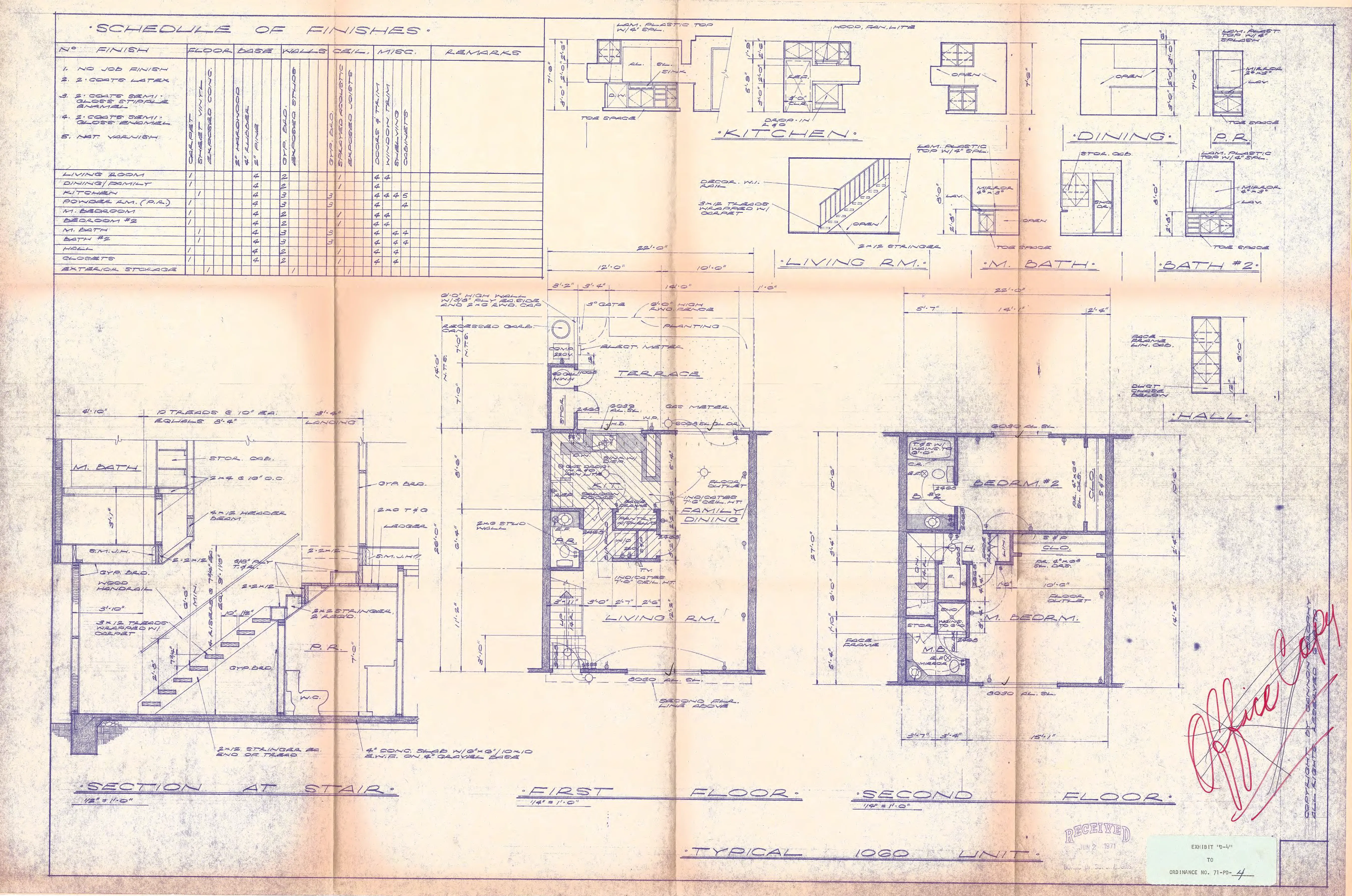
EXHIBIT “E”
Section titled “EXHIBIT “E””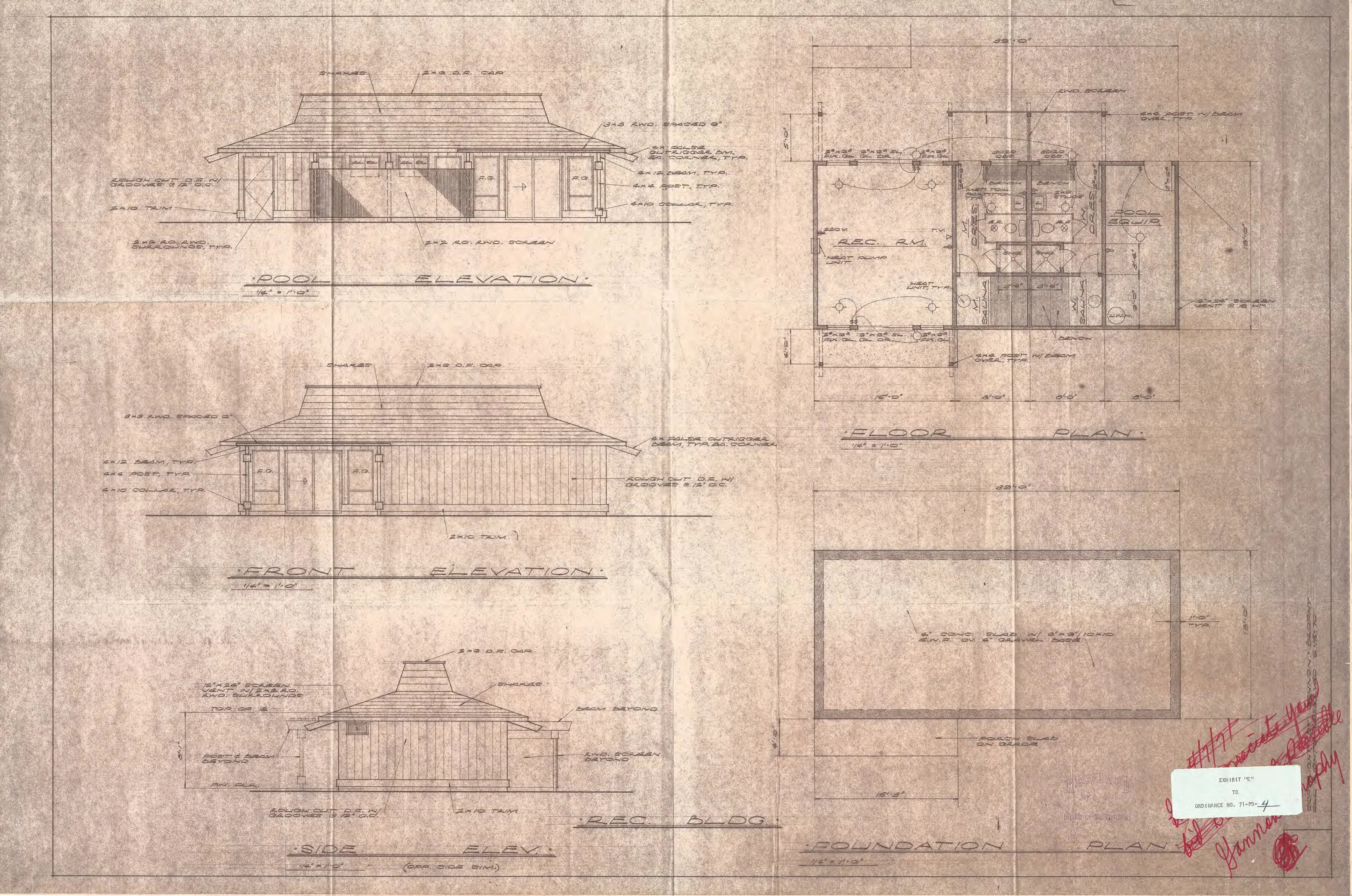
EXHIBIT “F”
Section titled “EXHIBIT “F””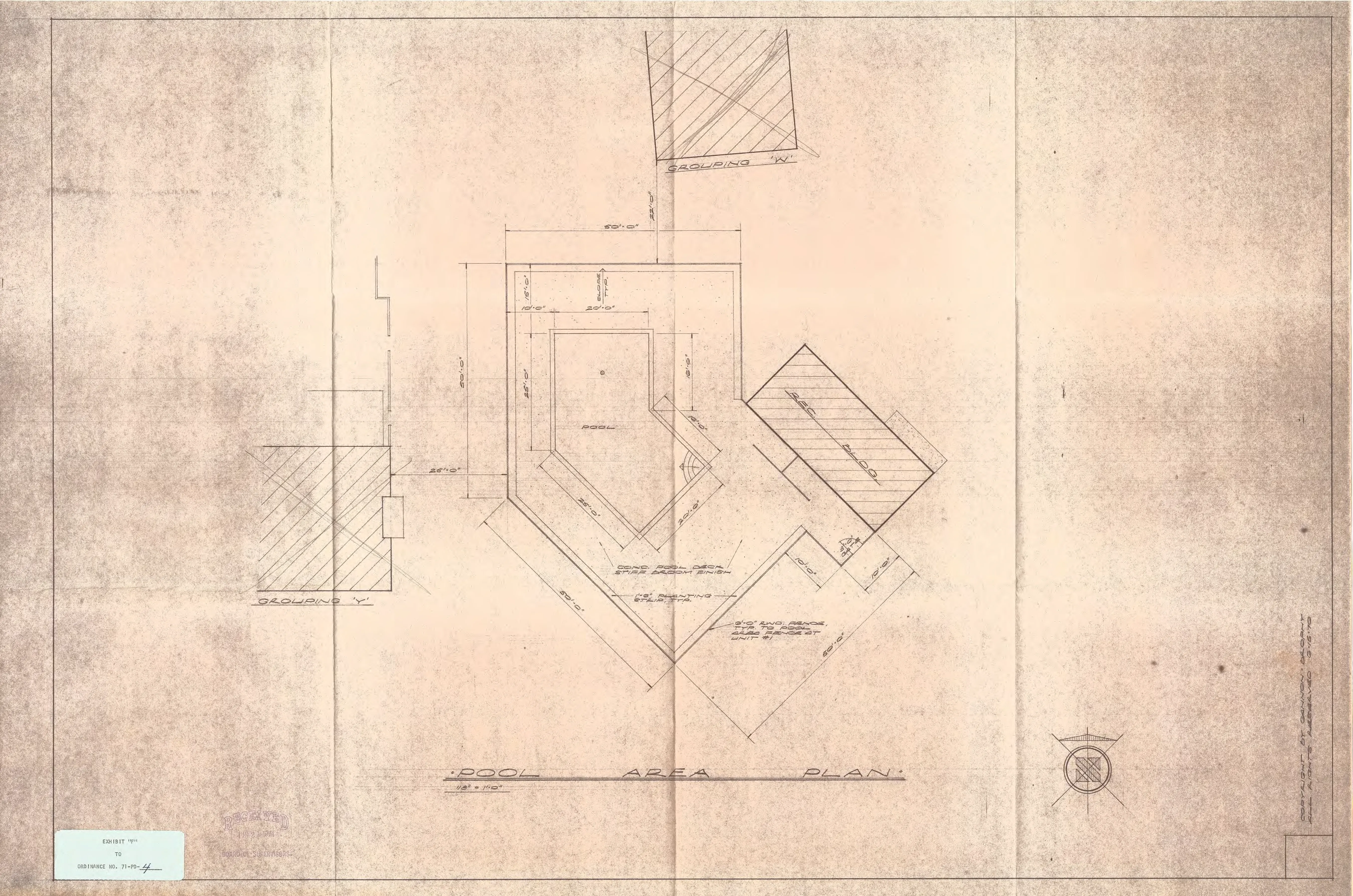
EXHIBIT “G”
Section titled “EXHIBIT “G””